


ClimateSCOpe 4
Climate Adaptation in Africa: soon the 4th ClimateSCOpe
Learn more ➔
FLORIA
FLORIA, or how to read the air we breathe
Learn more ➔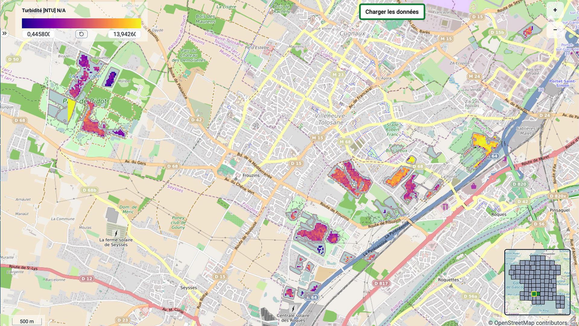
XtremQuality
XtremQuality: monitoring the 90% of freshwater that nobody looks at
Learn more ➔
ORENOS
ORENOS to reduce light pollution
Learn more ➔
LITTOSAT
LITTOSAT covers the entire Atlantic coast
Learn more ➔
Annual Report 2025
SCO Annual Report 2025
Learn more ➔
GreenSpace
GreenSpace, satellites and science to help cities plant the right trees
Learn more ➔
2026 France Edition
-
ClimateSCOpe 4
Climate Adaptation in Africa: soon the 4th ClimateSCOpe
Learn more ➔
FLORIAFLORIA, or how to read the air we breathe
Learn more ➔
XtremQualityXtremQuality: monitoring the 90% of freshwater that nobody looks at
Learn more ➔
ORENOSORENOS to reduce light pollution
Learn more ➔
LITTOSATLITTOSAT covers the entire Atlantic coast
Learn more ➔
Annual Report 2025SCO Annual Report 2025
Learn more ➔
GreenSpaceGreenSpace, satellites and science to help cities plant the right trees
Learn more ➔
2026 France Edition