

SCOFrance
10countries on the Indo-Pacific are covered by TAHATAI Neo
Useful linkPresentation of the project
Key words
Marine planning, anthropogenic pressures, uses, coastline, lagoon, atoll, water quality, maritime traffic, coastal subsidence, climate change
TAHATAI Neo takes shape
26 March 2024: 7am in France, 7pm in Tahiti, 3pm in Australia and 4pm in Vanuatu, the TAHATAI Neo launch webinar was held at unusual times to bring together all the stakeholders and potential future users. This is because BLUECHAM, the company piloting the project, is pushing the qualitative and geographical boundaries of its tool, which it has renamed the "QVX Smart Digital Platform".
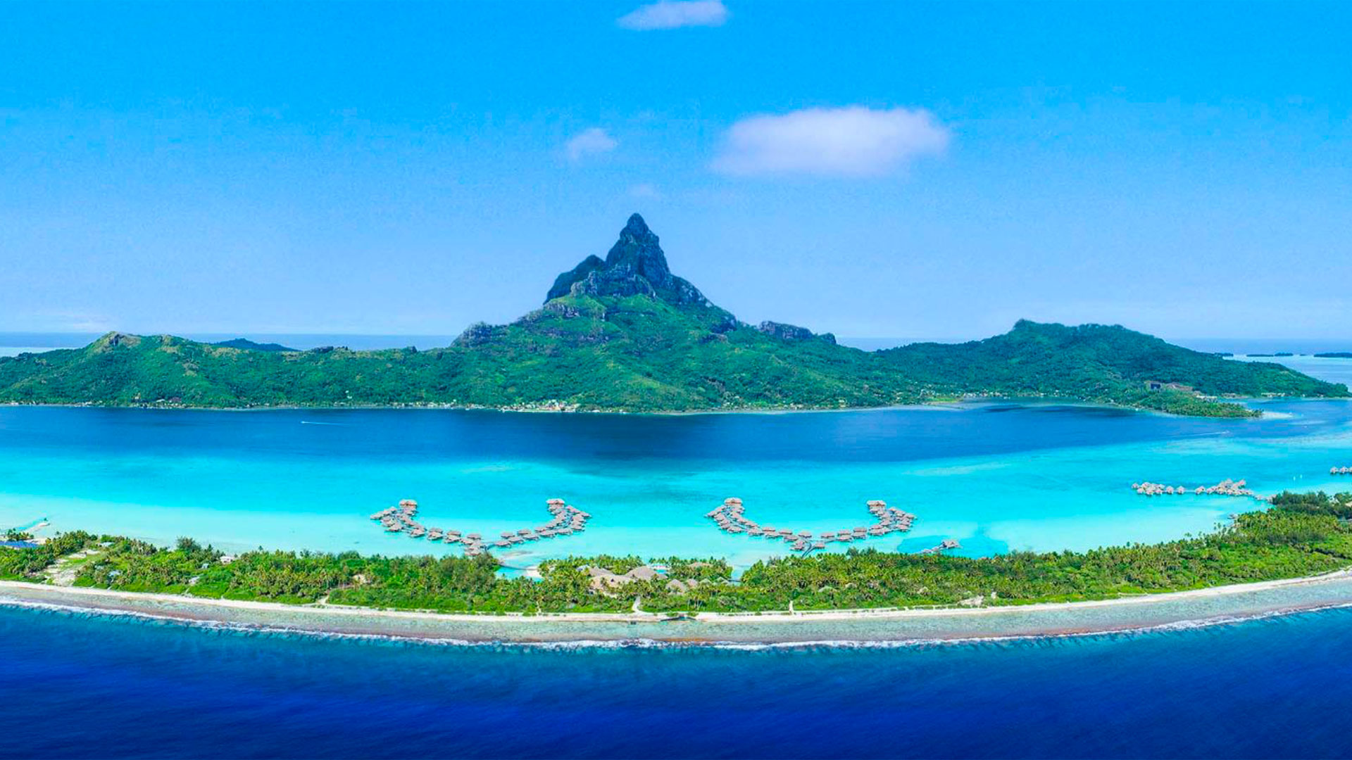
As a preamble, Pascal Correia, from the French Polynesian Marine Resources Directorate, looks back at the context that led him to become involved as the main user and co-pilot of the TAHATAI projects from 2021: "Virtually the entire Polynesian population lives within 5 km of the coastline, on atolls most of which are just a few hundred meters wide. At a time when the impacts of climate change and human activities - on land and at sea - are affecting the environment and even causing conflict, the management of this coastal area is a crucial issue for French Polynesia. With TAHATAI, we have put in place a solution that can detect and monitor human activities, the quality of lagoon water and the impact of urbanization. Today, we believe that this tool would be very useful for the whole of Polynesia and beyond, which is why we are committing to TAHATAI Neo".

Portion of the Tahitian coastline seen by Pléiades, one of the 43 satellites powering the QVX PF platform. © CNES, Distribution Airbus DS, 2021
TAHATAI Neo project manager Rémi Andreoli adds: "At a time when climate change is changing the very paradigm of governance, these interlocking regions need new tools to answer complex questions. Space is proving its added value here, with satellite data proving ideal for learning about the past (recreating a history), the present (having up-to-date information on the area and the sectors at stake) and predicting what is likely to happen next".
"Because of the geography of our archipelagos, satellite and digital tools quickly appeared to be the only way to deal with maritime planning.” Pascal Correia, French Polynesia Marine Resources Department
With TAHATAI Neo, the QVX PF platform, which is already operational on Tahiti and the Arutua atoll, is starting to be scaled up in the Pacific Basin (Australia, Fiji, Vanuatu, Papua New Guinea), then in the Indian Ocean (Reunion Island, Mayotte, southern India) and finally in the Atlantic (West Indies in particular). TAHATAI Neo is already of interest to the Australian Aquawatch programme.
Future features at a glance
Thanks to an architecture that allows data to be interoperable, even in large series, the simplified, user-oriented interface (MSDIA, Massive Satellite Data Instant Access) enables the user at the end of the chain to exploit all this information.
This interface will give access to 7 major products, processed according to 4 robust performance indicators: modelling of processing, automation at scale, adaptation of the interface design to the user's needs, integration of the solution into the QVX platform's market place for international marketing.
-
Coastline: automatic determination of the coastline and identification of anthropogenic pressures;
-
Updated bathymetry of shallow waters from 0 to 20 m;
-
Sanitary and biological water quality: water quality modelling and algal bloom alert;
-
Estimation of maritime traffic with extraction of zones of use;
-
Analysis of coastal subsidence, particularly on islands where the largest populations are located.
New!
-
Virtual Sentinel Stations: Allocation and analysis of tasks by satellite in real time. This new concept is based on the deployment of virtual sentinel stations that will enable users to operate indicators at locations of their choice.
-
Capacity building to support the skills development of teams and users. QVX PF webinars will enable communities of Polynesian users to talk to experts and share their experience, discuss the solutions they have implemented, compare their uses and create new uses so that we can move forward together.
You can find more details and illustrations in the presentation below (pdf, 17 pages, 2.3 MB).