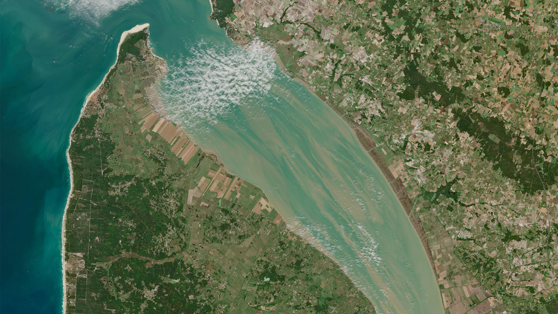
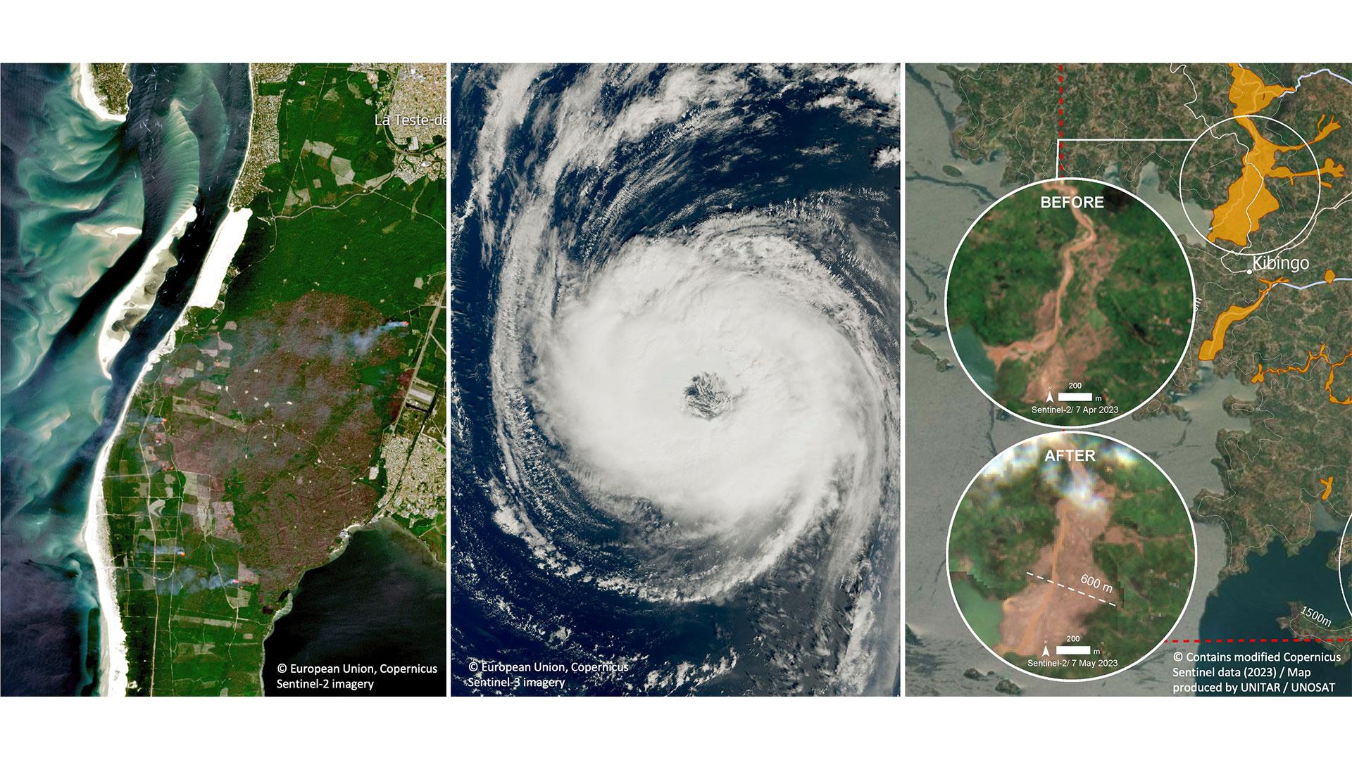
Coping with natural disasters
Fires, cyclones, mud, rain, snow, wind... Whatever their form, nature's wrath is intensifying. On Thursday 14 March 2023, at the twelfth " SCO France Quarterly Meeting ", three projects presented their SCOlutions, using satellite data to anticipate the impacts of some of them.
Learn more ➔
Pléiades 4 Urban Flood: start-up in situ
P4UF is exploring the potential of Pleiades monoscopic imagery to assess the susceptibility of an urban environment to flooding and report on this via risk maps. The first step is to go out into the field and talk to future users.
Learn more ➔
Transition for Cartovege
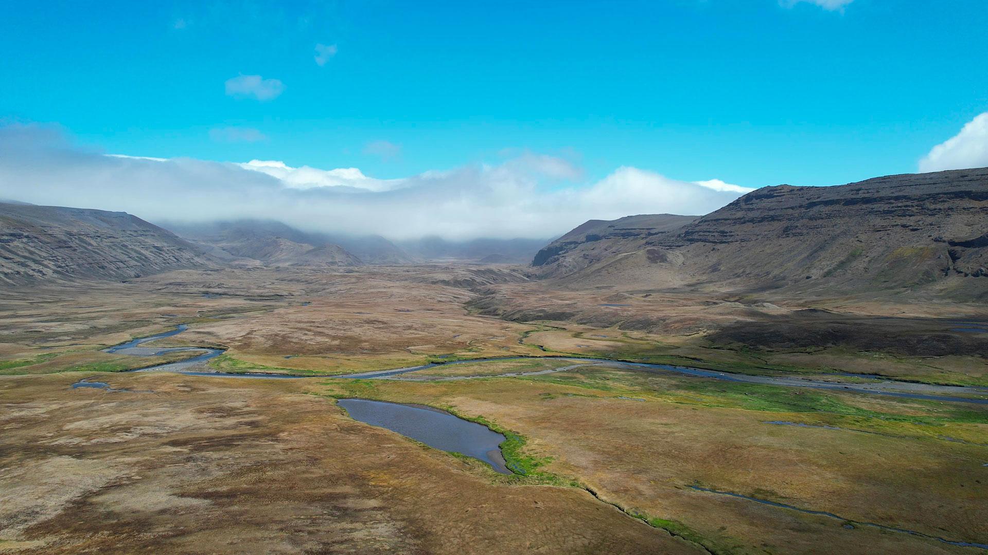
Dedicated to the French Southern and Antarctic Lands, the Cartovege project has produced the very first description of the habitats of the Crozet Islands and is now successfully completing the corresponding mapping. So much so that the SCO is extending its label to cover the Saint Paul and Amsterdam Islands, thereby consolidating the tool for the long term.
Learn more ➔
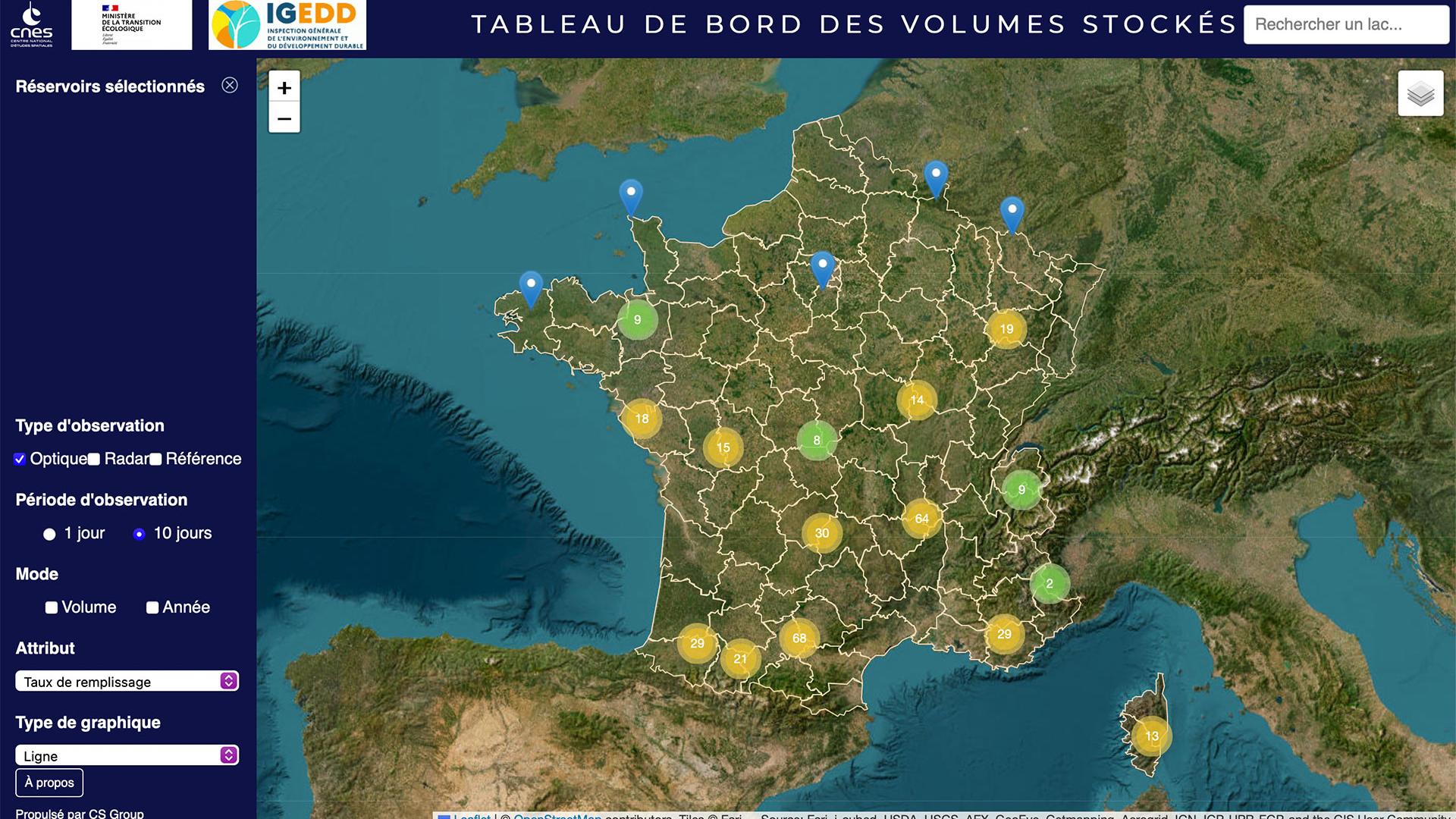
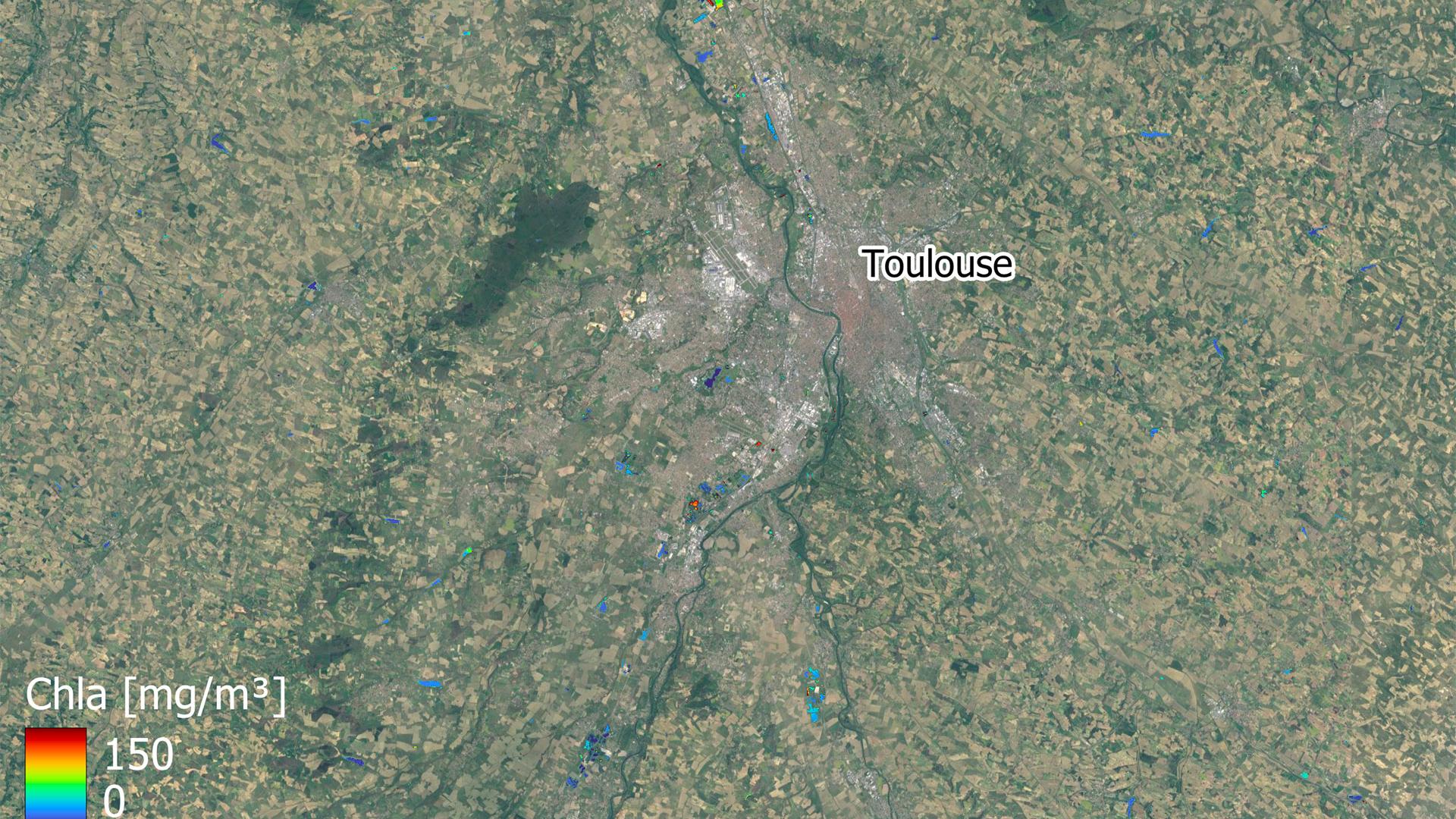
XtremQuality, space technology for detecting water quality
In order to take a comprehensive and effective approach to water, we need to consider both the quantity and quality of the resources available. As only the main reservoirs are instrumented for this purpose, the XtremQuality project is developing a method for satellite monitoring of the thousands of small bodies of water in France for which no information is available.
Learn more ➔
-
SCO France at the forefront of the future national hydrological service
The results of the France 2030 hydrology call for tenders are very SCO-coloured, reflecting the effectiveness of the approach, both for project developers and as a lever for public action in the face of climate change. For a number of SCO players, including the start-up MEOSS, it's a real success story!
Learn more ➔
-
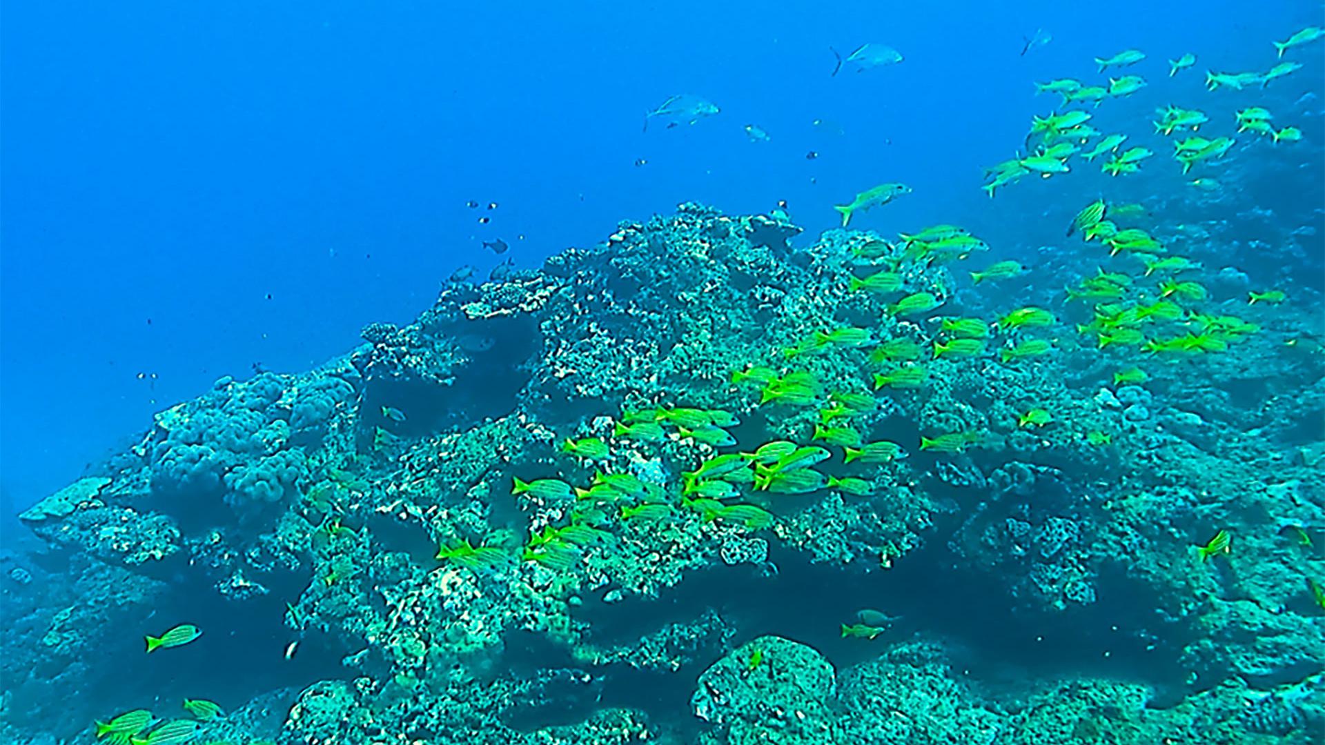
A tailor-made campaign for BioEOS
To validate the results of processing applied to satellite data, you need to be able to see the real thing on the ground, even when it's in the water! The BioEOS project takes us behind the scenes of a major in situ data acquisition campaign being carried out on La Réunion from 14 November to 1st December 2023, using unusual manipulations.
Learn more ➔
-
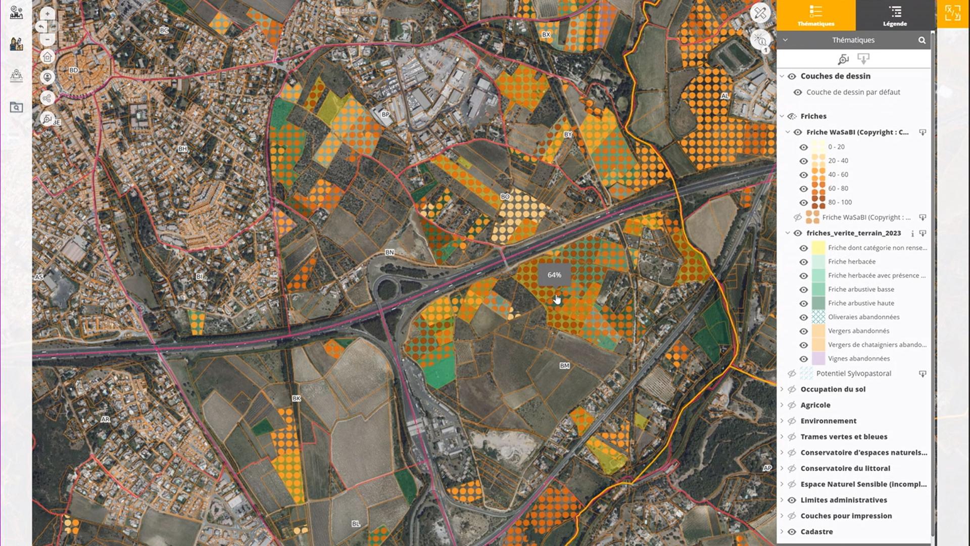
Agricultural wasteland, discover the Izifriche solution
Izifriche is the solution for local authorities, those involved in sustainable agricultural development and environmental protection! Developed in France by Safer Occitanie as a result of the SCO FrichesAgricoles project, this support service for identifying agricultural wasteland promises to be a real tool for reflection.
Learn more ➔
-
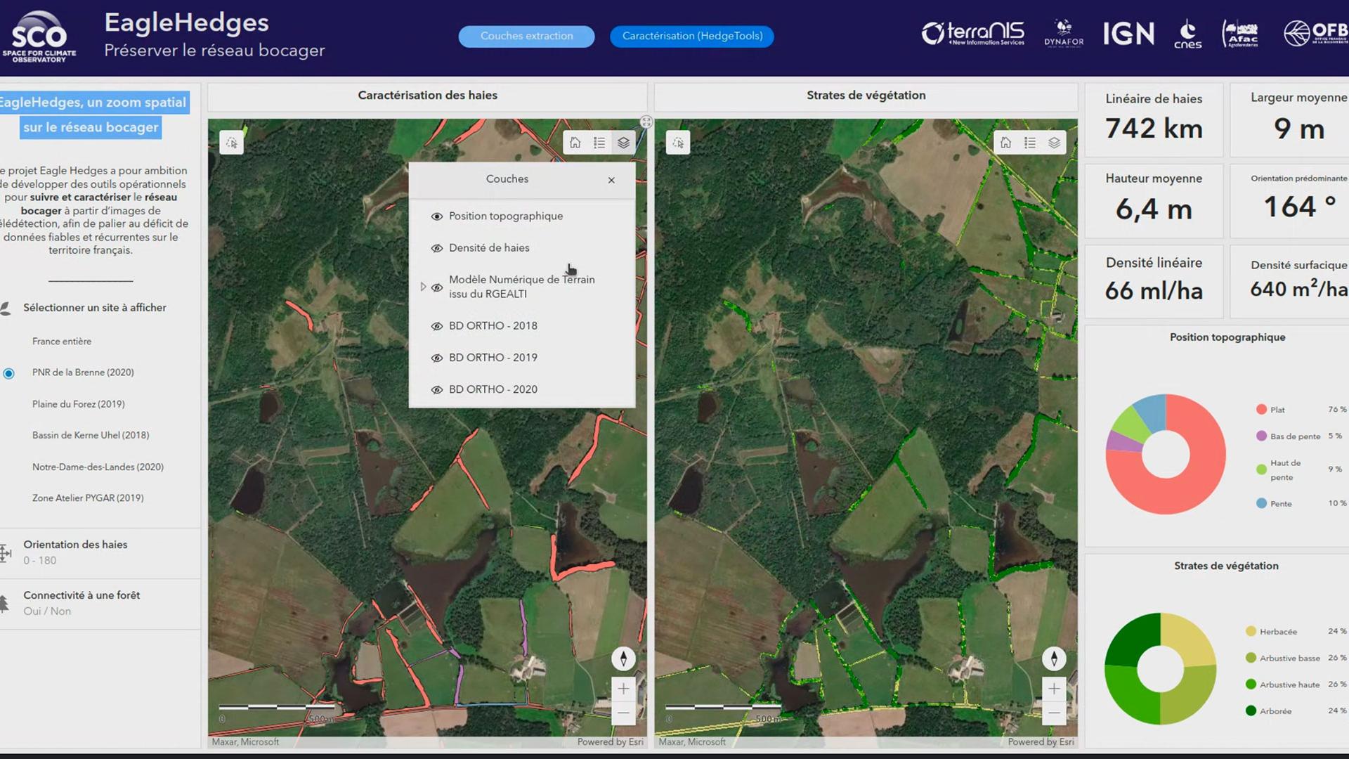
EagleHedges has delivered its tools for analyzing the bocage network
As ecological corridors offering numerous ecosystem services, hedgerows are an important lever for agro-ecological transition. Thanks to the EagleHedges project, territories now have access to a mapping service capable of automatically detecting hedgerows based on satellite images or aerial data. An open-source tool, HedgeTools, is also available to characterize the hedgerow network.
Learn more ➔
-
SCO France: 2024 Edition
The fifth call for projects of SCO France resulted in the approval of 11 projects covering several areas of climate change impacts. With water management still at the heart of our concerns, this year saw an increase in the number of digital twins and a clear focus on the African continent.
Learn more ➔
-
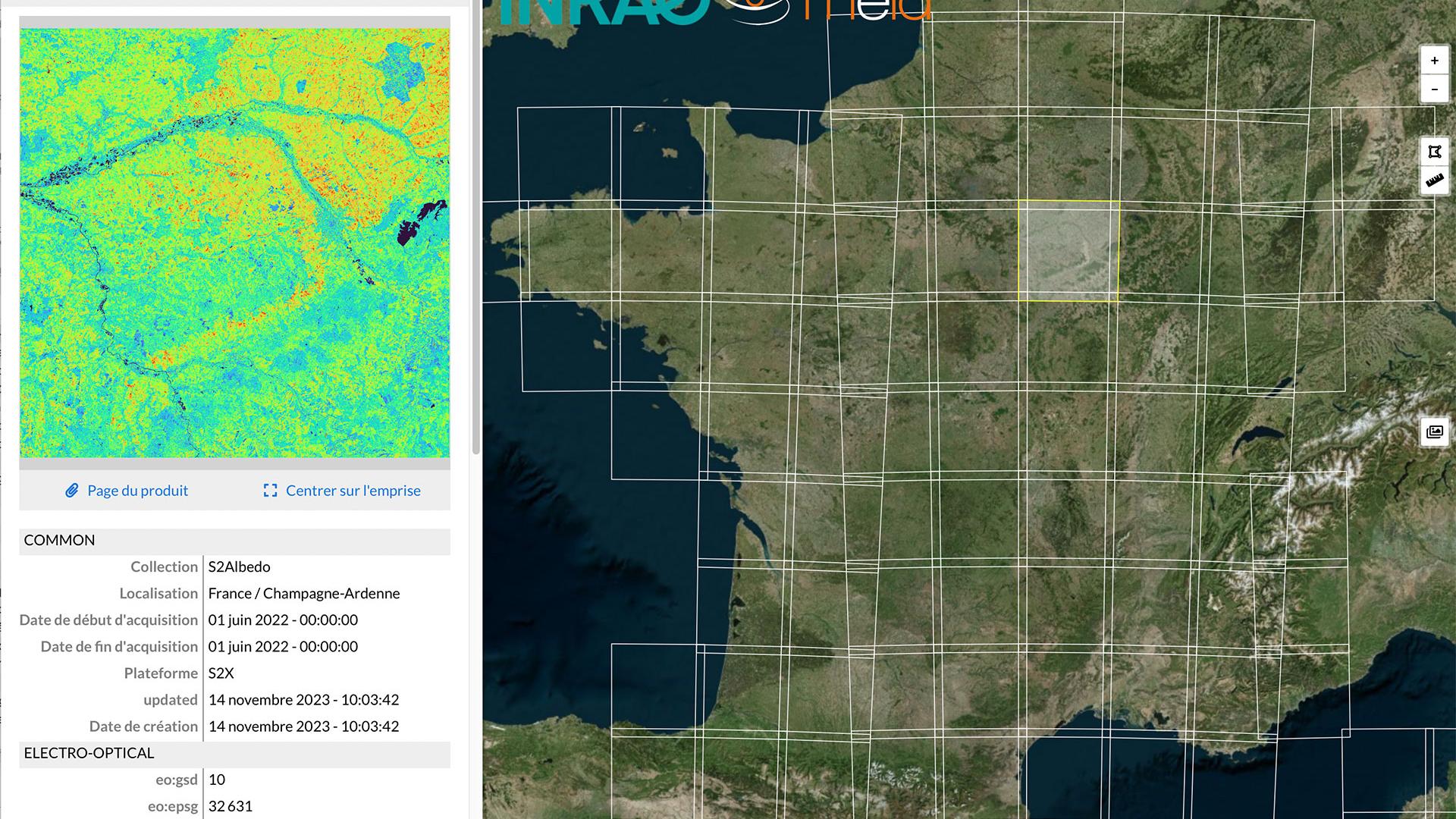
Sat4BDNB, French National Albedo
Cities: Sat4BDNB operationalizes albedo production on a national scale
Modifying the albedo of urban environments is an interesting way of reducing the urban heat island (UHI) phenomenon. However, albedo is easy to measure from space. Thanks to the SCO Sat4BDNB project, this measurement is now automatically calculated from Sentinel-2 data and freely available on Theia.
Learn more ➔
-
Coping with natural disasters
Coping with natural disasters
Fires, cyclones, mud, rain, snow, wind... Whatever their form, nature's wrath is intensifying. On Thursday 14 March 2023, at the twelfth " SCO France Quarterly Meeting ", three projects presented their SCOlutions, using satellite data to anticipate the impacts of some of them.
Learn more ➔
-
Pléiades 4 Urban Flood: start-up in situ
P4UF is exploring the potential of Pleiades monoscopic imagery to assess the susceptibility of an urban environment to flooding and report on this via risk maps. The first step is to go out into the field and talk to future users.
Learn more ➔
-
Transition for Cartovege
Dedicated to the French Southern and Antarctic Lands, the Cartovege project has produced the very first description of the habitats of the Crozet Islands and is now successfully completing the corresponding mapping. So much so that the SCO is extending its label to cover the Saint Paul and Amsterdam Islands, thereby consolidating the tool for the long term.
Learn more ➔
-
XtremQuality, space technology for detecting water quality
In order to take a comprehensive and effective approach to water, we need to consider both the quantity and quality of the resources available. As only the main reservoirs are instrumented for this purpose, the XtremQuality project is developing a method for satellite monitoring of the thousands of small bodies of water in France for which no information is available.
Learn more ➔