

SCOFrance
3 arbovirus predicted by ArbocartoRDengue, Zika, chikungunya
Useful links
- Arbocarto.fr website
- Arbocarto-V2 project
- GUS project
- News: When SCO's health projects become references
Key wordsMosquitoes, arboviruses, epidemics, prevention, vector control, urban vegetation, ecosystem services
Arbocarto opens an online version, GUS unveils itself

On 19 and 20 June 2024 at the Maison de la Télédétection in Montpellier, the Theia cluster organized a "Remote Sensing, Modelling, Health & Environment" workshop featuring 2 SCO-labelled projects: Arbocarto and Green Urban Sat.
🎥 The replay is available on the Theia website, HERE (in French).
Arbocarto to curb the proliferation of mosquitoes
With global warming, 'tiger mosquitoes' and the diseases they carry are no longer the exclusive preserve of the tropics. To prevent potential epidemics, a tool developed by CIRAD is becoming increasingly important: Arbocarto, which uses satellite imagery to provide predictive mapping of Aedes mosquito population densities.
With the latest version of ArbocartoR, its creator Annelise Tran is one step closer to her absolute goal of a "multi-mosquito" and "multi-disease" prevention tool.
|

Annelise Tran is a CIRAD researcher who has been working on dengue fever and the modelling of mosquito vector dynamics since 2004. |
"After the success of Arbocarto-V2, which was finalised thanks to the SCO, we quickly developed version 3, at the request of the French Directorate-General for Health, to enhance it with a module for calculating the basic reproduction rate (R0) for the dengue virus. We are now continuing our work as part of the H2020 MOOD project with ArbocartoR, developed by Pachka Hammami, a post-doctoral researcher at CIRAD (UMR ASTRE). Still with the main aim of providing indicators to help implement vector control (AVC) actions, this version can be used to simulate and explore the spatial and temporal dynamics of Aedes mosquito populations (albopictus and aegypti) and the transmission dynamics of three arboviruses: dengue, Zika and chikungunya, in various environments and under various AVC scenarios. ArbocartoR takes into account the main risk factors identified in the literature (temperature, rainfall, land use, human density and mobility). While the online version is intended for highly operational purposes, an R package is available for advanced users, primarily for research purposes." |
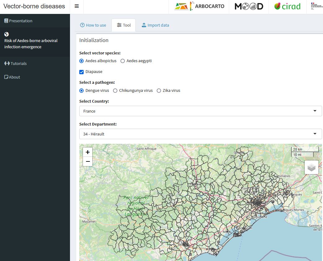
The ArbocartoR online platform requires no development or coding skills. © Arbocarto
GUS to support vegetation-based solutions in cities
As well as encouraging the spread of mosquitoes, global warming poses other threats to public health, particularly in cities, where vegetation can and should be our best shield.
Awarded the SCO label in 2021, the Green Urban Sat (GUS) project has developed a method for fine mapping of urban vegetation in order to better assess its many ecosystem services, which are vital for human health: cooling of the local climate, impacts on the water cycle, pollution, biodiversity, well-being, etc.
Tried out in the Greater Nancy area (France), the method is based almost exclusively on Pléiades satellite images and can therefore be replicated in any French, European or global city. As part of the SCO approach, the code developed is freely available on Cerema's GitHub.
Presented at the Theia seminar, the results obtained from the Greater Nancy demonstrator will shortly be made available online on the GreenCity platform operated by TerraNIS, a member of the project consortium alongside Cerema (satellite centre and urban environment research team) and the LIVE-A2S laboratory.
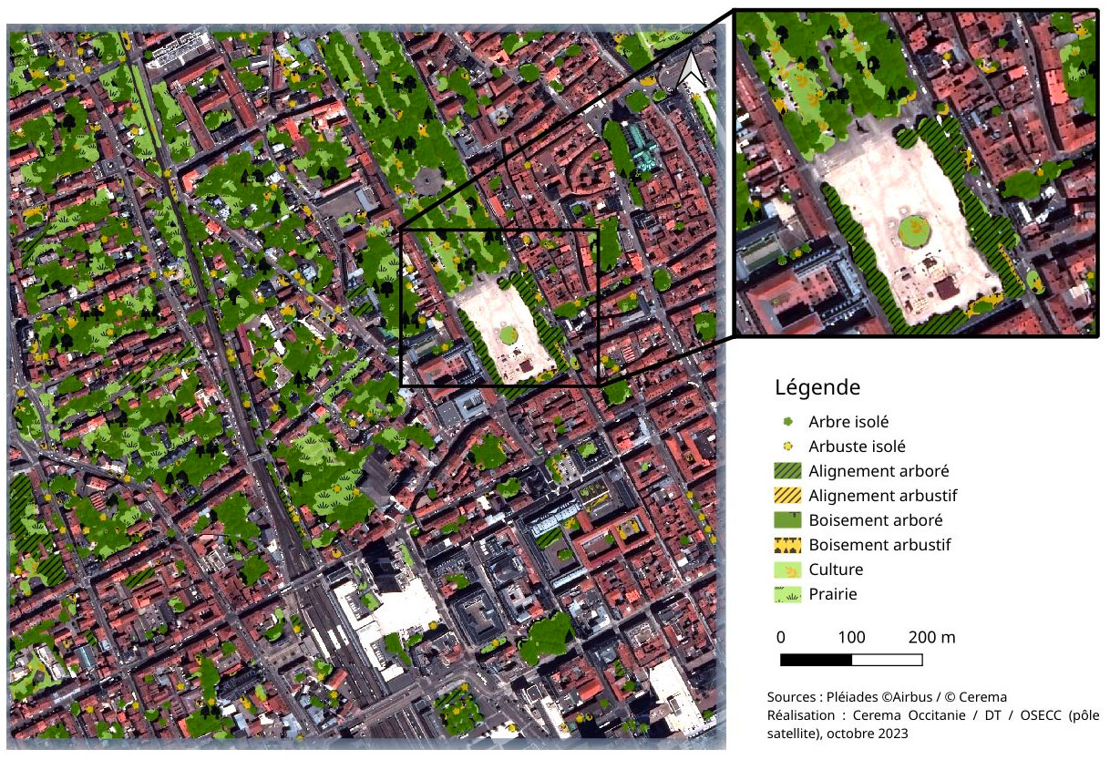
Using image processing and spatial analysis algorithms, as well as artificial intelligence for certain classifications, the GUS repository divides urban vegetation into vertical strata and then horizontal shapes, and detects the landscape in which the vegetation is located. © Green Urban Sat