Arctic-NEMO
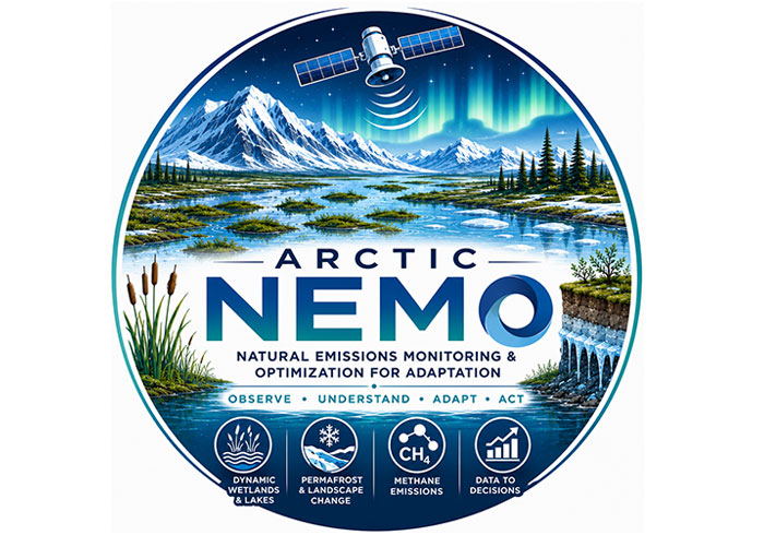
Natural Emissions Monitoring & Optimization for Adaptation
Overview
The Arctic is warming rapidly: why it matters
Arctic regions are experiencing rapid environmental change driven by permafrost thaw, changing wetland and lake dynamics, thermokarst (rugged terrain characterized by depressions and land subsidence caused by soil settlement resulting from the thawing of permafrost) development, landscape erosion, and increasing methane emissions. Together, these processes affect ecosystems, infrastructure, cultural sites, community planning and global climate feedback. Furthermore, CH₄ remains difficult to monitor because Arctic landscapes are vast, remote and highly dynamic, with strong seasonal changes in water extent, freeze-thaw state and surface connectivity.
👉 Decision-makers need timely, spatially explicit information to understand where and when these changes are occurring, where and when methane sources are most active, and which areas require adaptation or restorative action. However, this type of information is limited in Arctic regions due to limited funds, data, resources, and monitoring.
The Arctic-NEMO solution and impact
Arctic-NEMO responds to this gap by transforming outputs from two complementary initiatives, EOWetMet (ESA Carbon Science Cluster) and MACAI (CSA smartEarth Program)*, into an operational climate-service framework. The project combines multi-sensor satellite data, field validation and AI-based analytics to produce transparent and uncertainty-aware methane indicators for Arctic wetlands, lakes and permafrost landscapes. These indicators are designed with territorial and Indigenous partners so they can support practical adaptation, restoration and land-use decisions. Arctic-NEMO thus transforms EO data into practical climate intelligence. It helps governments, Indigenous communities, researchers and environmental managers better understand changing Arctic carbon landscapes, identify emerging risks and make better-informed adaptation decisions. These indicators will be easily accessible, and interpretable ensuring data are useful for a wide range of interested parties. | A key innovation of Arctic-NEMO is the integration of next-generation geospatial AI and EO foundation models to resolve methane-emission dynamics at unprecedented spatial detail. Building on recent advances from the EOWetMet and MACAI initiatives*, the project will use AI-driven modelling frameworks capable of identifying fine-scale Arctic landscape characteristics, hydrological connectivity, and methane-emission hotspots. These capabilities enable the production of harmonized, high-resolution indicators that capture environmental variability often missed by conventional monitoring approaches. |
Application site(s)
The application areas are in two regions in Northern Northwest Territories (NWT), Canada and North Sweden, where the EOWetMet and MACAI projects are underway. Measuring approximately 500 km x 500 km in size and capture large regions of wetland and lake under the effects of permafrost, these study sites are representative of Arctic and sub-Arctic environments. | 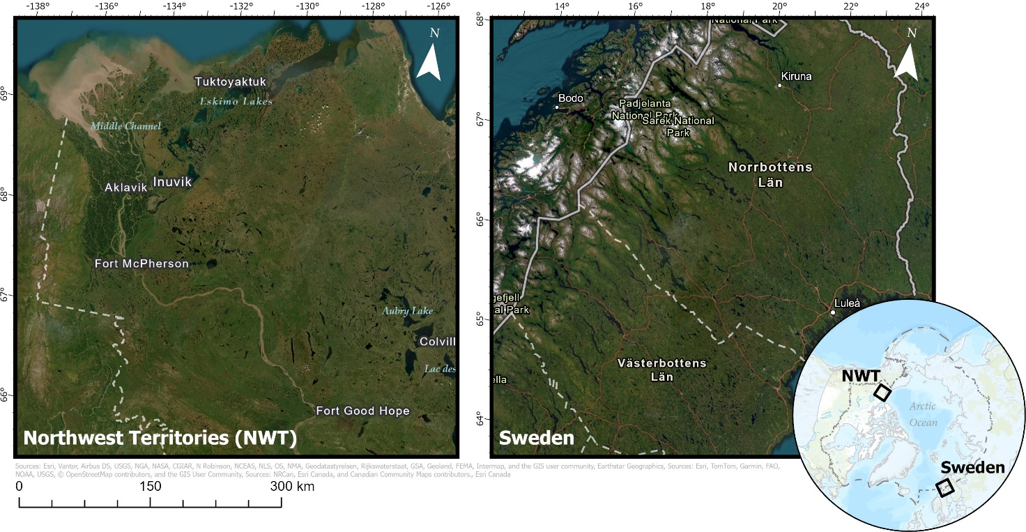 Figure 1 . Applications sites in Northern Northwest Territories, Canada (left) and northern Sweden (right). |
Data
Arctic-NEMO uses a multi-source data stack to describe the physical, hydrological and atmospheric controls on the Arctic landscape, building upon the work and results of ongoing EOWetMet and MACAI projects. Satellite observations are combined with Unmanned Aerial Vehicle (UAV), field, climate and socio-environmental datasets to connect environmental change with adaptation priorities. The proposed framework integrates these data to capture both spectral and physical characteristics.
Satellite
Sentinel-1 SAR radar data for inundation, water extent, freeze-thaw and surface change
Sentinel-2 optical data for land cover, vegetation and surface condition
Sentinel-5P / TROPOMI for atmospheric methane observations
Landsat-8/9 for long-term surface water and vegetation dynamics
SMAP for soil moisture and surface-water proxies
ALOS-2 PALSAR-2 and NiSAR for L-band SAR sensitivity to wetness and vegetation structure
Other
Environmental and Climate
ArcticDEM for topographic features including elevation, slope, and aspect
ERA5 for temperature and precipitation climate information
MERIT Hydro for hydrological input
Field and decision-context data
UAV and vehicle surveys provide multispectral and thermal data for fine-scale validation, local landscape interpretation and winter ebullition mapping.
In-situ and climate records reporting active-layer thickness, ground temperature, hydrological observations, flux measurements, government data and ERA5 reanalysis for model forcing and validation.
Socio-environmental layers such infrastructure, land-use, community assets and cultural priorities used to translate CH₄ indicators into adaptation-relevant information.
Results - Final product(s)
Arctic-NEMO transforms complex EO and atmospheric datasets into a practical climate-information service. Rather than delivering static maps or large scientific datasets, the project provides operational indicators that help users identify where Arctic landscapes are changing, understand how methane emissions are evolving alongside these changes, and assess implications for land-use planning, infrastructure development, environmental management, and climate adaptation. These indicators support informed decision-making by highlighting areas that may require adaptation, targeted monitoring, restoration efforts, or other proactive planning measures. The service enables informed decision-making for stakeholders including government agencies, Indigenous organizations, researchers, environmental managers, and northern communities. For example, it can support emergency preparedness planning, ecosystem management, and sustainable development initiatives.
The final product is an operational webGIS climate-service platform delivering harmonized, uncertainty-aware CH₄ indicators, maps and data services for Arctic wetlands, lakes and permafrost regions. The platform integrates validated outputs from EOWetMet and MACAI into three decision-ready indicator tiers:
Extent indicators: dynamic maps of wetlands, thaw lakes, inundation, permafrost disturbance and geomorphic change.
Flux indicators: bottom-up CH₄ emissions derived from Earth Observation, field data and AI-based models.
Integrated methane indicators: reconciled flux estimates from atmospheric inversions using TROPOMI and GOSAT. Results will be delivered through interactive dashboards, time-series analytics, APIs and scenario tools to support adaptation planning.
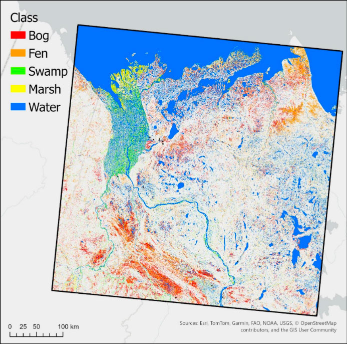 | 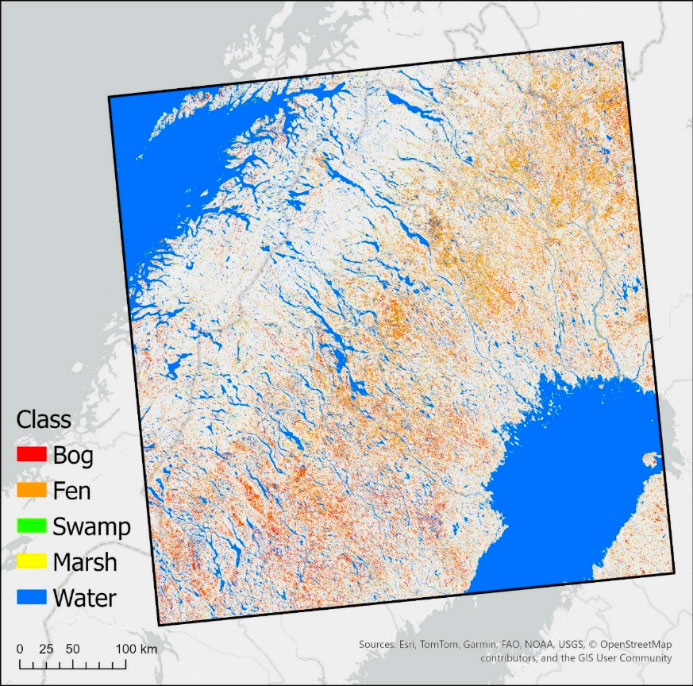 |
Figure 2 . The dynamic wetland maps, Canada (left) and northern Sweden (right).
References
C-CORE, 2026. EO-Driven Insights for Advancing Arctic Wetland and Lake Methane Emissions Monitoring (EOWetMet). C-CORE. https://c-core.ca/projects/eo-driven-insights-for-advancing-arctic-wetland-and-lake-methane-emissions-monitoring-eowetmet/
Hemati, M., Mahdianpari, M., Nassar, R., Shiri, H., Mohammadimanesh, F., 2024a. Urban methane emission monitoring across North America using TROPOMI data: an analytical inversion approach. Sci Rep 14.
Hemati, M., Mahdianpari, M., Shiri, H., Mohammadimanesh, F., 2024b. Integrating SAR and Optical Data for Aboveground Biomass Estimation of Coastal Wetlands Using Machine Learning: Multi-Scale Approach. Remote Sensing 16.
Jafarzadeh, H., Mahdianpari, M., Gill, E.W., Mohammadimanesh, F., 2024. Enhancing Wetland Mapping: Integrating Sentinel-1/2, GEDI Data, and Google Earth Engine. Sensors 24.
Kouhgardi, E., Mahdianpari, M., Shiri, H., Shakerdargah, A., 2025. The Future of Northern Canadian Land Use in the Age of Climate Change. EJFOOD 7.
Mahdianpari, M., Granger, J., Mohammadimanesh, F., Sonnentag, O., Marjani, M., 2026a. Dynamic Arctic wetland mapping: A multi-mission satellite time series approach. International Journal of Applied Earth Observation and Geoinformation 149.
Mahdianpari, M., Sonnentag, O., Mohammadimanesh, F., Radman, A., Marjani, M., Morse, P., Marsh, P., Lavoie, M., Risk, D., Wu, J., Suh, C.N., Gee, D., Giff, G., Ferguson, C., Peichl, M., Granger, J., 2026. State of the Art in Monitoring Methane Emissions from Arctic–boreal Wetlands and Lakes. Remote Sensing 18.
Marjani, M., Mahdianpari, M., Mohammadimanesh, F., Gill, E.W., 2024. CVTNet: A Fusion of Convolutional Neural Networks and Vision Transformer for Wetland Mapping Using Sentinel-1 and Sentinel-2 Satellite Data. Remote Sensing 16.
Marjani, M., Mohammadimanesh, F., Mahdianpari, M., Gill, E.W., 2025. A novel spatio-temporal vision transformer model for improving wetland mapping using multi-seasonal sentinel data. Remote Sensing Applications: Society and Environment 37.
Merchant, M., Bourgeau-Chavez, L., Mahdianpari, M., Brisco, B., Obadia, M., DeVries, B., Berg, A., 2024. Arctic ice-wedge landscape mapping by CNN using a fusion of Radarsat constellation Mission and ArcticDEM. Remote Sensing of Environment 304.
Mohammadimanesh, F., Marjani, M., Mahdianpari, M., 2026. HiResNet: A Low-to-High Deep Learning Framework for Updating Large-Scale Land Cover Inventory. IEEE Trans. Geosci. Remote Sensing 64.
Radman, A., Mohammadimanesh, F., Mahdianpari, M., 2024. Wet-ConViT: A Hybrid Convolutional–Transformer Model for Efficient Wetland Classification Using Satellite Data. Remote Sensing 16.
Related project(s)
- EOWetMet: ESA Carbon Science Cluster: EO-driven monitoring of Arctic wetland and lake methane emissions.
- MACAI (Mitigating Arctic Challenges Using AI): CSA smartEarth Program: AI-enabled mapping of permafrost, erosion and Arctic landscape change.