


Atlantic SENSE
Geospatial Intelligence for Climate Resilience and Environmental Monitoring
Continuous project Developed by the +Atlantic collaborative lab, which focuses on applying science to create innovative solutions for real-world challenges, this project involves ongoing efforts to improve the Atlantic Sense existing platform in Portugal and expand it to other regions for widespread adoption.
Overview
The Challenge
Across Europe and globally, climate change is intensifying metocean hazards, placing increasing pressure on society to anticipate, plan, and adapt. Although the scientific community produces vast amounts of data (including satellite Earth Observation (EO), but also in-situ monitoring, numerical models, and citizen sensing); however, the translation of this knowledge into accessible, actionable information for public authorities remains limited. As a result, decision-makers often lack harmonized, high-resolution indicators to understand local exposure or support long-term planning. Current reporting framework emphasize that observational systems are fragmented, urban areas are under-monitored, and climate– ecosystem–society interactions remain poorly quantified. This gap is particularly acute in coastal and metropolitan regions, where more than 40% of the global population lives within 100 km of the coast and where urbanization, infrastructure concentration and ecosystem fragility amplify climate impacts. The challenge is therefore no longer the availability of environmental data, but transforming that data into information that supports decisions.
The Solution
Designed to support organizations with different operational needs and levels of digital maturity, Atlantic SENSE was developed to help bridge the gap between environmental science and practical decision-making. This is achieved by leveraging Earth Observation, in-situ observations, Internet-of-Things (IoT) data and metocean modelling to produce high-resolution, cross-domain hazard and risk indicators. All translated into an intuitive tool for real-time awareness and long-term planning.
The Atlantic SENSE tool therefore:
provides an integrated geospatial multi-hazard tool for public authorities and citizens,
transforms various datasets into meaningful indicators of climatic and environmental risk,
ensures scalability, transparency, and affordability for widespread adoption.
Building on Portugal’s New Space Agenda, Destination Earth (DestinE) and the European Digital Twin Ocean (EDITO), Atlantic SENSE platform and products have been developed through an ongoing co-design process with early adopters from various sectors (municipalities, environmental agencies, researchers and other end users). In this way, it ensures that new functionalities respond to real operational needs. As a result, thanks to an intuitive, user-tailored web interface, different types of users can easily obtain downscaled, cross-domain land–ocean–atmosphere information within a single operational tool.
User journeys and interface prototypes have been tested each quarter to refine clarity, accessibility, usability and operational relevance.
Application site(s)
Initially developed for Portugal, Atlantic SENSE is designed to be fully reproducible and transferable to other regions, both within Europe and internationally. Its architecture is modular, relies primarily on open and globally available datasets, and uses processing chains that can be systematically adapted to different geographies, climates and governance contexts.
Data
The platform builds mostly on open data from several Copernicus services, Sentinel missions, numerical models and standardized geospatial formats and APIs (WMS, WFS, THREDDS, ERDDAP, GeoJSON). These data sources enable the AIR, LAND, COAST and OCEAN modules to be deployed anywhere with minimal structural adjustments. Machine-learning and statistical methods used for downscaling, anomaly detection and trend analysis are geographically agnostic, requiring only local calibration datasets, to ensure accuracy.
AIR
- Satellite: This domain uses atmospheric products from Sentinel-5P, the Copernicus Atmosphere Monitoring Service, and the Copernicus Climate Change Service. High-resolution urban-morphology layers from the Copernicus Land Monitoring Service support the downscaling of temperature and pollution.
- Other: In-situ sensors, including those from citizen-operated stations, are used to train and calibrate machine-learning predictions.
LAND
- Satellite: Land-use and land-cover mapping relies on products from the Copernicus Land Monitoring Service, which are derived from Sentinel-2 and complementary very high-resolution missions. These support the Local Climate Zones classification and carbon-stock estimation.
COAST
- Satellite: Coastal analyses using Landsat and Sentinel-2 for shoreline detection and Satellite-Derived Bathymetry. Satellite derived bathymetry is used for local high-resolution models. Satellite altimetry from Jason, Sentinel-6 and the XTRACK dataset provides sea-level anomalies for the historical Total Water Level series.
- Other: Operational coastal forecast system, using downscaling ocean circulation (MOHID) and wave model (Wavewatch III) to provide short-term (6 days) storm indications.
OCEAN
- Satellite: The ocean domain integrates reanalyzes and forecasts from the Copernicus Marine Service, complemented by sea surface temperature products for comparison. Hydrodynamic model outputs are downscaled for coastal areas and assessed against observations.
- Other: Traditional observations such as tidal gauges and moored buoys are included along with emerging technologies such as HF radars, Autonomous Underwater Vehicles (AUVs) and low-cost temperature sensors.
Results – FInal product(s)
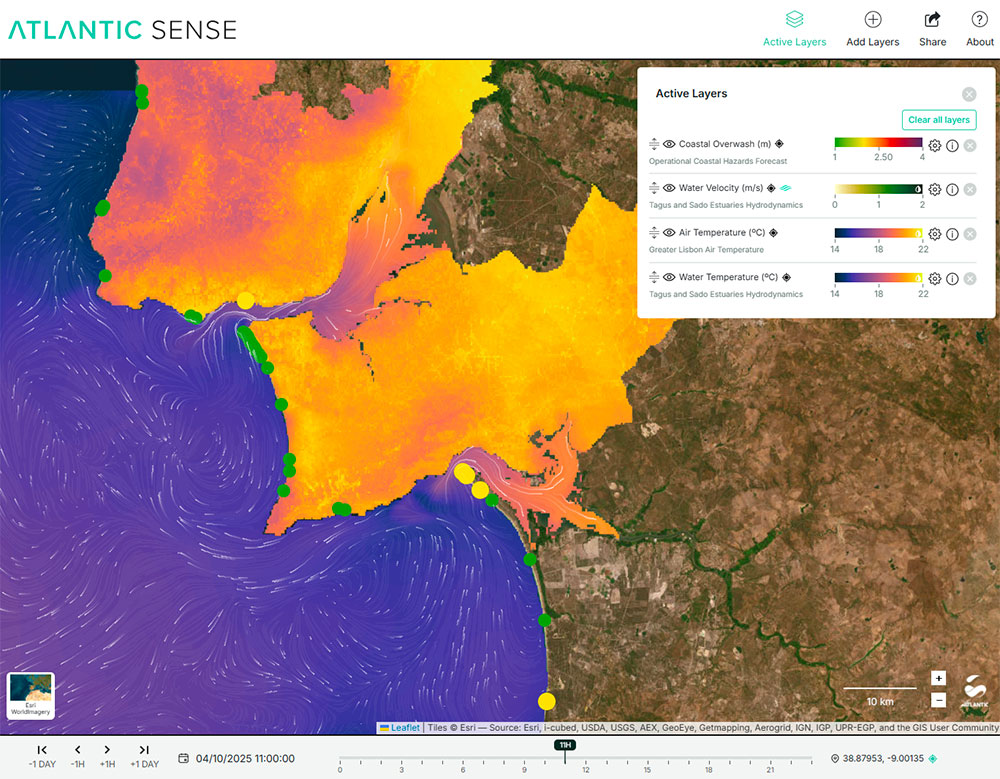
Available for free at www.atlanticsense.com, Atlantic SENSE is a geospatial multi-hazard information system that enables users to visualize, compare and analyze environmental information through an integrated set of geospatial tools. Users can visualize multiple hazards, compare environmental variables, analyze historical trends, explore forecasts, download information, access metadata, visualize observations, and integrate external services.
👥 Atlantic SENSE is structured as a three-level system, enabling organizations to adopt the platform according to their maturity and needs:
- Level 1 – Open Geovisualization: a free-access interface displaying EO and modelled data for exploration and awareness.
- Level 2 – Off-the-Shelf Platform: a ready-to-deploy version that can be installed within institutional infrastructure, integrating client or open-source datasets and complying with data-governance policies.
- Level 3 – Data-as-a-Service: a fully customized solution with tailored front-end/back-end workflows for advanced use cases such as urban-planning intelligence or maritime-operations support.
Already being adapted for external applications (see below), Atlantic SENSE is currently a transferable platform that can be adapted to different territories, governance contexts and user needs.
| ⚙️ The platform includes base layers, welcome and about pages, layer catalogues, active-layer controllers, full layer configuration options (palette, range, transparency, depth), metadata, disclaimers, time bar, thematic filters and a dynamic sidebar with plots and legends. Users can interact via click and hover, generate custom charts, download CSV data. It’s also possible to visualize AUV/drifter data. | 🛠️ It has a BackOffice tool to add/edit/remove layers and metadata. Infrastructure includes cloud production and staging servers, local testing, and dedicated services for resilient and scalable operations (WMS/GeoServer/MapServer for rasters, WMS/THREDDS for gridded data, ERDDAP for vector time series, GeoJSON for geometries and particle animations for flow representation). |
Operational modules already cover:
► Atlantic SENSE layers over the Portugal Mainland Area: Daily Heat Wave Intensity per Municipality, as obtained from the Excess Heat Factor. © +ATLANTIC CoLAB | 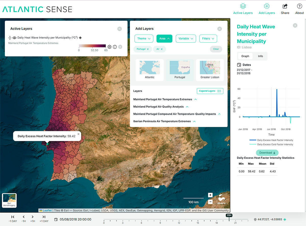 |
► Atlantic SENSE layers over the Portugal Mainland Area: Coastal Carbon Stock Change [2012-2018], as obtained from Coastal Zones Land Cover/Land Use 2012/2018 data from Copernicus Land Monitoring Service and standard carbon metrics from the InVEST Carbon Storage and Sequestration model. © +ATLANTIC CoLAB | 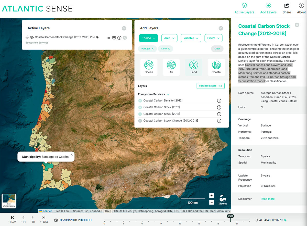 |
► Atlantic SENSE layers over the Portugal Mainland Area: Coastal Geomorphology, Shoreline Trends [1984-2024], as obtained using the CoastSat algorithm (Vos et al., 2019) applied to Landsat and Sentinel satellite collections. © +ATLANTIC CoLAB, Ciências-ULisboa | 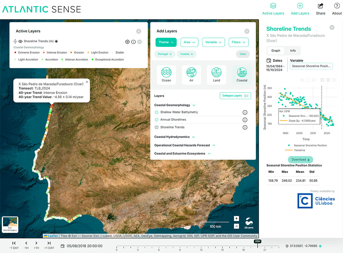 |
► Atlantic SENSE layers over the Atlantic Basin: Marine Heatwaves Intensity (daily), using Hodbay´s method applied on CMEMS forecast data. © +ATLANTIC CoLAB | 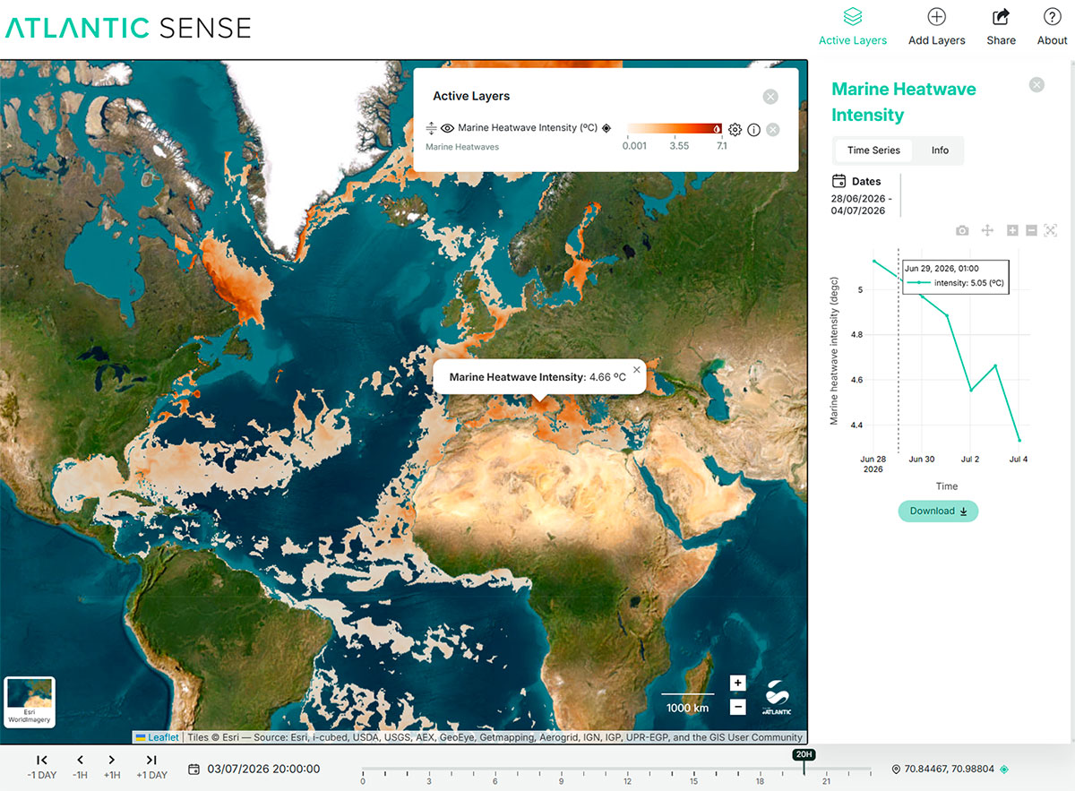 |
Atlantic SENSE is already being adapted for external applications.
Examples include versions developed for the University of Cádiz (Spain), SISdATA project (Portugal), ARNET network (Portugal). These implementations confirm the platform’s ability to adjust to diverse operational needs, providing reliable information for advanced visualization and informed decision-making.
Examples of the applications and tailor-made solutions include:
- Level 1 – Open Geovisualization: Open data visualization over the Atlantic Ocean basin, including layers on mainland Portugal, Azores and Madeira archipelago, as well as detailed information over the Lisbon Metropolitan Area. Available at: www.atlanticsense.com
- Level 2 – Off-the-Shelf Platform:
- Portugal (DataHub ARNET) - https://datahub.arnet.pt/
- Spain (Oceanuca Platform) - https://oceanucamaps.uca.es/
- Ireland (FreeLitterAT Platform) - In Development
- Level 3 – Data-as-a-Service:
- Portugal (Sisdata Project Platform and High Resolution Numerical Models for Madeira and Mondego River) - https://ucatlanticarea.dei.uc.pt/
- Spain (TriRuralTech Gemelo Digital and Downscaled Numerical Models for Murcia and Mar Menor) - https://omm.imida.es
Outlook
Next steps include scalability beyond Portugal, enhanced multi-hazard dashboards and sector-specific extensions for renewable energy, public health and urban infrastructures.
Related project(s)
New Space Portugal - https://www.newspaceportugal.org/
