

SCOFrance
PartnersSGEvT, INRAE, Université Toulouse Jean Jaurès, ONERA, Smmar, SmageAa, CNES
Useful linksProject page
🎥 Project presentation in Trimestrielle
KeywordsRunoff, flooding, drought, nature-based solutions
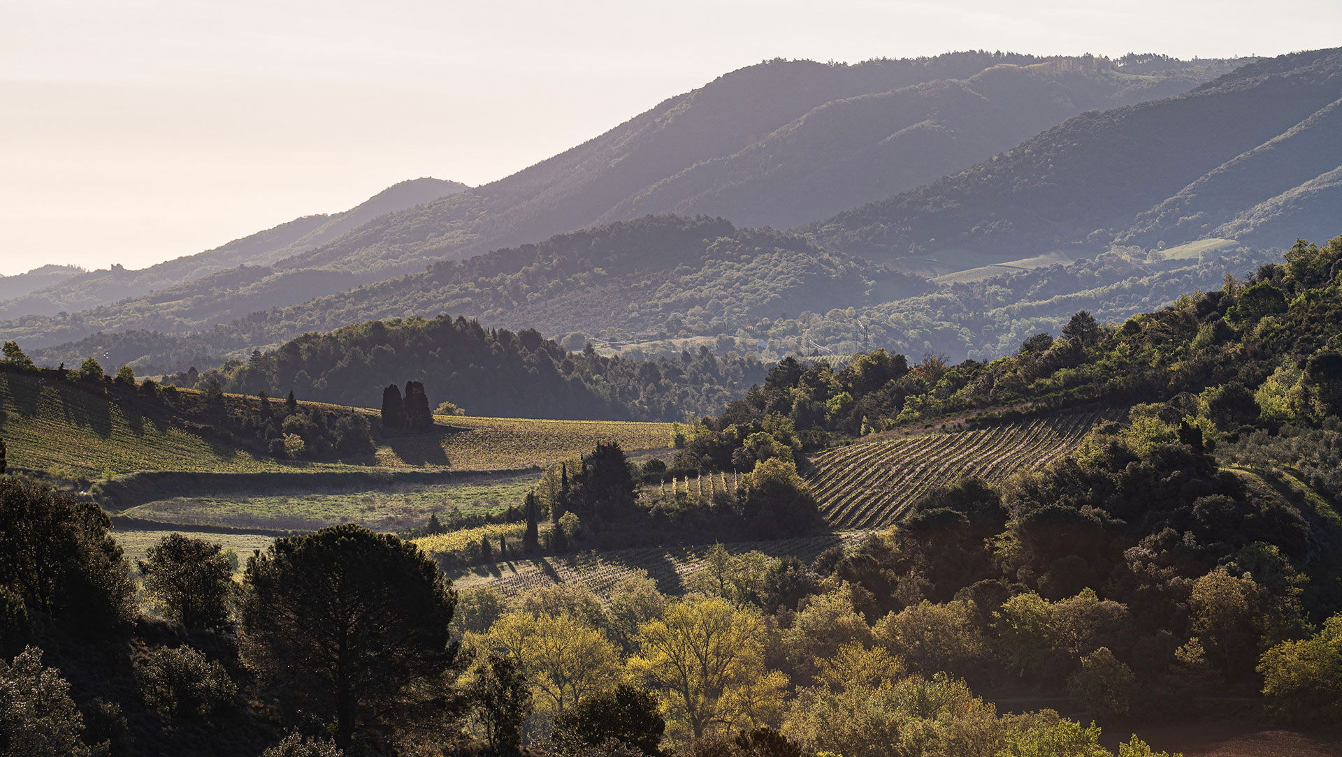
ATTEST: a story of Aude
The ATTEST project tackles what has now become the main cause of flooding – which is also the number one natural hazard in France – namely surface runoff. This is because, today, the combination of longer droughts, which harden the soil, and more intense rainfall is hindering water infiltration. Whilst the repercussions are disastrous, the long-term viability of insurance cover for this risk is being called into question by climate scenarios.
Against this backdrop, ATTEST aims to equip local authorities with tools to enhance their understanding of the phenomenon of surface runoff and to help prioritize preventive measures as far upstream as possible within catchment areas. To ensure the consistency of the methods developed, the project is being carried out jointly with two organizations responsible for water management in flood-prone catchment areas, which are nevertheless very different:
- SmageAa (Joint Association for the Development and Management of the Waters of the Aa) in Nord-Pas-de-Calais, where exceptionally prolonged and intense winter rainfall struck the region during the winter of 2023–2024;
- the Smmar (Joint Association for Aquatic Environments and Rivers) in the Aude, a region regularly affected by Cévennes weather events.
Beyond this regional roots which have underpinned the project since its inception, the Anne De Joyeuse winery is now taking a keen interest in ATTEST. The winery supports its members in a wide range of environmental initiatives and has provided us with a compelling account of today’s reality. Given how well the ATTEST solution meets local needs, a trial is now getting under way at a site in the commune of Preixan.
When water ‘falls badly’, runs off and erodes the ground
Heading for Limoux, on the upper reaches of the Aude, above Carcassonne. Guillaume Vaysse, an agricultural technician at the Anne de Joyeuse Winery, gives a clear account: “We are feeling the effects of climate change and its extremes. Two issues are of particular concern to us: firstly, water runoff, which leads to significant soil loss. When you consider that it takes nearly 1,000 years to form a single centimeter of soil, every episode of erosion represents a considerable loss. Not to mention the clearly visible damage: soil ends up in streams, which become blocked, whilst mudslides cut off roads, flood villages, and sometimes even reach residents’ garages. Secondly, water availability is a problem: we always have some, but it ‘falls badly’, increasingly in the form of thunderstorms. The challenge now is to retain it on the plots when it rains, so that we can make use of it later during the increasingly severe dry spells. Here, drought has had a significant impact on the last four vintages, with crop losses of 20 to 25 per cent over the past three years.”
Furthermore, “as we are also working on the quality of drinking water, which supplies nearly 60,000 residents of Carcassonne, we have observed a link between stormy rainfall and rising pollution levels, as runoff promotes the leaching of plant protection products and their transfer into watercourses. For all these reasons, we must take action upstream, adopt more appropriate practices and make the most of our farmers’ land. For example, using grubbed-up vines – as they no longer produce grapes – to implement measures that benefit everyone: retaining water, retaining soil, preventing runoff and thus flooding, and thereby preventing pollutants from being washed away.” |
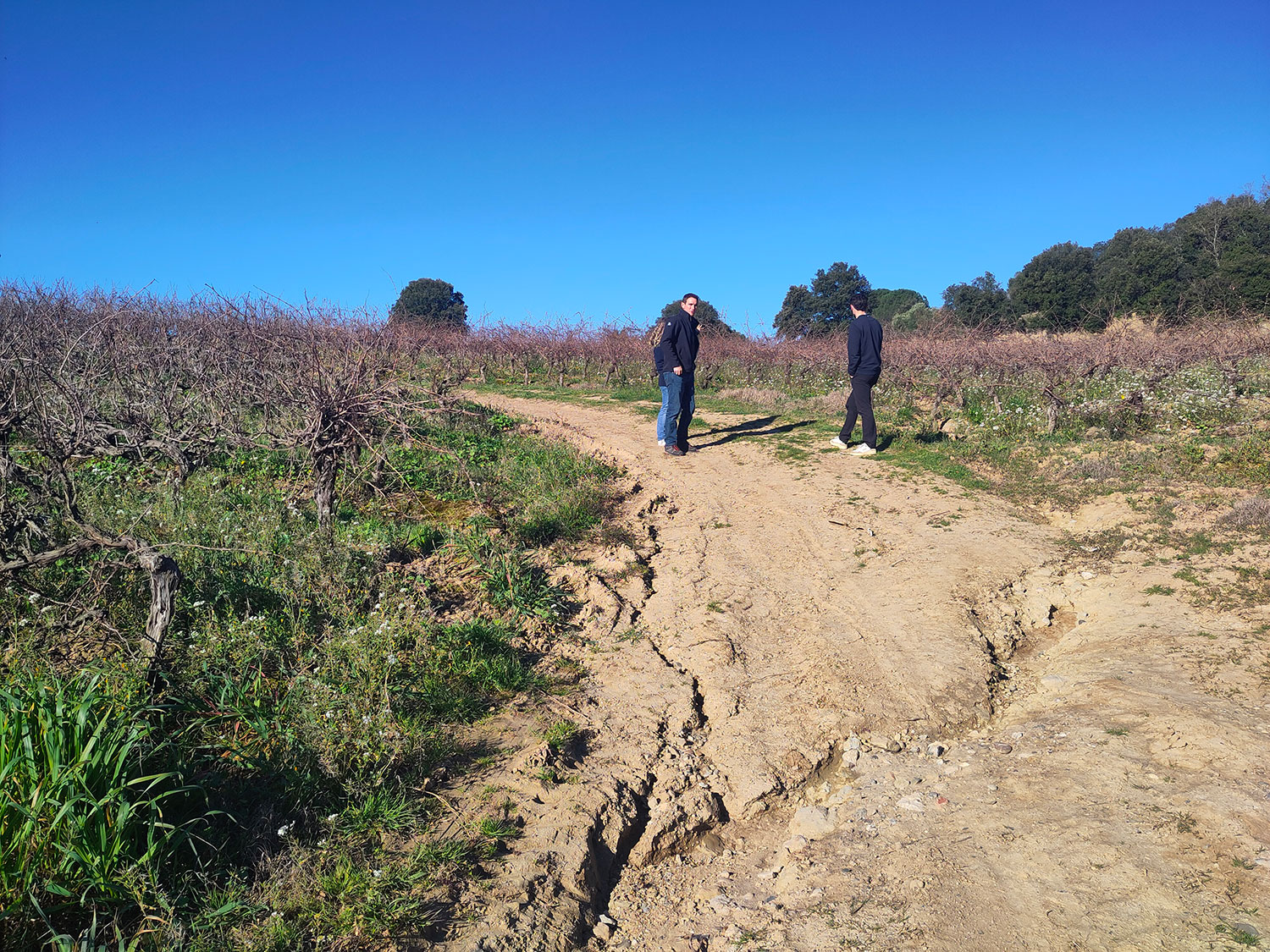
▲ Gully erosion on a path between two vineyards, situated on a runoff route (municipality of Preixan). © Adrien Solacroup |
For the Winery, which provides advice each year on around a hundred hectares of other farms – both wine-growing and non-wine-growing – the discovery of ATTEST is a real source of motivation. “Beyond anything we could have hoped for, ATTEST enables us to have an impact on the issues as a whole, to review the structure of our land and our entire watershed, and thus offer targeted advice on soil management,” says Guillaume Vaysse.
The ATTEST solution: taking action upstream, before runoff becomes concentrated
Developed by SGEvT (Société Générale d’Évaluation des Territoires, General Society for Land Appraisal), ATTEST uses satellite imagery on which algorithms identify areas affected by runoff and monitor the status of nature-based solutions implemented to reduce these impacts (hedges, grass strips, buffer ponds, etc.). This information is then cross-referenced with predictive models of floodwater runoff, as well as with local priorities (residential areas, transport infrastructure, etc.).
Verified in the field and made available on an online platform (currently under development), this data enables the prioritization of measures to slow down water flow and promote its infiltration, with the added benefit of combating droughts – the flip side of water runoff. In addition, a documentation module compiles the knowledge of stakeholders over the years to better prevent the impacts of water runoff.
► Modelling, based on a Pleiades satellite image dated 6 February 2020, of water runoff channels at the Preixan vineyard. © SGEvT / Pléiades CNES, Distribution Airbus DS |  |
► Algorithm for detecting, via satellite imagery, plots affected by runoff (shaded in red) and modelling theoretical water flow channels (in blue), in the vicinity of the village of Salsigne, in the north of the Aude department. (3D view from the TEREvAL software © SGEvT / SPCD algorithm © INRAE / Pléiades satellite image of 3 November 2018 © CNES, distributed by Airbus DS) | 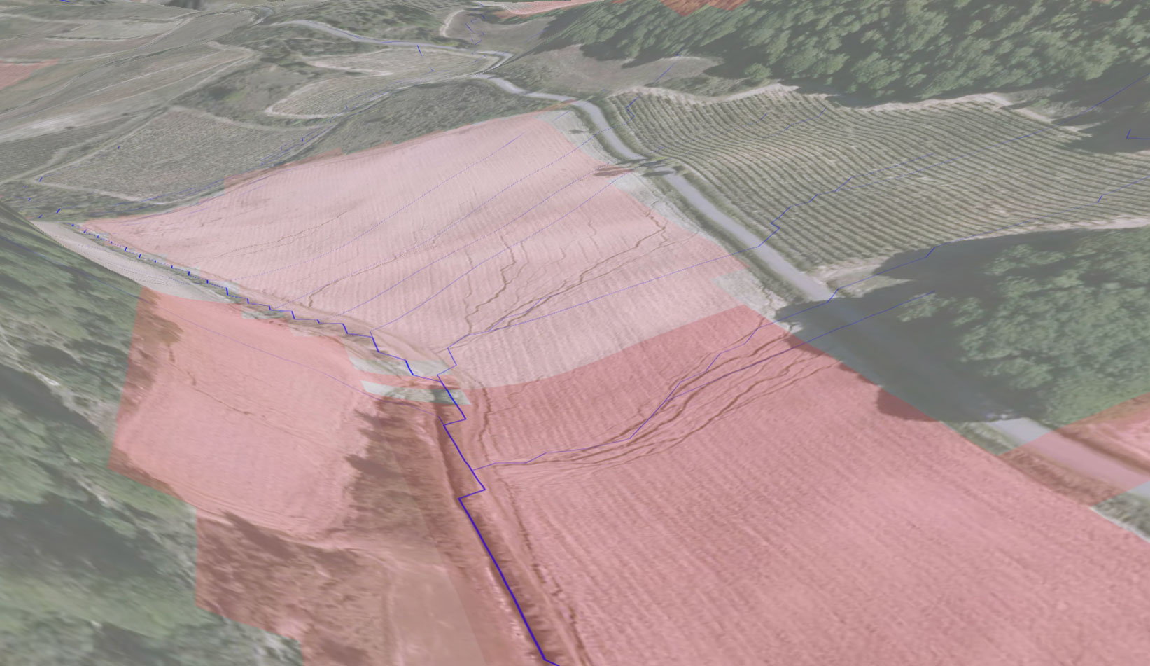 |