EeyouSat
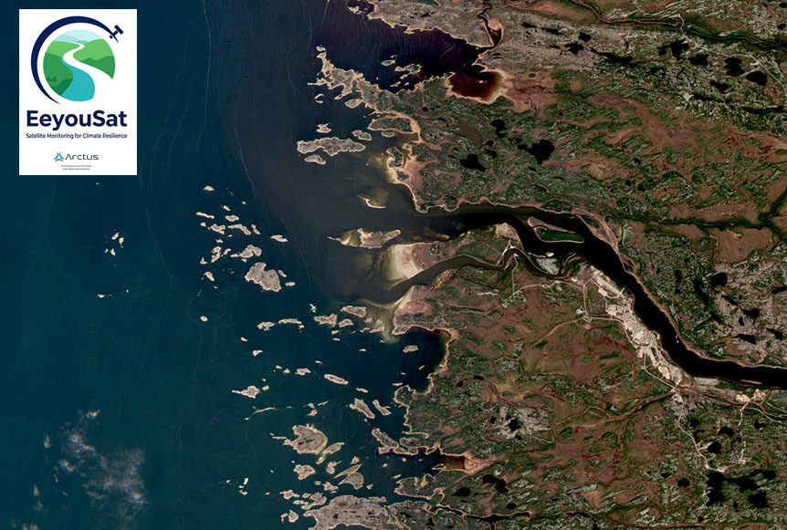
Satellite Earth Observation based monitoring system for climate resilience in Eeyou Istchee, James Bay, Quebec, Canada
Overview
The Challenge: Climate Change in Eeyou Istchee
In Canada, Northern coastal ecosystems are highly vulnerable to climate change. Rising air and sea temperatures, permafrost thaw, and loss of protective shore ice accelerate erosion and transform habitats. Among the most affected are eelgrass (Zostera marina) meadows: key “blue carbon” habitats that sustain biodiversity, stabilize sediments, improve water quality and store carbon. Their decline, exceeding 30% globally, threatens both ecosystem resilience and climate mitigation.
Efforts to preserve or restore seagrasses have been widely recognized as nature-based solutions in coastal zones to mitigate climate change and recover biodiversity.
In Eeyou Istchee (Eastern James Bay, Quebec, Canada), the ancestral territory of the Cree Nation, climate change and hydroelectric development have degraded eelgrass meadows, affecting biodiversity and traditional Cree harvesting. The Cree Coastal Habitat Comprehensive Research Project (CHCRP Coastal Habitat Comprehensive Research Project) confirmed links among eelgrass loss, turbidity, and light reduction but revealed a critical lack of spatial tools for monitoring these changes. | 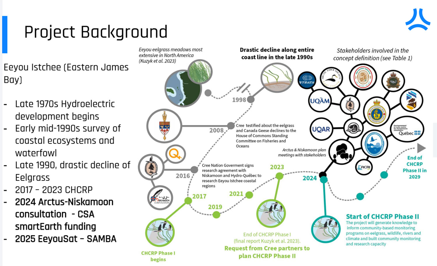 |
The EeyouSat Solution: A Community-Based Monitoring System
Deployed in partnership with Cree Nation, this EeyouSat project gives geospatial data, including submerged vegetation habitat mapping and coastal ice mapping to support Indigenous-led conservation efforts, guide restoration projects and sustainable coastal management strategies and provide insights for Canadian researchers, policymakers, and restoration initiatives.
Conducted with the financial support of the Canadian Space Agency, the program is led by Arctus, a company specializing in remote sensing of aquatic environments, in partnership with Niskamoon Corporation, a nonprofit organization that manages cooperation between the Cree communities of Eeyou Istchee and the electricity producer Hydro-Québec, as well as the Quebec Ministry of the Environment, Climate Change, Wildlife, and Parks*.
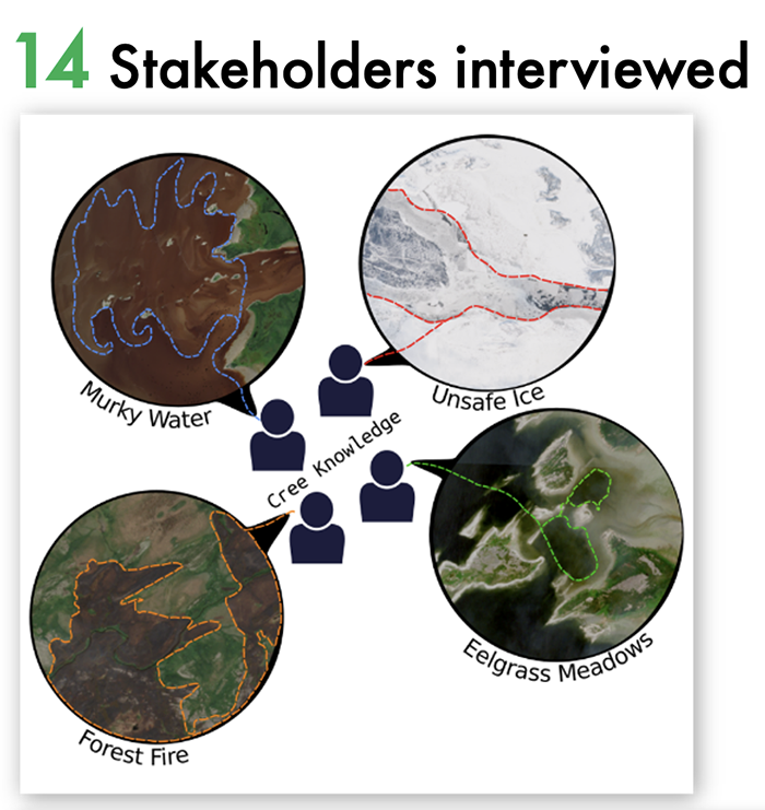
► EeyouSat is part of the CHCRP (Coastal Habitat Comprehensive Research Project), designed to meet the need for space-based tools to monitor changes in coastal habitats. | 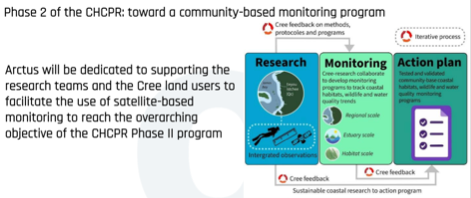 |
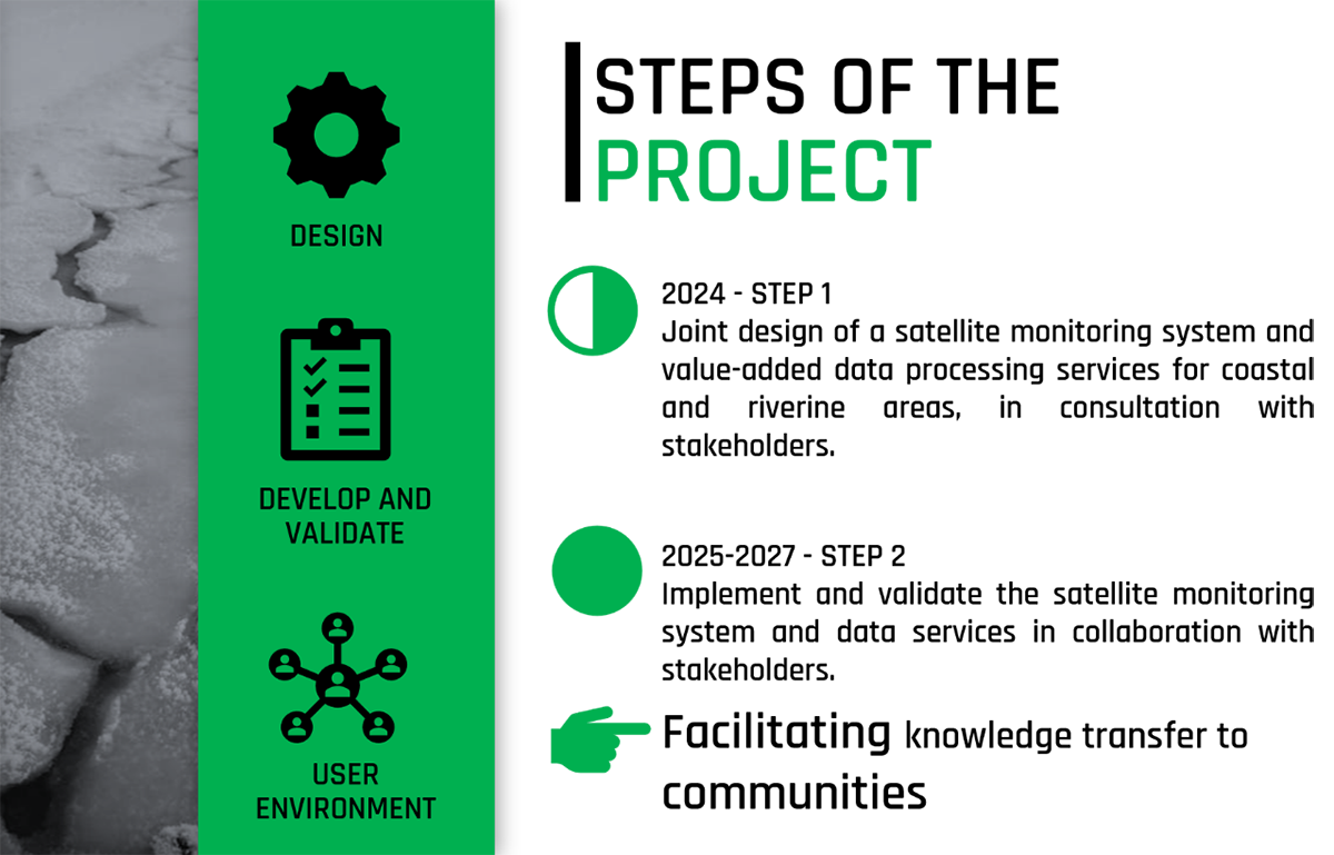
The EeyouSat methodology and tools are designed from the outset for transferability and reproducibility across Arctic and sub- Arctic coastal environments. The project’s modular, open-source architecture allows its components: data processing, product generation, and dissemination, to be readily adapted to other regions facing similar challenges related to climate change, turbidity, and ice dynamics. It prioritizes open access, transparency, and community benefit through a comprehensive dissemination plan.
 |  |
 |
Our Impact: Supporting Indigenous-Led Conservation
Enhancing remote sensing techniques to monitor river ice conditions and coastal biodiversity including submerged vegetation mapping.
Strengthening climate resilience and adaptation and ensuring the autonomy of environmental monitoring by indigenous peoples
Increasing awareness and engagement among the Cree Coastal communities including making data easier to access and use.
Advancing biodiversity conservation
Generating and providing satellite-derived environmental variables as analysis-ready data products to support modeling habitat suitability and restoration planning.
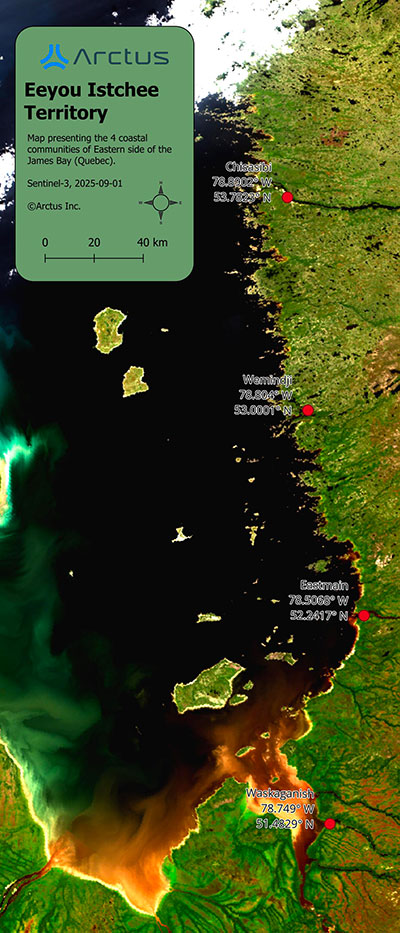
Application site(s). Eastern James Bay, Canada . James Bay Cree comunity (Waskaganish, Eastmain, Wemindji, Chisasibi), Canada |
Data
Satellite
Use of Optical and SAR data for innovation:
- Sentinel-2 (Copernicus) – optical mapping of eelgrass, water quality, and bathymetry
- Landsat-8/9 (USGS) – complementary water quality monitoring
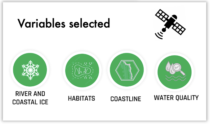
- Sentinel-1 (SAR) – river and coastal ice monitoring
- RCM (RADARSAT Constellation Mission) – SAR for ice mapping
- Pleiades / Pleiades Neo – validation of eelgrass and nearshore habitats
- Potential integration with SWOT, ICESat-2 for coastal ice and bathymetry
Other
- In-situ data - Optical measurement (CHCRP), Eelgrass presence (CHCRP), Eelgrass (CHCRP), Crowdsourced bathymetry data
- Traditional knowledge
- Cree Coastal Habitat Comprehensive Research Project (CHCRP) field surveys (eelgrass, turbidity, salinity, bathymetry).
- Community-based monitoring using Indigenous land users’ observations.
- All datasets are processed to Analysis-Ready Data (ARD) standards using open-source frameworks (e.g.SNAP, rioxarray). Data fusion ensures interoperability, transparency, and scalability—supporting operational restoration and climate-resilience applications across northern coasts.
Results – Final product(s)
The EeyouSat project delivers an integrated Earth Observation (EO) based monitoring service providing end users with validated, high-resolution datasets, mapping tools, and operational interfaces to support ecosystem restoration and climate adaptation in northern coastal regions.
1. EO-Based Monitoring System and Web Interface
A bilingual, web-based monitoring platform, accessible via the CHCRP website and compatible with Carto Vista, SIKU, and WMTS services, will allow stakeholders to visualize, analyze, and download satellite derived products. Users will access dynamic layers on eelgrass distribution, water quality, intertidal changes, and coastal ice through interactive dashboards, enabling direct integration into GIS applications.
2. Space-based Environmental Datasets
The system will provide Analysis-Ready Data (ARD) following SpatioTemporal Asset Catalogs (STAC) specifications for:
Validated eelgrass and coastal vegetation maps from Sentinel-2 and Pléiades imagery;
Water quality variables (turbidity, SPM, CDOM, chlorophyll-a);
Satellite-Derived Bathymetry (SDB) and intertidal change maps;
Seasonal river and coastal ice products describe ice type, thickness, and roughness.
► Preliminary Sentinel-2 imagery used to track sediment plumes impacting eelgrass. © Contains Copernicus Sentinel-2 imagery processed by Arctus Inc. (2024-10-18)
▼ Preliminary Sentinel-1 imagery used to classify ice types in La Grande river. © Contains Copernicus Sentinel-1 imagery processed by Arctus Inc. (2026-03-25) 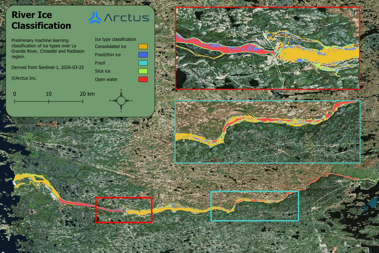 | 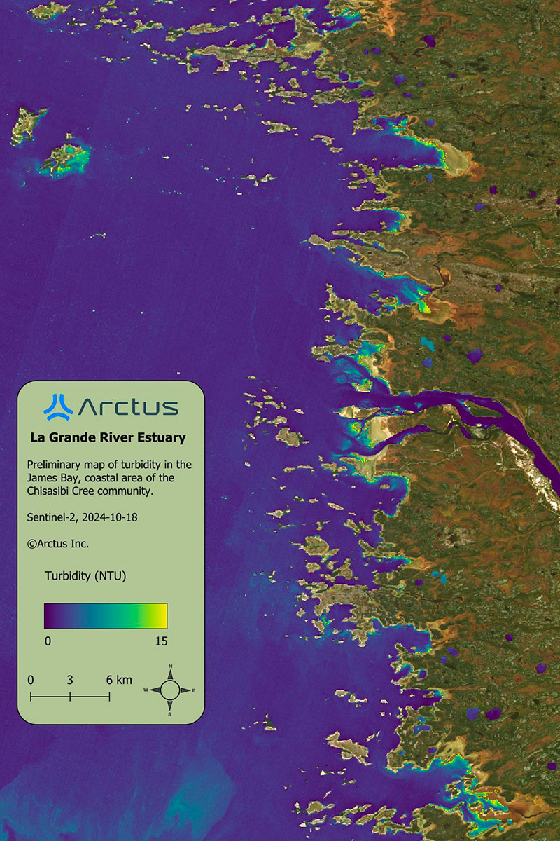 |
3. Methodological and Training Deliverables
An EO-based coastal monitoring guideline will document best practices in atmospheric correction, water column modeling, and AI methods, integrating Cree knowledge for ecosystem mapping. Capacity-building tools will include analytical Jupyter notebooks for advanced users and outreach materials for Cree organizations, government agencies, and policymakers.
4. Expected Impact
By providing reliable spatial indicators, the project is enabling the Cree Nation Government, Cree Trappers Association, Niskamoon, and environmental authorities to identify priority restoration areas and evaluate ecosystem recovery. The project’s transferable, open-source prototype will serve as a scalable model for operational EO-based coastal monitoring across Arctic and sub-Arctic environments.
By combining open data, open tools, and community-focused training, EeyouSat offers a sustainable and replicable model for Earth Observation-based coastal monitoring led by northern communities.
References
- Leblanc, M.L. et al. (2023) ‘Limited recovery following a massive seagrass decline in subarctic eastern Canada’, Global Change Biology, 29(2), pp. 432–450. https://doi.org/10.1111/GCB.16499
- Pan, Y. and Bélanger, S. (2025) ‘Genetic Algorithm for Atmospheric Correction (GAAC) of water bodies impacted by adjacency effects’, Remote Sensing of Environment, 317, p. 114508. https://doi.org/10.1016/J.RSE.2024.114508
Related project(s)
CHCRP Coastal Habitat Comprehensive Research Project