

HOSWA

Ho Chi Minh City Observatory for Adaptation to Subsidence and Water
Overview
The observatory is being deployed in Ho Chi Minh City, identified by the Intergovernmental Panel on Climate Change (IPCC) as one of the 10 cities most vulnerable to the impacts of climate change [reference 2*].
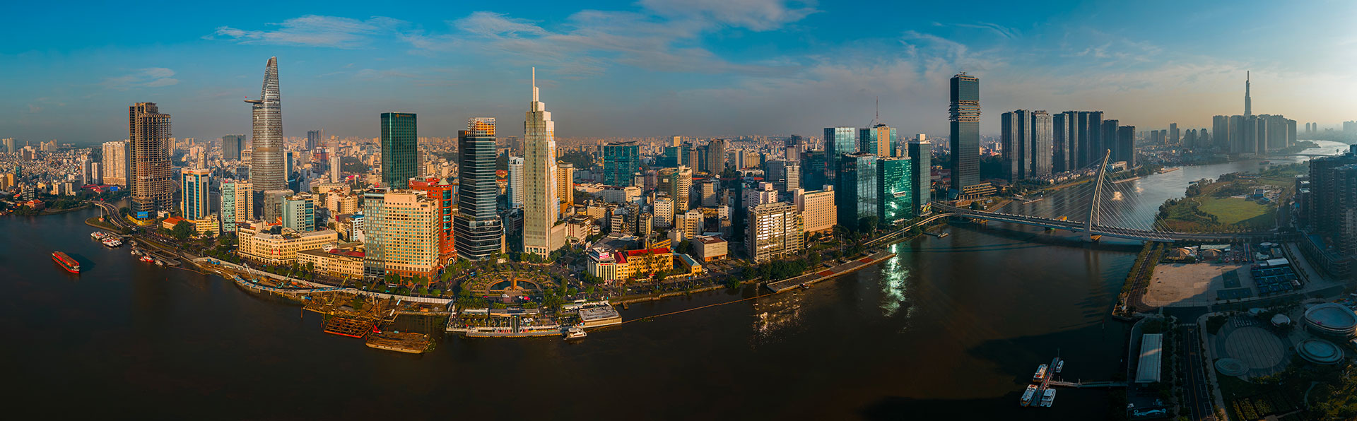
In the heart of Ho Chi Minh City: an urban panorama along the Saigon River. © TomoSAR France
Context
Ho Chi Minh City (HCMC), the economic heart of Vietnam with a population of nine million, is facing a serious and complex climate crisis. The main problem is critical subsidence, with parts of the city sinking at alarming rates (up to 3.0 cm/year) due to groundwater extraction and rapid urbanization [reference 1*]. This is an existential threat because, by mid-2025, 65% of HCMC’s land area is already less than 1.5 meters above sea level.
| 🌊 🌧️ Climate change acts as a powerful threat multiplier. The impacts of sea-level rise and increased rainfall are severely exacerbated by land subsidence, creating a compound risk of unprecedented magnitude. |
The lack of effective monitoring is a critical gap that this project aims to fill. Current systems rely on scattered ground-based measurements that cannot capture the complex spatial and temporal dynamics of these interconnected phenomena. HCMC urgently needs a comprehensive, high-resolution and operational tool to inform its climate adaptation strategy.
👉 HOSWA will provide an operational Web GIS platform to guide climate adaptation, protect critical infrastructure and offer a robust and transferable solution for other at-risk coastal megacities.
Furthermore, HOSWA will not be limited to the urban fabric. Since the integration of the former provinces of Binh Duong and Ba Ria–Vung Tau into Ho Chi Minh City on 1 July 2025, the city’s area has tripled, reaching 6,773 km², of which 1,500 km² is agricultural land. In this context, monitoring water levels using the SWOT satellite will make a significant contribution to flood risk monitoring as well as to the management and optimization of agricultural irrigation.
The HOSWA solution
Current monitoring in HCMC is inadequate. Although valuable, ground-based GPS stations and monitoring wells are too sparse to provide a complete picture of subsidence and flooding across the entire metropolitan area.
Drawing on Earth observation, HOSWA takes a novel approach to integrate high-resolution subsidence monitoring with comprehensive surface water dynamics for urban climate adaptation.
HOSWA is thus the first to combine:
Sentinel-1 InSAR radar topographic data: For city-scale subsidence mapping with millimeter-level accuracy [references 3 and 4*].
Hydrological data from the SWOT mission: Enabling unprecedented two-dimensional monitoring of water surface elevation and extent [references 5 and 6*].
This synergistic approach, implemented on a fully operational Web GIS platform, represents a significant technological leap. It provides a holistic view of the interconnected risks of subsidence and flooding - something single-purpose projects cannot achieve - and offers an accurate decision-support tool for climate resilience.
Application site(s)
Ho Chi Minh City, Vietnam
Data
The project is based on the synergistic integration of global satellite data and local in situ measurements.
Satellite
SAR Sentinel-1 (from 2017 to present): open-access C-band SAR data will be used for InSAR processing (topography and ground deformation) to generate high-resolution subsidence maps.
SWOT (from 2023 to present): level 2 high-resolution hydrological products (PIXC, Raster and aggregated) will be used to derive elevation, extent, slope and flow rate of the water surface. The data are accessible via CNES and NASA’s PODAAC.
Other
In situ data (provided by Vietnamese partners)
GPS measurements: data from HCMUT, HCMUNRE and HCMC DOAE will be used for InSAR validation.
Hydrological data: groundwater and water level data from monitoring wells (from HCMC DOAE) will be used for validation.
Topographic data: a high-resolution DTM derived from local surveys (from HCMC DOAE) will be used as the base layer.
Results – Final product(s)
The final deliverable is the HOSWA Web GIS platform, an operational web application available 24/7 for monitoring and decision support. Optimized for desktop computers and mobile devices, it will be available in Vietnamese and English. Freely accessible, it will provide three main services:
Interactive monitoring dashboard:
Subsidence: quarterly subsidence rate maps (based on Sentinel-1 InSAR) covering the period 2017–2025, with color-coded risk levels (green/yellow/red) and historical trends.
Water levels: maps of surface water extent and levels (based on SWOT).
Infrastructure risk visualizer: overlay of critical infrastructure with integrated assessment of subsidence and flood risks.
Analysis and decision-support tools:
Time series visualizer: interactive visualization of historical subsidence and water levels for a location of your choice.
Identification of hotspots: detection of areas of accelerated subsidence or recurrent flooding.
Scenario modelling: visualization of future risks under different sea-level rise scenarios.
Data access:
Download portal: processed data (GeoTIFF) for local use (Sentinel-1 InSAR with 100 m resolution; SWOT with 100 m resolution; scenario modelling with 0.025° resolution)
References
[1] Ho Tong Minh D., L. Van Trung, L., Le Toan T. Mapping Ground Subsidence Phenomena in Ho Chi Minh City through the Radar Interferometry Technique Using ALOS PALSAR Data. Remote Sens. 2015, 7, 8543-8562. https://www.mdpi.com/2072-4292/7/7/8543
[2] IPCC. (2022). Climate Change 2022: Impacts, Adaptation and Vulnerability. Contribution of Working Group II to the Sixth Assessment Report of the Intergovernmental Panel on Climate Change. https://www.ipcc.ch/report/ar6/wg2/
[3] Ho Tong Minh D, Ngo Y-N (2022). Compressed SAR Interferometry in the Big Data Era. Remote Sensing. 14(2):390. https://doi.org/10.3390/rs14020390. https://www.mdpi.com/1450440
[4] Ho Tong Minh D., Y. -N. Ngo, T. C. Le and Q. D. Nguyen (2025), "The Sinking Ho Chi Minh Megacity by Radar Interferometry", in IEEE Journal of Selected Topics in Applied Earth Observations and Remote Sensing, vol. 18, pp. 23228-23241. https://ieeexplore.ieee.org/document/11153027
[5] Vinogradova, N.T., Pavelsky, T.M., Farrar, J.T., Hossain, F. and Fu, L.L., (2025). A new look at Earth’s water and energy with SWOT. Nature Water, 3(1), pp.27-37. https://www.nature.com/articles/s44221-024-00372-w
[6] Fu, L.L., Pavelsky, T., Cretaux, J.F., Morrow, R., Farrar, J.T., Vaze, P., Sengenes, P., Vinogradova‐Shiffer, N., Sylvestre‐Baron, A., Picot, N. and Dibarboure, G., (2024). The surface water and ocean topography mission: A breakthrough in radar remote sensing of the ocean and land surface water. Geophysical Research Letters, 51(4), p.e2023GL107652. https://www.researchgate.net/publication/378364690_The_Surface_Water_and_Ocean_Topography_Mission_A_Breakthrough_in_Radar_Remote_Sensing_of_the_Ocean_and_Land_Surface_Water