

MethLandfill

Monitoring Methane Emissions from Landfills in the Yellow River Basin, China
Overview
Context
Rapid urbanization and growing waste volumes have established landfills as major contributors to China's methane (CH₄) emissions. As a potent greenhouse gas, methane has a global warming potential approximately 28 times greater than carbon dioxide (CO₂). Landfill-derived methane substantially increases the overall greenhouse gas burden, accelerating climate change—making precise emission quantification critical for developing effective mitigation strategies.
Approach and objectives
MethLandfill is a project focused on developing an innovative system to monitor methane emissions from landfills using satellite remote sensing data. By incorporating deep learning models, the project significantly enhances detection capabilities, enabling precise identification of methane hotspots and accurate estimation of emission rates. This approach ensures temporally consistent and highly accurate monitoring of methane emissions.
👉 The resulting dataset will support more effective methane reduction policies and optimized waste management practices, which are essential for achieving China's climate targets and advancing global climate change mitigation efforts.
|
|
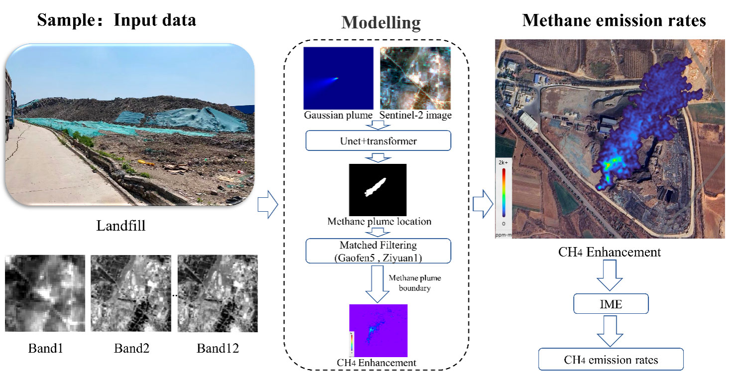
◀︎ Flowchart of quantification methods for Landfill CH4 emission rates. © Henan University |
Application site(s)
Yellow River Basin, China
Data
Satellite
- Gaofen 5
- Ziyuan 1
- Sentinel-2
Other
- ERA5
- Ground-Based Observations
Results - Final product(s)
This project presents a high-resolution methane emissions dataset from landfill sites across China. The final products include the spatial distribution of methane emissions from multiple sites, along with emission rates and temporal trends.
The methane emission data will be delivered through a WebGIS plateform, enabling users to explore emission hotspots, temporal trends, and spatial patterns across landfill sites in China. This interactive platform will feature dynamic maps that visualize the spatial distribution of methane emissions, providing an intuitive tool for data exploration.
Related project(s)
SCO MethMine : Methane emission estimation of coal mine point sources