

OpenGCS
 between 2003 and 2011")
OVERVIEW
CO2 capture and storage (CCS) technology capture CO2 from fixed point sources (such as power plants and steel plants) and stores it in relatively closed geological structures or oceans for a long time. It can significantly reduce the CO2 emissions to the atmosphere, which is of great significance to slow down global warming.
Geological carbon sequestration (GCS) is usually stored in deep saline aquifers, abandoned oil and gas reservoirs, or unexploited deep coal seams. In the latter case, CO2 injected into the coal seams, from which it drives out the methane CH4, must be maintained in a supercritical fluid state (i.e. pressure above 74 bar at a temperature above 31°C). Once it leaks to the surface through faults, fractures, or oil and gas wells and other channels, it will form a gas cloud heavier than air near the surface, sink to the ground, and spread horizontally, which is harmful to human health, life safety, and ecological environment.
In order to assure the studies of GCS safety assessment, environmental impact, and risk control, OpenGCS is designed and implemented by the China University of Mining and Technology to provide geological carbon sequestration project with dynamic monitoring of CO2 leakage. It combines online, real-time monitoring of wireless sensor networks and regional satellite observations. In the sequestration experimental area, the deployment of wireless sensor networks (WSNs) is optimized to characterise CO2 leakage. Information from these multi-source sensors is combined with space and ground-based CO2 and CH4 observations to analyse their natural concentrations in the atmosphere.
Based on the online monitoring information of WSN, the parameters of leakage and diffusion model are constantly calibrated, adjusted and reported via an online monitoring and early warning platform for CO2 leakage from geological storage. Integrated local (Wireless Sensor Network), regional (atmospheric background observation network) and global(hyperspectral satellite remote sensing), this OpenGCS platform is helpful to promote monitoring and verification of the effectiveness, durability and safety of geological carbon sequestration projects. It can thus provide monitoring and observation data support for the assessment of the impact of CO2 leakage from geological storage on human health, life safety, and the ecological environment.
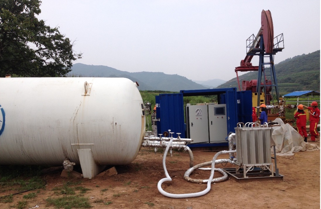
Field experiment of Geological Carbon Sequestration carried by China United Coalbed Methane Co., Ltd
The goal of OpenGCS is to provide free and open access to real-time monitoring data and long-term observation data of CO2 geological storage areas. Through the analysis of geological, geographical, and meteorological factors, the deployment of ground wireless sensor network monitoring nodes is optimized. Combined with space-based atmospheric observation data and ground-based measurements from the WMO's Global Atmosphere Watch (GAW) programme, the local atmospheric background concentration and change trend of geological storage site were screened. Shared on the online platform, OpenGCS data can be used to monitor and verify the effectiveness, sustainability and safety of a CO2 geological storage project.
Application site(s)
Qinshui Basin, Shanxi Province, China
DATA
Satellite
- NASA AIRS
- OCO-2
- TROPOMI
Other
- Geological survey and evaluation data
- Topographic data (DEM), land use (MODIS)
- Meteorological observation data from ground station
- CO2 and CH4 wireless sensor network local online WSN monitoring data
- Ground-based GAW atmospheric background area observation data
RESULTS - FINAL PRODUCTS
- WSN network online monitoring data (CO2, CH4, temperature, humidity, wind force, wind direction, air pressure) of CO2 geological storage area
- The spatial distribution map of the CO2 and CH4 in the geological storage area
- Temporal (monthly, annual) variability of CO2 and CH4 in the geological storage area
- Analysis results of the impact of the observed changes on the environment