

PODCAST-Demo

OVERVIEW
Cholera is a waterborne epidemic disease affecting 1.3 to 4 million people each year worldwide, with 21,000 to 143,000 reported fatalities. Highest incidence is reported in highly-populated coastal regions, connected with enhanced pollution of water bodies and food sources, especially through contamination of drinking water sources. The responsible pathogen, Vibrio cholerae, is harboured by planktonic and detrital hosts, and survive transportation by ocean currents. New reports of pathogen emergence and associated disease outbreaks have been shown in relation with global warming and increase of extreme climate and weather events such as droughts and floods, storm surges, and heat waves.
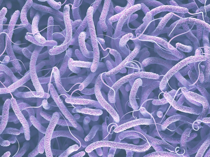
Vibrio cholerae, the pathogen of cholera © Getty Images
We propose to develop the proof-of-concept project ‘PODCAST-DEMO’ (Pathways Of Dispersal for Cholera And Solution Tools DEMOnstrator). It is a web-based visualisation and analysis tool to provide local populations and public health authorities with robust information on climate-driven hotspots of Vibrio cholerae in the northern Indian Ocean. The information products will be developed based on a pilot model that uses systematic observations of key climate indicators from the European Space Agency (ESA) Climate Change Initiative (CCI), in-situ and clinical data from publicly available archives.
The web-based tool will be designed in consultation with end users and decision makers to provide them with the ability to access environmental, climate, and health datasets and to display them on a map in an intuitive manner. Further analysis such as time-series plots and histogram will be available for selected regions of interest. The ultimate goal of this demonstrator will be to provide a decision-support tool that enables stakeholders to implement preventative measures and so reduce risk for human health.
Application site(s)
India
DATA
Satellite
ESA-CCI Essential Climate Variables of Sea Surface Temperature, Sea Surface Salinity, Ocean Colour, Sea Level Anomalies, Soil moisture, Land Surface Temperature.
Other
Epidemiological data of cholera outbreaks from the Integrated Disease Surveillance Programme (IDSP) India.
RESULTS - FINAL PRODUCTS
The demonstrator geospatial data products include:
- maps of Vibrio cholerae habitat suitability (Racault et al. 2019);
- maps of ESA-CCI indicators of Sea Surface Temperature, Sea Surface Salinity, Ocean Colour, Sea Level Anomalies (ESA Climate Office);
- time-series of climate indices for El Niño and Indian Ocean Dipole (Ogata et al., submitted);
- maps of reported cholera outbreaks from publicly available data archives, such as Integrated Disease Surveillance Programme (IDSP) India (Campbell et al., 2020).
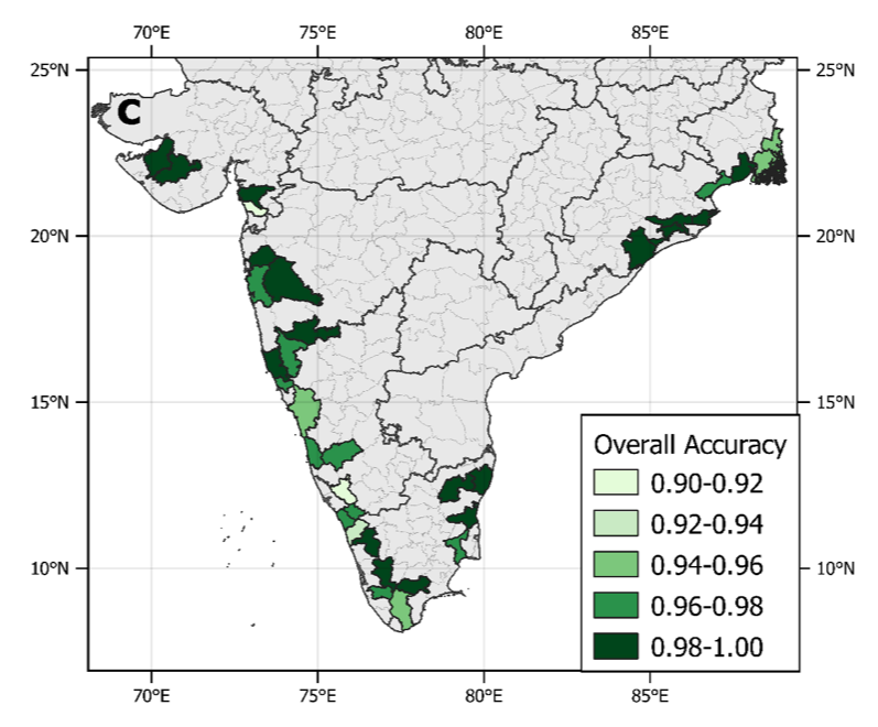
Accuracy scores of the cholera-risk model for districts in coastal India that reported cholera outbreaks in the study period 2010-2018. © Campbell et al. (2020)