

SCOInternational
OrganisersAEM (Mexico)
CNES (France)
53Participants logged in
27SCO signatories, to date
KeywordsLatin America, Mexico, Argentina, Colombia, Paraguay
Towards a Latin American SCO

Mexico, INECC (Instituto Nacional de Ecologia y Cambio Climatico - National Institute of Ecology and Climate Change)
The Mexican National Institute of Ecology and Climate Change, which already uses Sentinel 3 and Sentinel 6 data to identify the factors that must be taken into consideration to protect ecosystems and the population, would like to promote its studies to improve decision-making on a local scale to better withstand the impacts of climate change. Among other things, it is developing a fire-fighting application. Based on satellite imagery (to monitor plumes of smoke and hot spots) and supplied with integrated data (wind direction, pollution, etc.), the application is both a monitoring tool and a warning system for fire and pollution.
In this vein, the SIRIS (Sistema Integrado Regional de Información Satelital / Satellite integrated information system) platform is an example of regional cooperation for the use of satellite data. Partly funded by the Inter-American Development Bank, SIRIS aims to improve risk management in Argentina, Bolivia, Ecuador, Mexico, Paraguay and Uruguay in four areas: fire (tracking, monitoring and detection of fires), health (climatic and atmospheric analysis of diseases and their spread), water (water level monitoring and assessment of damage from flooding) and agriculture (monitoring of farm use and forests). These products are free.
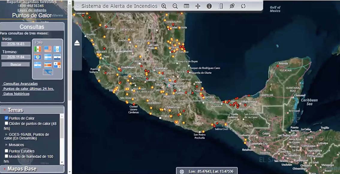
Monitoring of hot spots with SIRIS © AEM
Argentina, CONAE (Comisión Nacional de Actividades Espaciales - National Space Activities Commission)
Also a member of the SCO, the Argentinian space agency is developing projects that comprehensively cover various themes. Included in a catalogue and a geoportal and on a website, the products generated are of a wide variety in terms of spatial, geographical and time resolution: rugosity maps, monitoring of crops and species, agricultural statistics, biomass estimations, etc. They are also applied at regional level to produce maps of the water status, ground humidity, volcanic activity and risks of dengue. Lastly, CONAE also takes educational action via academic training in partnership with the region as well as with schools and professionals.
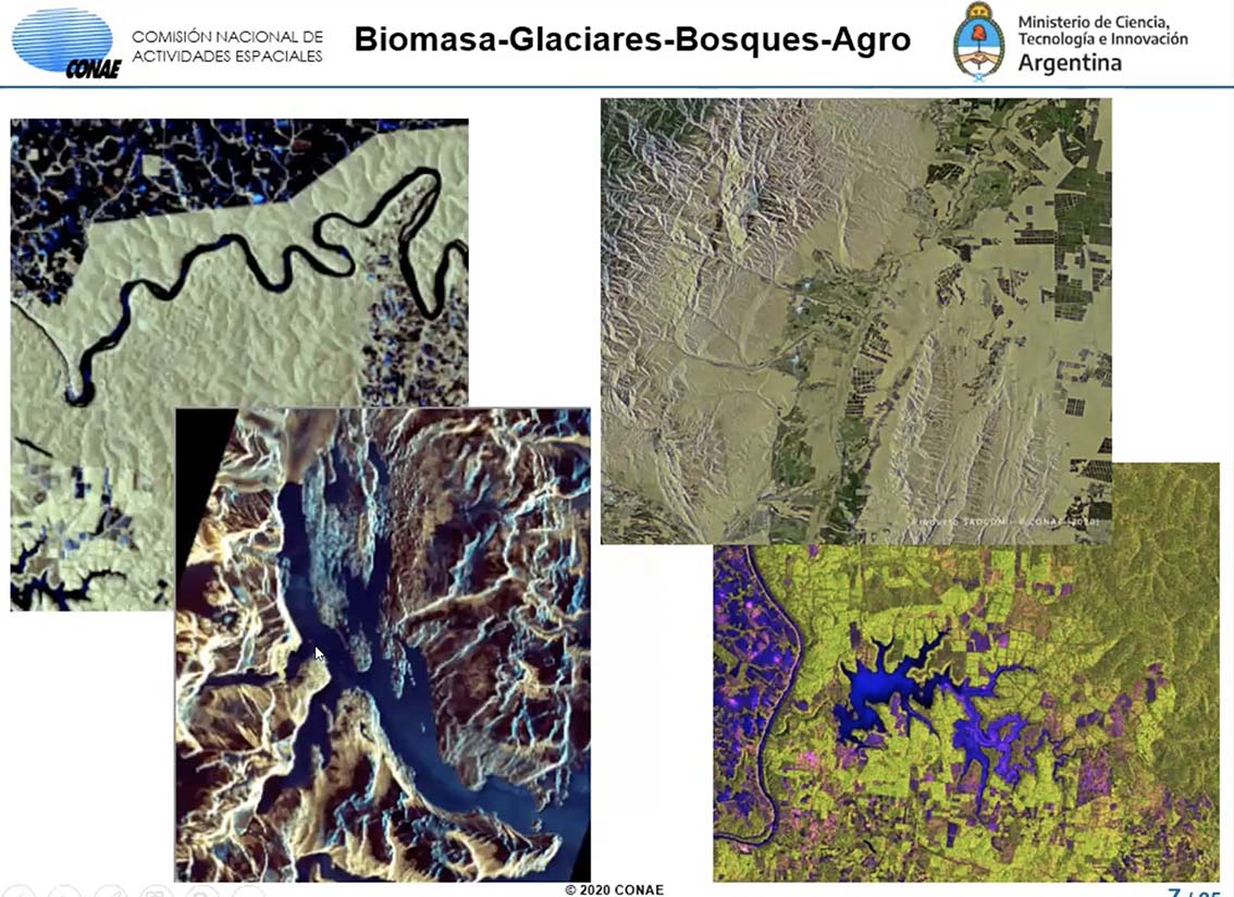
CONAE is already carrying out various satellite monitoring projects.
Colombia, AEC (Agencia Espacial de Colombia - Colombian Space Agency)
84% of Colombia has agricultural potential, and only 35% is actually used. The AEC is focusing its efforts on the "vision agro" project to improve knowledge of this land and enable the development of agricultural projects. The AEC is also investing in the Green Cubsat project, a constellation of satellites for the development of applications linked to sustainable development (monitoring of water sources, forests, air quality, agriculture, etc.). To enhance agricultural development, the AEC is also creating a data bank of spectral footprints in Latin America and the Caribbean. Its main activity is, however, education, in particular with the establishment of the "apprendre avec Galileo" [Learn with Galileo] platform for comprehensive school children.
Paraguay, AEP (Agencia Espacial de Paraguay - Paraguayan Space Agency)
Alongside the SEN (Secretaría de Emergencia Nacional - Secretariat for National Emergencies) to foster the creation of capacities and the development of the space sector, the AEP is already working towards a Latin American space agency. Due to the increased number of floods over the past few years in Paraguay, the agency is working with the Pacific Disaster Center (PDC) in particular. Seeing space data as a tool to fulfil its Sustainable Development Goals, the AEP would like lasting international collaboration and has declared that it is very keen to use and mobilise space imagery.