

SCOFrance
PartnersGET, UASZ, DGPRE, Magellium, LETG, CNES
Useful linkProject page
KeywordsSenegal, agricultural water management, field campaign, training
VOQUALISE, mission report from Upper Casamance
West Africa is experiencing one of the highest rates of population growth in the world, suggesting an increase in agricultural water consumption. In the Casamance region, in southern Senegal, managers are concerned about the future: will the infrastructure in place be sufficient to meet agricultural water demand, even as climate projections paint a bleak picture? Rising temperatures and evaporation, reduced rainfall and, most likely, changes in water quality… They urgently need reliable information to act and plan ahead.
Against this backdrop, the SCO VOQUALISE project is using SWOT, Sentinel-2 and Landsat satellite data to assess the capacity of the Upper Casamance reservoirs to meet agricultural water demand in the coming years. To this end, it has set itself four objectives:
To provide estimates of the water balance of reservoirs and natural lakes.
To assess water quality parameters.
To characterize water uses and public policies.
To study scenarios for future developments.
Let’s join Manuela Grippa, project lead for the GET laboratory, and Tristan Harmel, a remote sensing specialist from Magellium, hosted by Cheikh Faye, a professor of geography at the University of Ziguinchor, and Elimane Fall, a hydrologist at the Senegalese Directorate of Water Resources Management and Planning, during their visit to Senegal in February 2026. The mission had two objectives: to carry out on-site measurements and sampling, and to engage with partners in the Casamance region.
Heading to Niandouba, Waima, Kounkane and Confluent
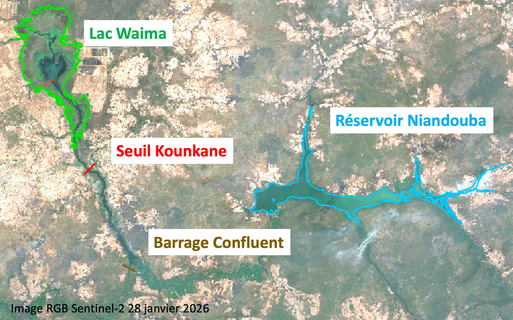
The project’s four pilot sites (image © GET):
|  |
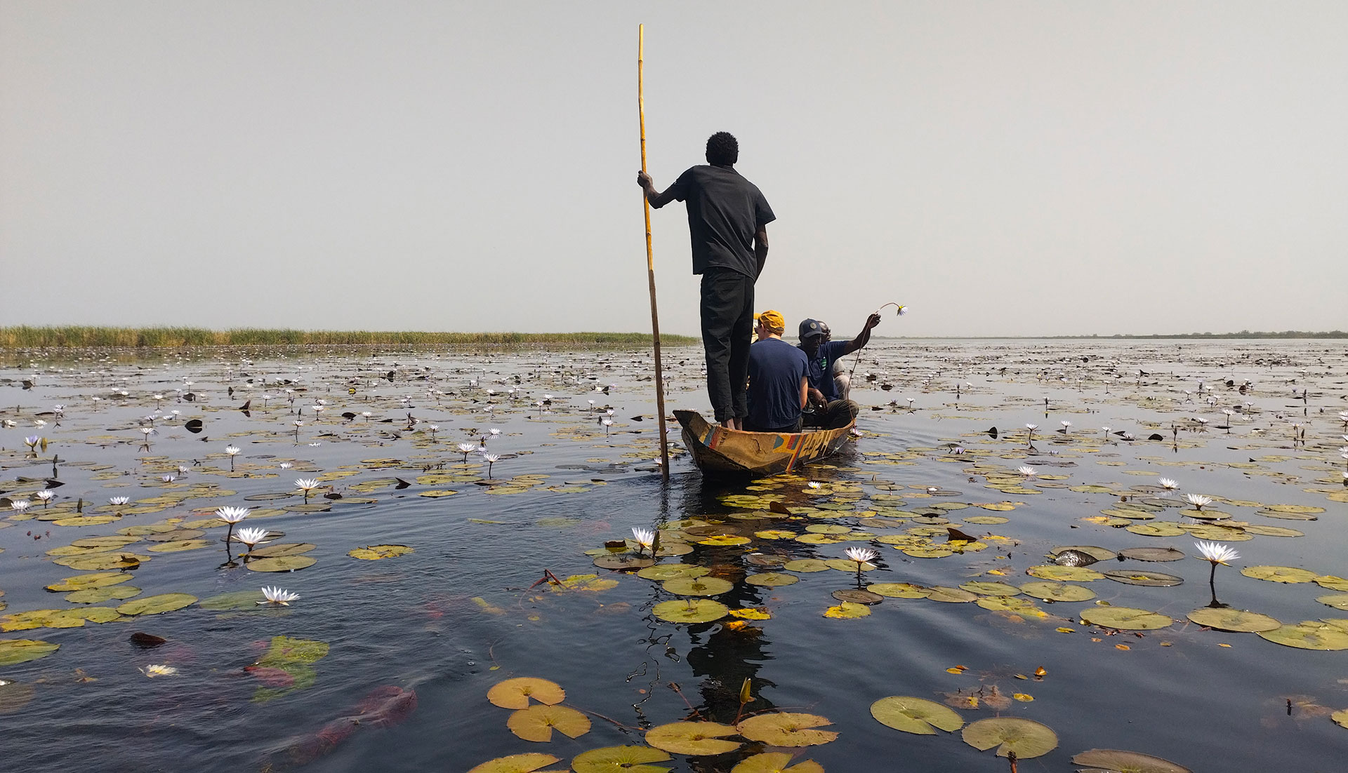
While in-situ data is necessary to validate the results of satellite image processing algorithms, it is equally essential from the outset of the project: to understand the terrain and define the different water types, and to grasp the specific characteristics and pitfalls involved in interpreting pixels. Thus, each water body has its own unique characteristics. “At Waima, on the lake’s periphery, elements such as algae and macrophytes will alter the satellite signal. On the shore, plants like water lilies will cover the lake’s edges and interfere with the water masks, and thus the estimation of surface area and volume,” explains Tristan Harmel.
| At the four pilot reservoirs, as well as at a few additional sites along the Casamance River, measurements have been well underway: suspended solids, physico-chemical parameters, radiometric data and ‘limni scales’ – those graduated scales used to read water levels. To complement this, the project can rely on its local partners to provide any historical water levels they have on record, and to continue taking water samples at a rate of one per week at certain sites. | 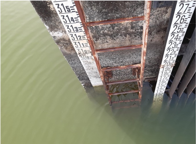 Limni scale at Niandouba. © M. Grippa |
💧 But let us pause for a moment to consider the complexity of the water quality aspect, a microscopic alchemy that must be deciphered from satellite data and translated into biogeochemical parameters: “In particular, we must take into account the biochemical activity of microalgae, which can be more or less toxic, as well as mineral particles and dissolved matter that will alter parameters such as light intensity and change the color of the water,” explains the Magellium specialist, radiometer in hand.
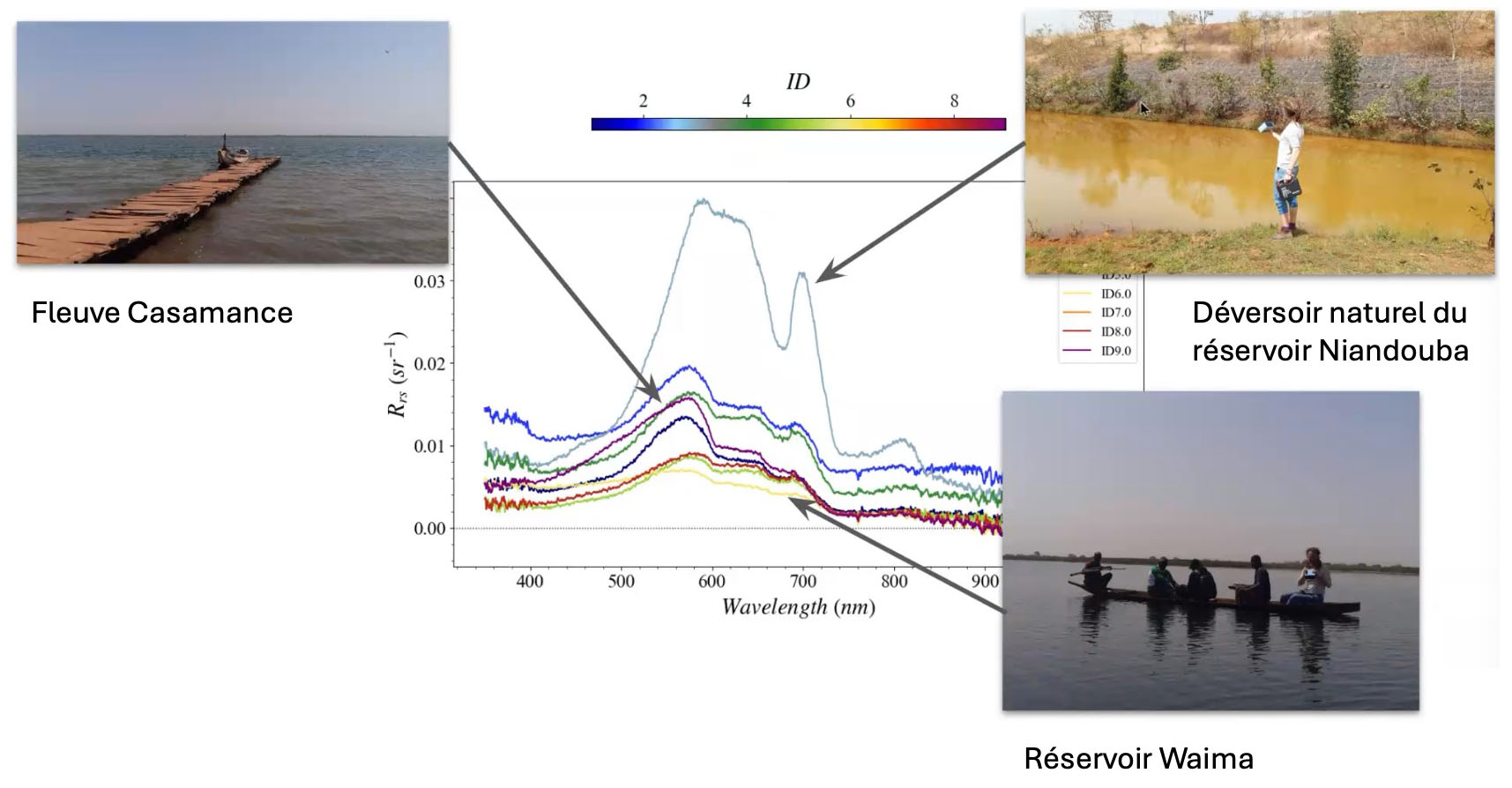
▲ Tristan Harmel has produced radiometric spectra for each of the nine sampling sites “to measure the light emerging from the water, excluding that reflected by the surface”, with the highest spectrum corresponding to the most turbid water. He will be able to correlate this information with satellite signals and interpret it in terms of various water quality parameters. © Magellium
Sharing and start passing it on
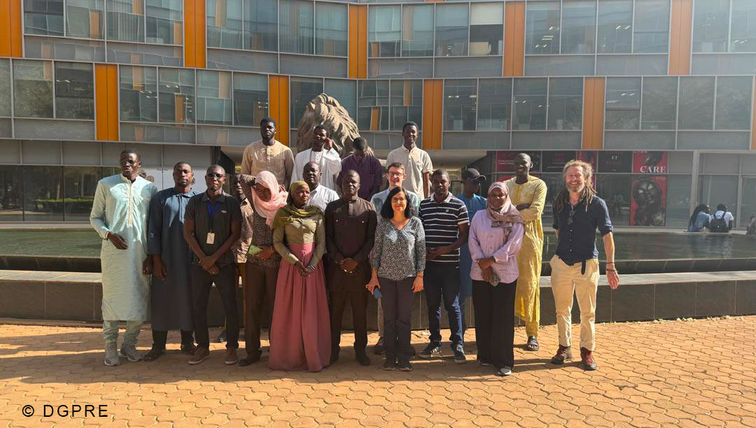
The other main objective of this trip to Senegal was to organize two training sessions on “Remote sensing and surface water monitoring” at the premises of their partners: the DGPRE, the Senegalese Directorate for Water Resources Management and Planning – “which we met through the SCO,” notes Manuela Grippa – and the UASZ, Assane Seck University of Ziguinchor.
🤝 Designed to encourage local stakeholders to take ownership of remote sensing tools, “these very pleasant exchanges also enabled us to better understand their needs so we could adapt the products to be released, and to identify the best images to provide them for their studies,” emphasize Manuela and Tristan in unison.
 | 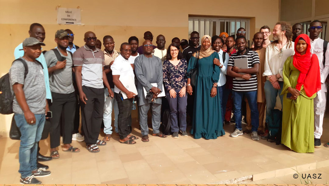 |
▲ The training groups at the DGPRE on the left, and the UASZ on the right.
Seeing water from space
Having returned to France armed with all this valuable information, the VOQUALISE team will be able to make significant progress in its processing chain.
Work already carried out shows that:
👉 SWOT products offer very good results for estimating water level variations in water bodies, to be consolidated.
| ► Comparison of in-situ data (pressure sensor on the Niandouba reservoir), SWOT products (PIXC) and altimetry data from Sentinel-6 and ICESat-2. ©GET (Felix Girard’s thesis) | 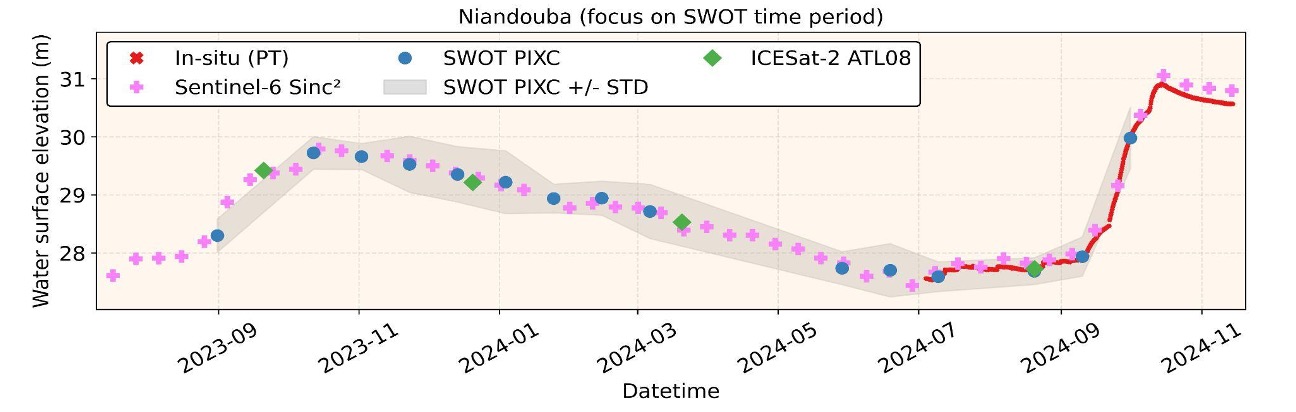 |
👉 Used to assess water surfaces, Sentinel-2 optical images are also proving well suited to monitoring the spatiotemporal variability of various parameters related to water quality. Landsat images will also be tested.
► Water quality parameters extracted from Sentinel-2 images: turbidity, chlorophyll-a concentration and transparency. © Magellium | 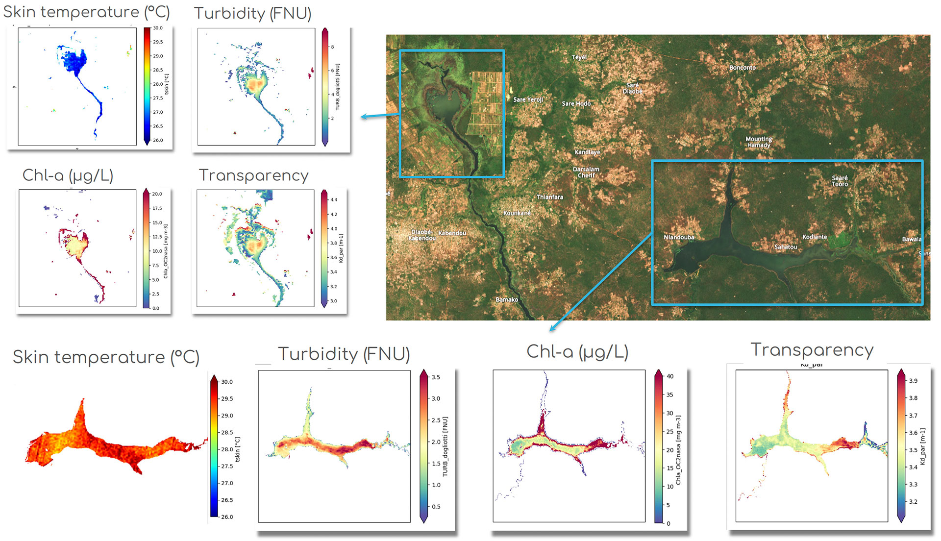 |
► Changes in the Niandouba reservoir from 10 January to 14 March 2026, following processing (atmospheric correction and water mask) applied to Sentinel-2 images. © Copernicus Sentinel Imagery / Traitement Magellium | 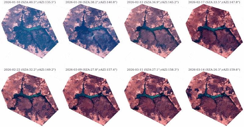 |
Bonus
As part of its mission, the team was able to request images from PRISMA and EnMAP, two pioneering European satellites designed to characterize the physical and biogeochemical parameters of terrestrial and aquatic environments. The two images received will help them to understand the hyperspectral signature in relation to in situ data.
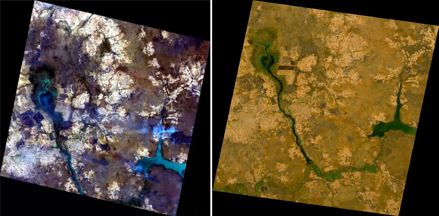 |
◀︎ Raw images received from PRISMA (© ASI) on the left and EnMAP (© DLR) on the right. The PRISMA image clearly shows smoke, which hinders remote sensing, caused by slash-and-burn farming, common in both the dry and wet seasons. |
An extraterrestrial mystery?
Reminding us that Earth is our spaceship in the Universe, Lake Waima raises questions: with its elegant heart-shaped form, its origin could stem from a meteorite impact, a hypothesis being investigated by GET, CEREGE and UCAD (Dakar). To find out more, click here (L’Astronomie Afrique article) and here (ESA publication, as satellites also shed light on our understanding in this field).
A story in progress, but not a long-term one
With very promising initial results and an extremely fruitful field mission, the team has its work cut out for it and is delighted! Among the major tasks ahead:
Comparing in situ data with satellite data.
Combining SWOT data with that from optical satellite sensors (relationship between heights, surface areas and volumes) to go back as far as 2014.
Cross-referencing the data with the study on invasive plants around Lake Waima currently being conducted by UASZ.
Assessing the water balance of each reservoir, taking into account variations in volume, precipitation and evaporation.
Analyze past dynamics, i.e. previous water balances.
Estimate future development scenarios in the context of climate change, population growth and public agricultural policies.
Ultimate objective: early 2027, with a web-based platform for visualizing and analyzing satellite data, which will serve as a management and forecasting tool for the DGPRE.