AEROPMAP
AEROsol and Particulate Matter MAPping
Overview
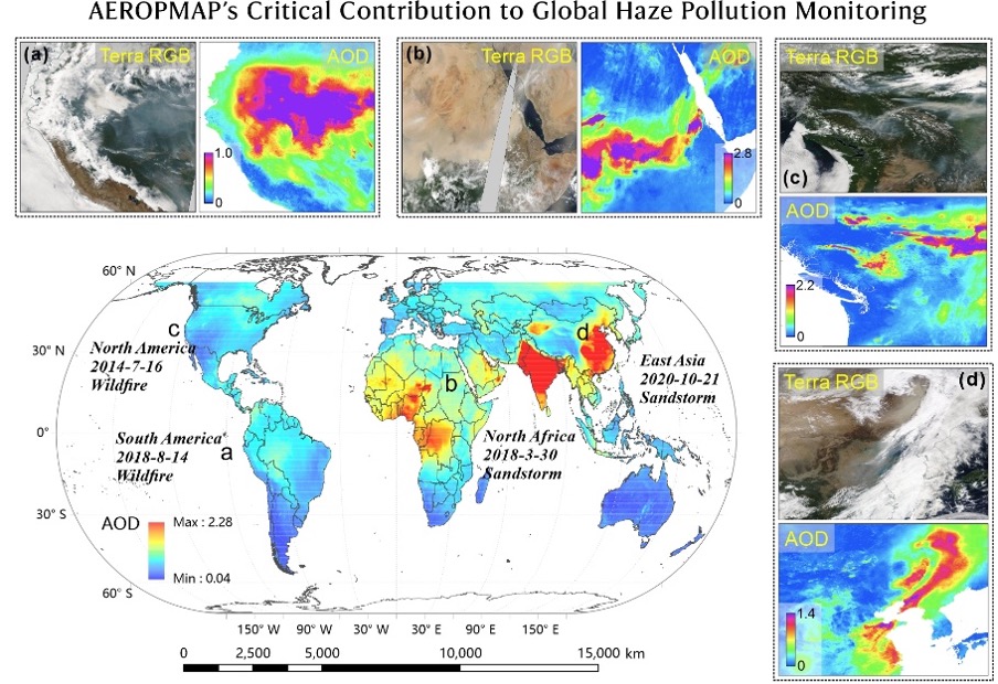
AEROPMAP is a global mapping project of aerosol optical depth (AOD) and fine particulate matter (PM2.5). It integrates satellite observations and ground monitoring data into a consistent, high-resolution (1 km) dataset.
The project delivers daily global coverage, filling gaps in existing remote sensing data and addressing spatial limitations of ground networks. By applying deep learning methods tailored to the spatial and temporal patterns of aerosols, the project generates robust estimates even in regions with poor monitoring infrastructure. Its innovative fusion framework improves completeness and accuracy, supporting reliable environmental assessments at local and global scales.
The resulting dataset supports applications in air quality management, public health analysis, and climate research. Users can track pollutant exposure, study trends, and assess risks with greater confidence. This work helps bridge critical data gaps, offering decision-makers and researchers a new tool to address environmental and societal challenges linked to air pollution.
Test area
China
Data
Satellite
- EXERCICE 3 MERSI AOD
- Terra/Aqua MODIS AOD
- MODIS NDVI & Land Cover
Other
- Ground-Based Observations
- Numerical Model Data
Results - Final product(s)
The project delivers a global dataset of daily 1 km resolution Aerosol Optical Depth (AOD) and surface PM2.5 concentrations.
The final products include gap-filled AOD maps derived from satellite retrievals and globally inferred PM2.5 estimates. These datasets offer broad spatial coverage, high temporal consistency, and enhanced accuracy.
Accessible via an open data platform, the products support diverse applications, including air quality monitoring, health risk analysis, and climate modeling. The outputs are updated in near-real time and designed for ease of use by researchers, policymakers, and the public, significantly advancing global environmental data availability and utility.
References
-
Bai, K., Li, K., Qiu, S., Zheng, Z., Jiao, P., Sun, Y., Shao, L., Liu, C., Li, X., Li, Z., Guo, J., Chang, N., 2025. SCAGAT: A scene-aware ensemble graph attention network for global PM2.5 pollution mapping via land–atmosphere interactions. ISPRS J. Photogramm. Remote Sens. 225, 19–35. https://doi.org/10.1016/j.isprsjprs.2025.04.019
-
Bai, K., Li, K., Shao, L., Li, X., Liu, C., Li, Z., Ma, M., Han, D., Sun, Y., Zheng, Z., Li, R., Chang, N.-B., Guo, J., 2024. LGHAP v2: a global gap-free aerosol optical depth and PM2.5 concentration dataset since 2000 derived via big Earth data analytics. Earth Syst. Sci. Data 16, 2425–2448. https://doi.org/10.5194/essd-16-2425-2024
-
Bai, K., Li, Ke, Ma, M., Li, Kaitao, Li, Z., Guo, J., Chang, N., Tan, Z., Han, D., 2022. LGHAP: the Long-term Gap-free High-resolution Air Pollutant concentration dataset, derived via tensor-flow-based multimodal data fusion. Earth Syst. Sci. Data 14, 907–927. https://doi.org/10.5194/essd-14-907-2022


