

SCOFrance
27Mediterranean countries involved
Useful linksPresentation of the project
Key wordsMediterranean wetlands, protection, conservation
AIonWetlands trains its algorithm
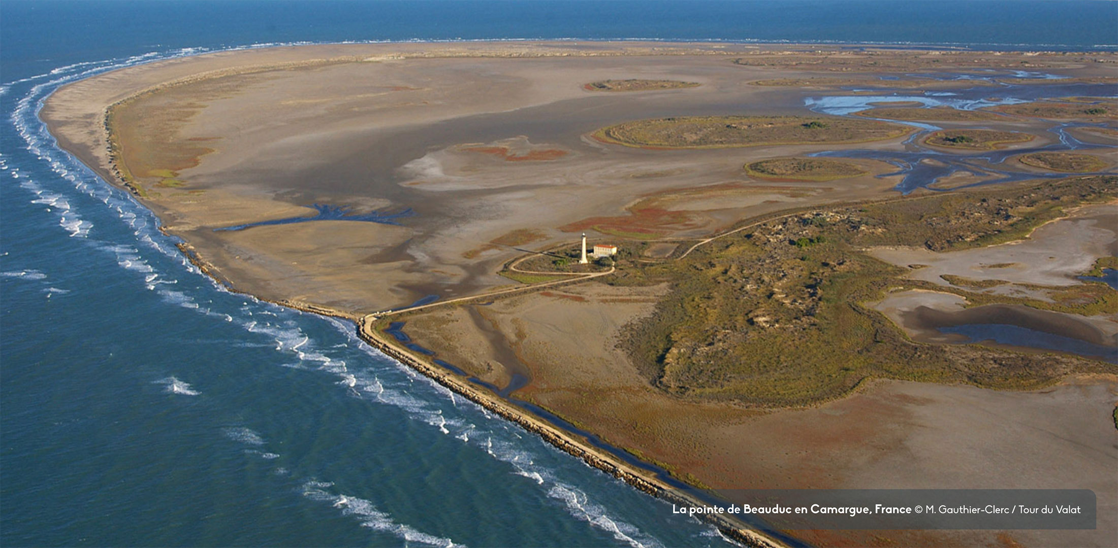
Conducted in collaboration between the Tour de Valat, the ICube laboratory and the company Geomatys, AIonWetlands is part of the Mediterranean Wetlands Observatory (MWO), created in 2008 and coordinated by the Tour du Valat, a private research institute nestled in the heart of the Camargue and dedicated to the conservation of these ecosystems.
Building on the solid foundations already laid by the MWO, AIonWetlands will aggregate and automate a maximum amount of geo-referenced data to make it an effective tool for the management and preservation of wetlands. "Our tool is aimed at decision-makers, who have the levers to make regulations evolve, at civil society actors who work at the heart of wetlands, and of course at the scientific community that studies them," announces Anis Guelmami, MWO coordinator.
Objectives and progress
The project aims at a better dissemination of knowledge on Mediterranean wetlands, in order to improve their management, conservation, protection and restoration. To this end, the project team has set three objectives:
1. Better characterise the status and trends of the main Mediterranean wetlands by integrating into the MWO dataset indicators spatialised on sites not yet monitored
👉Thanks to exchanges and joint work with ICube, the team is carrying out neural network learning and is testing an adaptation of the U-net algorithm, usually used in medical imaging. Using Sentinel-2 satellite images of areas already monitored (and therefore known), the algorithm first learns to identify water surfaces and then, gradually, other more complex classes.
👉 Once the network will have learned to classify wetland habitats at the 320 monitored sites, it will be able to extrapolate to unmonitored sites and classify their habitats automatically.
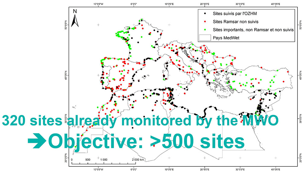
The MWO already monitors 320 Mediterranean sites, whose data are used to establish monitoring indicators. Thanks to new machine learning and deep learning algorithms, AIonWetlands will help extend this monitoring to more than 500 sites. © Tour du Valat
2. Determine the most relevant indicators and standardize them to identify the areas most threatened by anthropogenic pressures and most vulnerable to the effects of climate change
The MWO has already been developing certain indicators for about fifteen years by conducting cross-analyses on a multitude of data. To do this, it uses existing databases, but also generates its own databases, thanks in particular to satellite images.
👉 For the next report on the status and trends of Mediterranean wetlands, planned for 2025, the MWO plans to include 20-25 indicators, classified by themes:
. driving forces: demographic change, mean sea level rise, wetland management and governance, water-related risks etc.
. pressures: exploitation of water resources, evolution of cultivated areas and agricultural practices, urban sprawl...
. status of wetlands: total extent of water-related ecosystems, evolution of natural habitats over time, water availability for wetlands, wetland habitats within Key Biodiversity Areas (KBAs) etc.
. impacts of observed changes on wetland habitats: loss of natural habitats, habitat fragmentation, alteration of ecological functions, loss of ecosystem services...
. responses and recommendations: level of protection of wetlands, effort to restore degraded and/or lost wetland habitats, implementation of management plans within Ramsar sites...
3. Develop a simple, interactive and innovative geoportal, allowing better reporting on the status of Mediterranean wetlands and the trends observed and thus helping to prioritize future conservation and/or restoration actions.
👉 As a result of the previous work, this geoportal, developed by the MWO with the technical support of Geomatys, will produce maps of the indicators at three scales: Mediterranean, national and local (by site).
👉 It will integrate the "Red Alert" function to signal a site in distress and calling for short-term action.
Presentation of the geoportal to the Mediterranean Wetlands Alliance (MWA)
On 10 March 2023 in Samsun (Turkey), Anis Guelmami presented some of the AIonWetlands work in progress at the annual general meeting of the MWA (AMZH in French), including the conceptualization of the future geoportal on Mediterranean wetlands. His presentation was very well received: "The participants showed great enthusiasm and willingness to use this type of product themselves. Some expect data and indicators at the national scale, which allow contextualizing the status of wetlands in their country. Others are more interested in indicators and maps at the site level to monitor the evolution of wetlands, identify the main pressure factors and adapt the most appropriate protection and/or restoration measures. They have suggested many indicators, in particular to identify the effects of climate change on wetlands," says the MWO coordinator.
Based on these exchanges, the team is working hard to develop AIonWetlands products that meet their needs as much as possible. Some of these products, including the geoportal, will be presented at the next Ramsar (International Convention on Wetlands) COP15 in 2025 in Zimbabwe.