

Clic'Forest
CLImate Change and FOREST health
Overview
Context
Forests in France play an essential role in economic, environmental and societal services. They cover 31% of the French metropolitan area, absorb around 7% of the country's CO2 emissions and reduce them by substituting wood for materials with a high carbon footprint. Since the 1990s, carbon absorption by French forests has increased thanks to the expansion of forest area and the growth of stocks. However, climate change, with the intensification of extreme weather phenomena (drought, heat, storms), is affecting their health and favoring bio-aggressors. In recent years, we have seen an increase in the deterioration and mortality of trees in forests, threatening their role as carbon sinks in certain areas.
To meet these challenges, it is essential to have up-to-date geo-spatialized information on which to base public policy and management planning. Mapping and temporal monitoring of dieback, as well as analysis of risk factors (e.g. soil and climate conditions), are necessary to effectively adapt stand monitoring and management.
The Clic'Forest answer
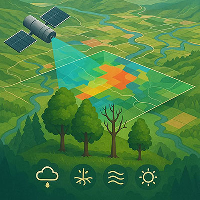
In this context, Terranis and the P2E laboratory are proposing the "Climate Change and Forest health" (Clic' Forest) project, with the aim of mapping forest dieback and analyzing forest vulnerability, using Sentinel-2 satellite imagery and geospatial data. Sentinel-2 imagery, which is freely and globally accessible, provides invaluable information on forest health. Coupled with other large-scale geospatial data (weather, climate, soil, etc.), they will help improve forest health monitoring and identify vulnerable stands.
The project will focus on two species and pilot areas: spruce around the Grand Est region, affected by drought and bark beetles, and oak, around the Centre-Val de Loire region, facing increasing dieback due to drought and heat waves. These two zones cover 30 départements. The results will be useful for forest managers, researchers and local players. Developments will be carried out with a view to extending this work to other geographical areas and tree species in the future.
The project comprises three main phases:
- Production and analysis of dieback maps over the last 5 years using Sentinel-2 time series and the RECONFORT (supervised forest health classification) and FORDEAD (vegetation anomaly detection) tools.
- Analysis of decline trends in relation to environmental and climatic variables, and development of predictive models for the production of vulnerability maps.
- Automation of processing and development of an interactive visualization tool in the form of a demonstrator to enable analysis of dieback and risks at different scales.
🎯 The French National Forestry Office (ONF) and the Forest Health Department (DSF) are already involved as users, and other public and private players will be progressively involved in the course of the project. The data disseminated, the indicators proposed and the demonstrator's functionalities will be defined in consultation with these users, in order to best meet their operational needs.
The project complements other initiatives such as the BioClimSol tool, the CES Théia "Changes and health of temperate forests", and the Sylvosansat and MONITOR* projects. In general terms, this project is intended to be complementary to current projects, in particular
- by working on two specific tree species and more local scales, to better understand the specific features of the territories and tree species that will need to be taken into account in the construction of the models.
- in-depth work on the dynamic interactions between environmental and climatic factors, to better understand the cumulative or amplifying effects on dieback and the differences between the species and territories in the pilot areas.
- by developing a practical tool for visualizing maps and data, enabling forest stakeholders to make the best use of the project results and help them in their decision-making.
Application site(s)
France : Grand Est Région and Centre Val de Loire
Data
Satellite
- Optical data: Sentinel-2
- Radar data: Sentinel-1, ALOS-PALSAR, NISAR
- Thermal data: TRISHNA
- LIDAR data: LidarHD
NB: The main data used is Sentinel-2. For other current or future data (such as TRISHNA), the aim is to test or anticipate their use in the chains.
Other
- Weather/Climate: SAFRAN (Météo France), ERA5-land (ECMWF), others
- Soil: GIS-sol, regional soil reference system (RRP), SoilGrids, GlobalSoilMap
- DTM (digital terrain models)
- Dieback field data
Results – Final product(s)
-
The dieback and vulnerability maps produced in the project will be shared with users for their internal use (ONF, DSF, other stakeholders).
-
Possible methodological improvements to the RECONFORT or FORDEAD tools will be shared with the laboratories concerned and/or published.
-
The interactive visualization tool will be the property of Terranis, with:
- a "pro" demonstrator accessible to users identified in the project, as well as to other public players on request. It will integrate maps produced as part of the project, statistics by mesh (regular, administrative, etc.), indicators, dashboards and advanced data filtering functionalities.
- A simplified version of the tool will also be made available online with full free access.
Related projects and References
- FORDEAD project, led by INRAE, to develop a tool for detecting spruce dieback anomalies using Sentinel-2 image time series.
👉 Dutrieux, R., Ose, K., de Boissieu, F., Féret, J.-B., 2024. fordead: a python package for vegetation anomalies detection from SENTINEL-2 images. https://doi.org/10.5281/zenodo.12802456 -
RECONFORT project, led by Université d'Orléans (ARD Sycomore CVL), to develop cartographic tools for predicting stand health and .update stand growth models, so that these tools can be used to prevent forest dieback.
👉 F. Mouret, D. Morin, H. Martin, M. Planells, and C. Vincent-Barbaroux, ‘Toward an Operational Monitoring of Oak Dieback With Multispectral Satellite Time Series: A Case Study in Centre-Val De Loire Region of France’, IEEE Journal of Selected Topics in Applied Earth Observations and Remote Sensing, vol. 17, pp. 643–659, 2024. https://doi.org/10.1109/JSTARS.2023.3332420 -
DepCast, developed by EI Purpan / UMR Dynafor, is a model for mapping chestnut dieback using Sentinel-2 images.
👉 V. Chéret, M. Chartier, J. Denux, J. Julie Vigouroux, and M. Goulard, “Cartographier l’état sanitaire des châtaigniers par télédétection,” Forêt & Innovation, ol. 2023, no. 1, pp. 20–26, 2023. -
SCO SCOup project, which aims to improve and generalize the method developed in the RECONFORT project for mapping declining forests using satellite imagery.