CopPhil-BLUEHAB
Copernicus Philippines: Benthic Habitat Observation for Climate-Linked Impacts and Monitoring
Overview
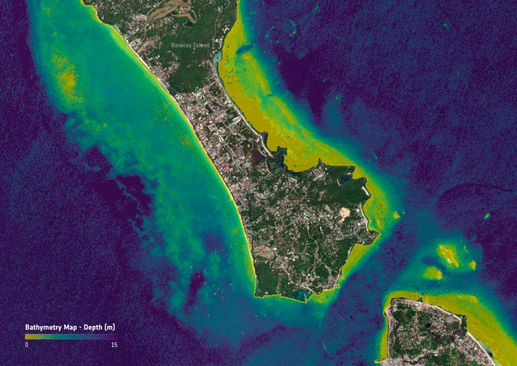
As one of the most climate-vulnerable nations globally, the Philippines faces mounting environmental pressures that endanger both biodiversity and the livelihoods of millions dependent on coastal ecosystems. In response, this project will establish a pilot Coastal Marine (Benthic) Habitat Monitoring Service as part of the development of Earth Observation (EO) pilot services framework under the National Copernicus Capacity Support Action Program for the Philippines (CopPhil). The service will utilize Copernicus satellite data to map, classify, and monitor benthic habitats such as coral reefs, seagrass beds, and common substrates.
👉 The pilot service will focus on providing detailed and accurate data on coastal habitats. This type of monitoring will provide key information on the status and quality of coastal waters by, for example, monitoring coral bleaching. The products will combine Copernicus satellite data and in situ data provided by Filipino stakeholders to confirm that benthic habitats are identified and classified accurately.
👉 In the long term, the service will be enhanced to include monitoring of water quality indicators (e.g., turbidity), sea surface temperature anomalies, and sea-level rise, further increasing its relevance to climate resilience planning. The goal is to build a cost-efficient, scalable, and science-based decision support system that empowers national and local agencies in marine spatial planning, ecosystem-based management, and climate adaptation strategies, among others.
👉 As part of the broader coastal environmental monitoring framework, this pilot service aims to support local authorities, coastal resource managers, and scientific institutions in understanding and managing complex marine ecosystems. The project enhances data-driven decision-making for sustainable coastal development, biodiversity conservation, and climate adaptation by offering accessible data.
👉 The modular and scalable nature of the service also allows for replication across other regions in the Philippines and the ASEAN (Association of Southeast Asian Nations-, aligning with the goals of the Space for Climate Observatory (SCO) to advance climate resilience using space-based data and services.
Application site(s)
Boracay Island, Aklan. The project will expand to the whole Philippines in the following years.
Data
Satellite
Copernicus Datasets (Sentinel satellites)
Other
In-situ data (corals, seagrass…)
Results - Final product(s)
The following data will be made available on the CopPhil open platform:
-
Benthic habitat layers – baseline and updated spatial maps of key benthic features (e.g., coral reefs, seagrass beds, and common substrates), classified using Copernicus data.
-
Coral bleaching extent layers – spatial products identifying areas of coral bleaching linked to sea surface temperature anomalies and other climate stressors.
-
Change and trend analysis – multi-year assessments of habitat condition and extent, highlighting degradation or recovery trends to support long-term monitoring and climate adaptation strategies.
-
In-situ data - Geotagged images of corals, seagrass, and other benthic classes
Related project(s)
🇫🇷 SCO BioEOS (BIOdiversity Earth Observation and monitoring at regional Scale) : With an initial demonstrator in the Indian Ocean, this project uses remote sensing to characterize the spatiotemporal dynamics of coastal biodiversity, map changes, produce operational indicators to report on its status, and thus improve conservation measures.


