

SCOFrance
Useful linkProject page
3 sensors comparedPleiades, Pleiades Neo, BD ORTHO
Key wordsHedgerows, ecological planning, agro-ecological transition, ecosystem services
Eagle Hedges, a spatial zoom on the hedgerow network
Why dedicate a project to hedgerows?
Hedges and trees outside forests are a lever for ecological planning, providing agronomic benefits and ecosystem services to agriculture and the countryside. In order to monitor the impact of policies in favor of hedges, regular knowledge of the state of the French bocage is needed, as attested by report no. 22114 from the French Ministry of Agriculture and Food Sovereignty published in April 2023 - in which the Eagle Hedges research programme and its partners are cited.
The aim of the Eagle Hedges project is to develop operational tools for monitoring and characterizing the hedgerow network using remote sensing imagery, in order to make up for the lack of reliable, recurring data in France. Earth observation imagery is proving to be a crucial tool for detecting the surface area and length of hedgerows. It also offers the possibility of recurrently updating the state of the hedgerow to give a more representative picture.
The project consortium is the result of collaboration between private, research and institutional players (TerraNIS, DYNAFOR, AFAC, IGN, OFB and CNES).
Methodology for "remote sensing" hedgerows
In order to best meet the objective of monitoring the hedgerow network, different sources of Earth observation data were evaluated for hedgerow detection. To achieve this, an innovative method for detecting hedges using Artificial Intelligence (Deep Learning) was implemented by TerraNIS, a company with dual expertise in remote sensing and agronomy. The field partners proposed several pilot sites spread across France to represent the diversity of the French bocage. These pilot sites were used to train the AI models. The TerraNIS teams compared hedge detection performance using three data sources: the Pleiades and Pleiades Neo satellites and aerial orthophotographs from the BD ORTHO IRC IGN, with or without a Digital Surface Model (DSM).
💡 The DSM is a 3D model which, combined with a Digital Terrain Model (DTM), provides information on the height of the canopy, the Digital Height Model (DHM).
The DSM is calculated by correlating stereo images. Pairs of Pleiades and Pleiades Neo stereo images were used to calculate a DSM using CARS software (a 3D restitution tool for producing DSMs from satellite images) developed by CNES. The photogrammetric DSM derived from the IGN's aerial photos is available to the public on the IGN's Geoservices portal.
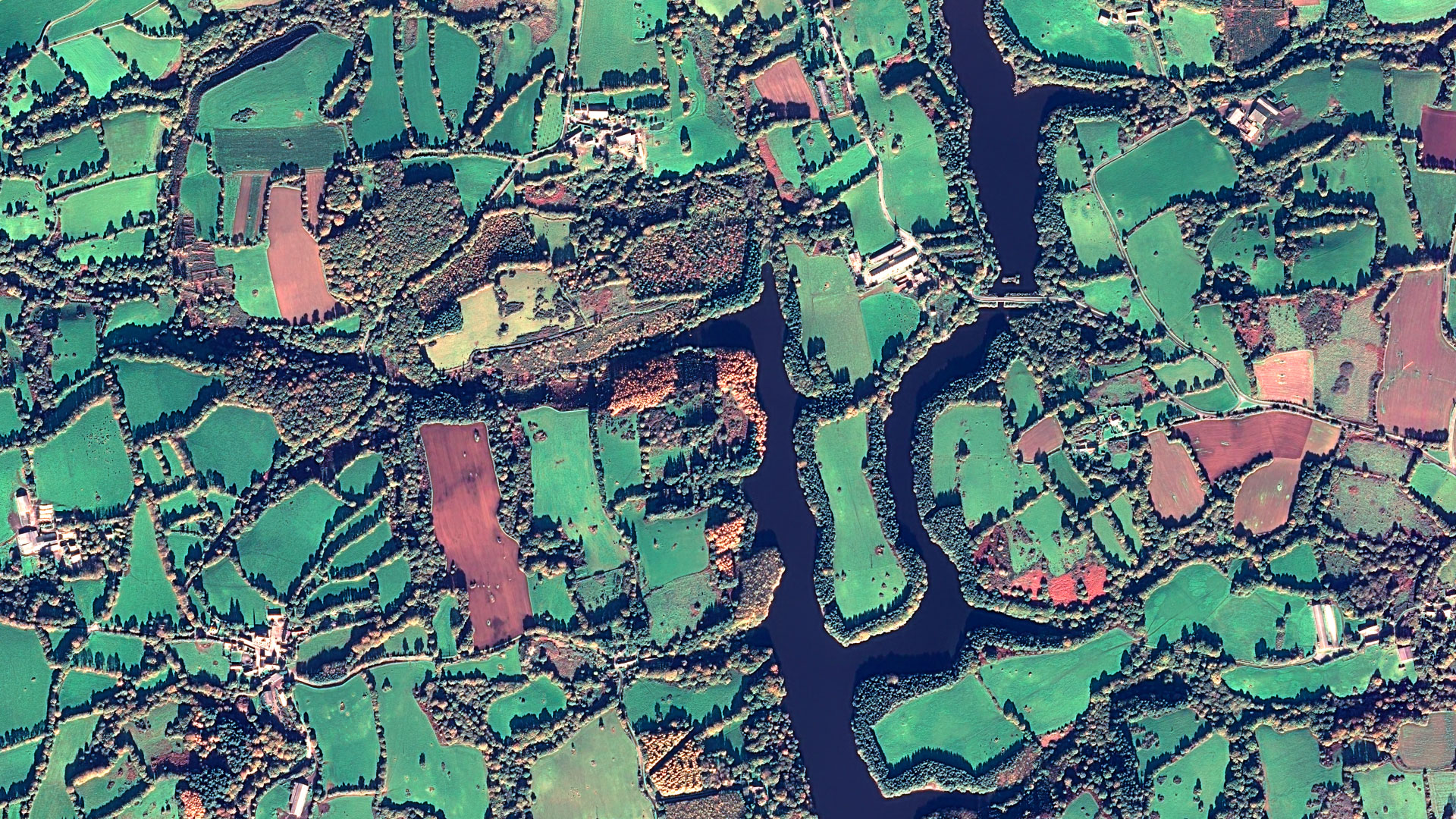
▲ Notre-Dame-Des-Landes seen by Pleiades on 09/11/2021 © CNES 2021, Distribution Airbus DS
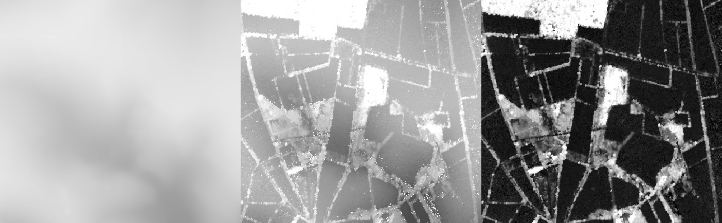
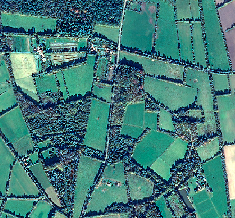
▲ Notre-Dame-des-Landes : MNT (RGE Alti® IGN) – MNS (Pléiades) – MNH © CNES
Results
The sensors compared gave almost equivalent overall detection performance. The BD ORTHO detects more hedges than the Pleiades data, because it is more detailed (20 cm spatial resolution for the BD ORTHO and 50 cm for Pleiades). However, this high level of detail can lead to over-detection errors. The date on which the image was taken also has a bearing on the ability to detect hedges. For example, a BD ORTHO image taken in early spring, when the trees do not yet have their leaves, will detect fewer hedges than a Pleades image taken later in the season.
About using Pleiades Neo, its interest seems to lie in its additional spectral bands and not in its higher spatial resolution (30 cm) compared with Pleiades. On the basis of initial tests carried out on the site of the Kerne Huel pond protection perimeter, we hypothesize that the red edge (a portion of the electromagnetic spectrum in the near infrared) will improve the detection of hedges.
Finally, the addition of height information from the DSM helps to improve hedge detection in the majority of cases. In particular, this information helps the model to avoid confusing a hedge with a grassy ditch, and to better detect narrow hedges. Nevertheless, with the AI method in place, hedgerows can still be detected without DSM, with satisfactory prediction quality.
|
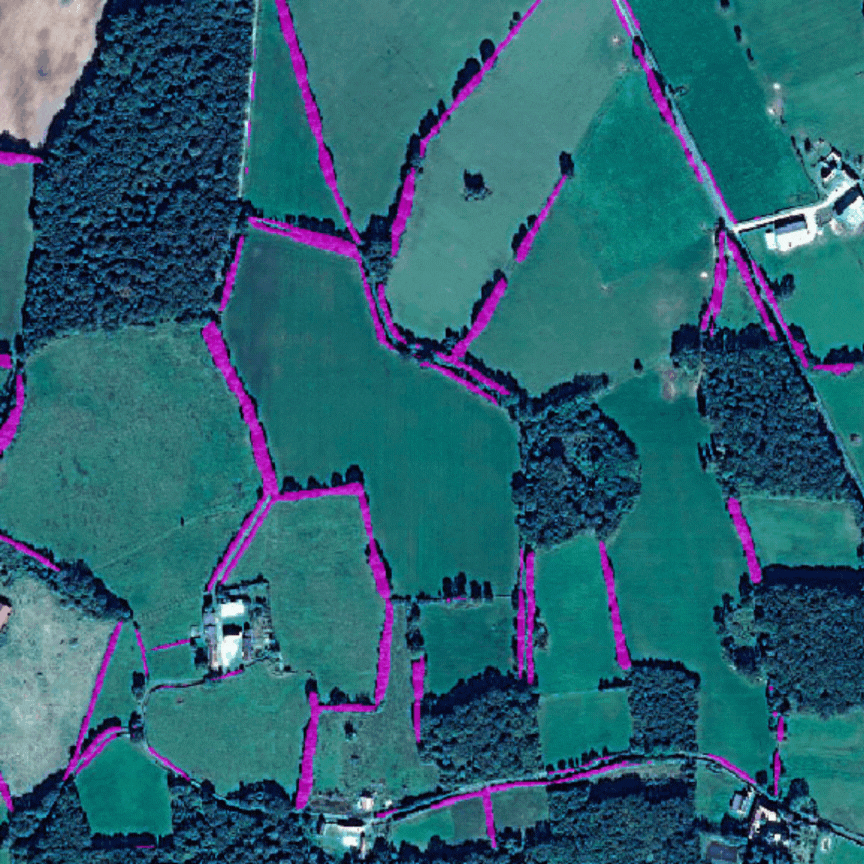
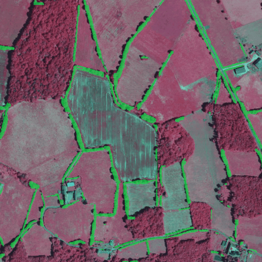
▲ Detection of hedgerow areas from Pleiades with and without DHM (MNH in French) in the Brenne Regional Nature Park. © Image: CNES 2021, Distribution Airbus DS / Processing: TerraNIS |
▲ Detection of hedge surfaces from BD ORTHO with and without DHM (MNH in French) in the Brenne Regional Nature Park. © Image: IGN / Processing: TerraNIS |
Moral: solid building blocks to complete the final tool
👉 This work has enabled the consortium to understand the best data sources for detecting hedgerows and to develop a methodological framework to meet users' hedgerow monitoring needs.
👉 At the same time, the DYNAFOR laboratory has developed Hedge Tools, an automatic hedgerow characterization tool that generates indicators from different perspectives on hedgerows: morphological, structural and functional. Distributed freely, Hedge Tools can be used to characterize hedges detected from remote sensing images and thus assess their roles and the ecosystem services they provide.
👉 Thanks to this work, TerraNIS is able to provide a hedge mapping and characterization service on demand, using very high-resolution satellite images or the IGN BD ORTHO, depending on the needs of the region.
The consortium aims to continue its work in two main areas: quantifying changes (uprooting, cutting, planting) in the hedgerow network, and detecting other agroecological infrastructure elements (isolated trees, copses, woods, permanent grasslands, wetlands, etc.). The final tool will be presented in the first quarter of 2024.