


SCOFrance
PartnersM2C, ISPA, IDEES, CNES, CNRS, Université de Rouen
Useful Links Project page
KeywordsIntertidal zone, topography, classification, sedimentation, erosion, accretion, storms


EO4Intertopo, 800 km² of the Normandy foreshore monitored from space
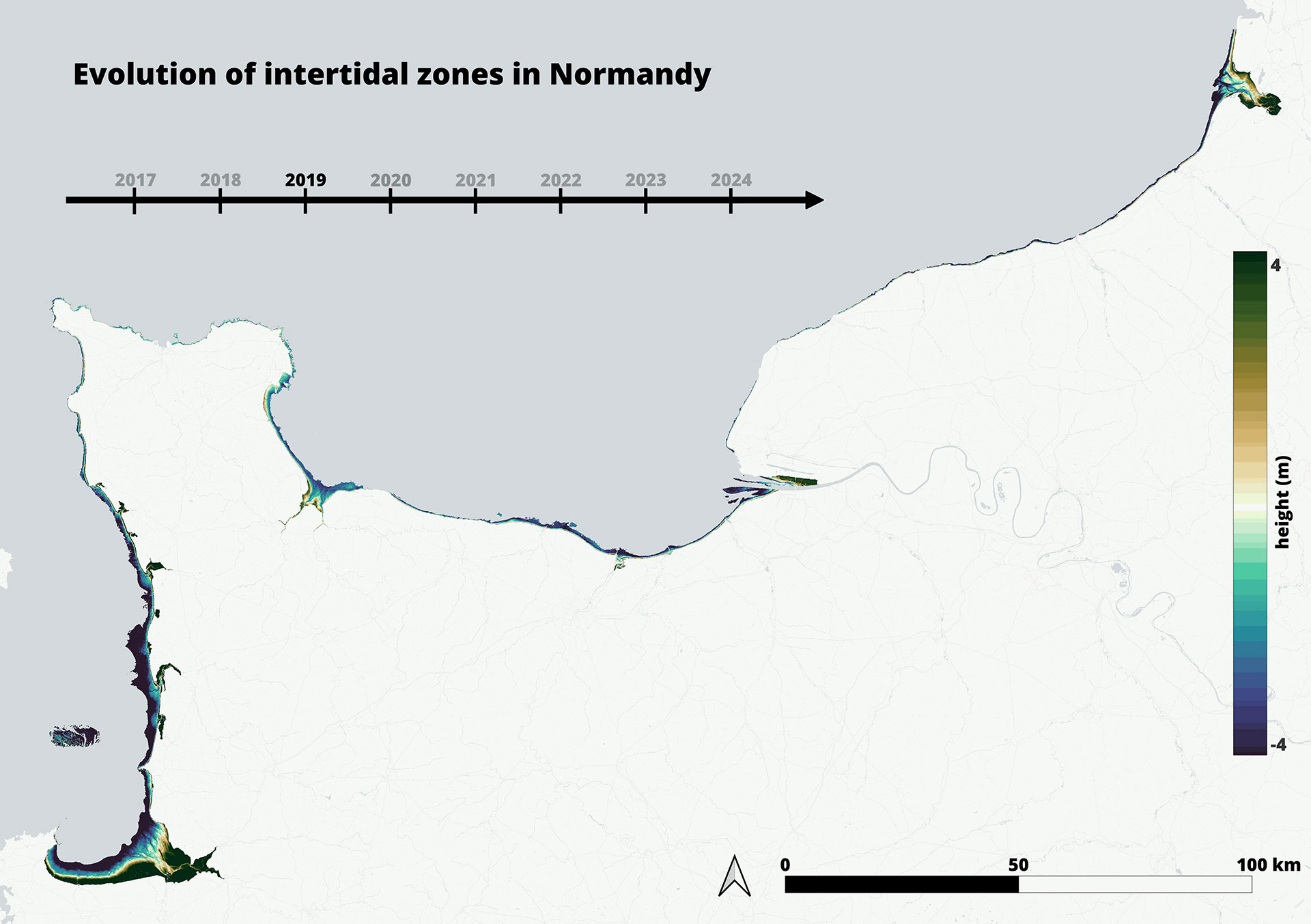
On the Normandy coasts, the sea retreats twice a day under a semidiurnal tidal regime, exposing kilometers of sand, mud, and rock where life flourishes and where the coast finds its best defense against flooding and storm surges. Under the combined effects of sea-level rise, intensifying storms and human pressures, global intertidal areas lost 16% of their surface between 1984 and 2016, an alarming result for tide-dominated coasts.
How can we monitor these changes along the Normandy coast and guide effective management?
This is precisely the challenge taken up by the SCO EO4Intertopo project. Over two years, the team used the Sentinel-2, Sentinel-1, Pleiades, ICESat-2 satellites and even the recent SWOT mission to monitor the Normandy intertidal areas. The result: a decade of topographic and sedimentary evolution, from 2016 to 2025, is now accessible in a few clicks via an online Google Earth Engine application.
Satellite-derived topography and classification for the whole Norman coast
The team’s approach combines two complementary perspectives: topography tells us how the relief changes, classification tells us what covers the ground. By combining them, we can identify where erosion and accretion acts and how sediments are redistributed.
For topography, the team used the water occurrence method: by analyzing hundreds of Sentinel-2 images acquired at different tidal levels, each pixel is assigned a flooding frequency, directly converted into elevation using the FES2022 tidal model. The resulting digital elevation models were validated against airborne LiDAR surveys, with mean errors between 27 and 48 centimetres.
For sediment classification, a Machine Learning algorithm (Random Forest) was trained on Sentinel-2 multispectral imagery to automatically distinguish six surface types: water, sand, mud, rock, pebble and vegetation. With an overall accuracy of approximately 90%, the model produces a complete substrate map of the entire coastline each year.
► Automatic substrate classification of Normandy Coast from Sentinel-2 imagery. The Machine Learning algorithm distinguishes six surface types. © CNRS/Edward Salameh | 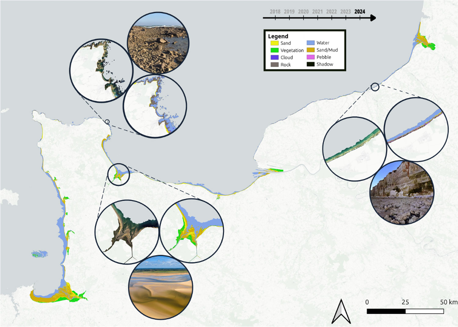 |
A toolkit for understanding coastal change
By comparing topographic models from one year to the next, EO4Intertopo produces erosion and accretion maps and calculates sediment budgets across the entire Normandy coastline. The substrate classification maps complement this analysis by providing essential context: they help interpret the topographic changes and allow users to exclude areas where the method is less reliable, such as rocky zones where elevation changes do not reflect sedimentary dynamics. Storm data derived from ERA5 reanalysis complete the picture, enabling users to investigate the link between morphological changes and coastal forcing events.
All of these products are brought together in a single Google Earth Engine application, freely accessible from any web browser. Designed as a toolkit for cross-referencing all data (topography, sediment context, erosion, storms), each user can explore the questions that matter to them. A coastal manager can identify erosion hotspots on a bay, verify that they correspond to sedimentary areas rather than rock, and check whether major storms occurred during that period. A researcher can extract topographic profiles and track how tidal channels migrate over a decade. A dedicated module identifies statistically significant erosion trends through a cautious and conservative approach, specifically designed for decision-makers.
► The EO4Intertopo Google Earth Engine application brings together topographic models, classification maps, sediment budgets and storm data in a single interface. © CNRS/Edward Salameh | 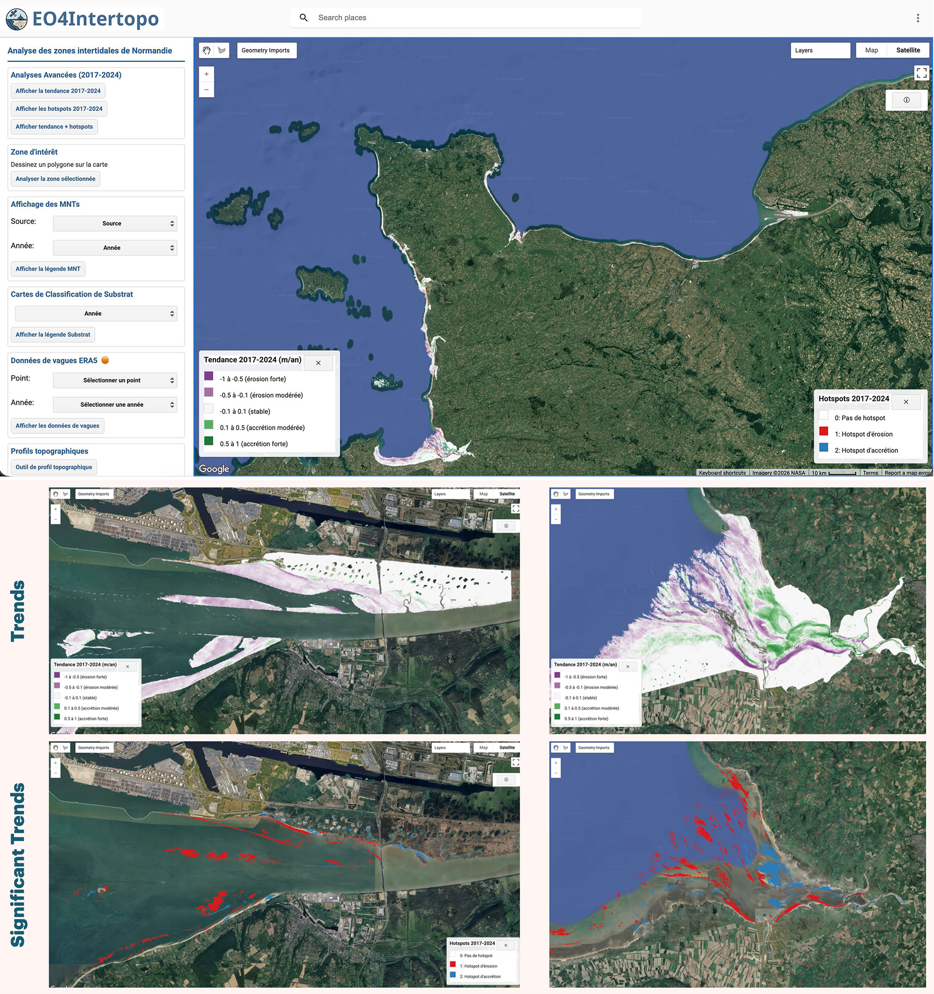 |
| Early exploratory analyses already hint at promising patterns - notably a possible connection between major storm years and morphological changes - but these remain to be confirmed through further investigation. The datasets and tools are now in place to do so. |
| A second application, the Water Occurrence Map tool, generates flooding frequency maps over any intertidal zone worldwide from Sentinel-2 archives, offering the possibility of replicating the method beyond Normandy. |
What's next? A PhD thesis to scale up to the whole of France
The methodological building blocks laid by EO4Intertopo open perspectives well beyond Normandy. A doctoral thesis has been financed by the Normandy Region, entitled "InterTideFrance" and launched in October 2025 at the University of Rouen Normandy under the supervision of Benoit Laignel and Edward Salameh. It aims to extend the mapping and morphodynamic monitoring of intertidal zones to the entire French coastline.
Two scientific publications are also in preparation, and the team has already planned to analyze the impact of the storms that struck French coasts in early 2026, a use case that will be the subject of an upcoming article on the SCO website!