

SCOFrance
15Mangroves monitored by the demonstrator
Useful linkProject page
Key wordsMangroves, ecosystem, mapping, temporality, Sentinel-2, remote sensing
How about Mangroves?
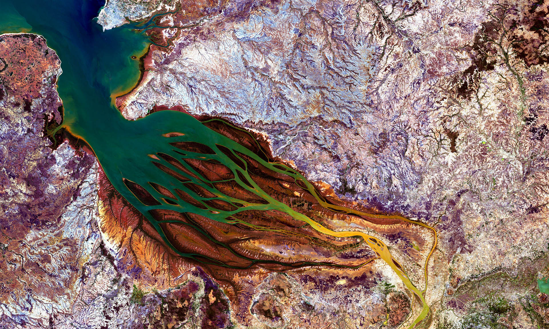
Labelled SCO in 2020, the Mangroves project was not finally able to start until the beginning of 2022. But it is well known that better late than never, and the team has been working hard to develop more than half of the building blocks of its future platform for operational monitoring of mangroves using Earth observation data.
A unique and indispensable project
Led by the IRD, this project aims to produce, catalogue and disseminate sets of environmental information for :
- Improving mangrove mapping;
- To have standardised and updated information characterising the state of mangroves (diagnoses) and the dynamics underway (retrospective analyses);
- Identify the risks and threats to this ecosystem in space and time.
A wide range of users
From scientists to public actors in the territories, through NGOs, associations and the private sector, the monitoring of mangroves interests many people. In fact, the team adopts a user-centred development philosophy, so that those with little or no knowledge of cartography and remote sensing can access the platform's services. Eventually, the system will be integrated with Theia, the land surface data hub.
A platform powered by Sentinel-2 data
Developed by the company Magellium, the Mangroves platform will be fed with medium spatial resolution images from the Sentinel-2 satellite every 5 days. Thus, 11 spectral indices (vegetation, soil, water and mangrove-specific indicators) will be updated every 5 days.
This temporality will make it possible to produce each quarter a vector outline of the mangroves as well as a statistical synthesis of the various indices on all the mangrove polygons.
Another special feature is that users will be able to import or draw their own polygons, on which they will be able to run statistical calculations (averages, standard deviations, minima and maxima, etc.) from 2016 (entry into service of the Sentinel-2 satellite) to the day of the request.
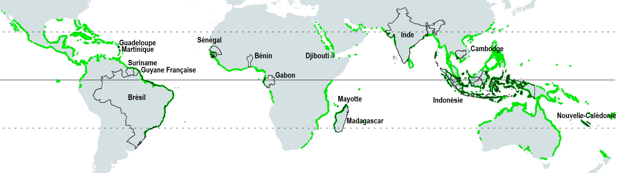
Distribution of mangroves in the world (green). The demonstrator will monitor 15 of them (black lines).
The test phase is coming soon
With 15 sites monitored in this experimental phase, the IRD is already in contact with resource persons on each of these sites to select the first users in order to launch a test phase in autumn 2022. Motivated and efficient, the team is already thinking of a rapid evolution with very high spatial resolution images and a larger number of mangroves covered, the final objective being to monitor a maximum of the mangroves of the planet.