

SCOFrance
150 000 haof wasteland sites identified in Occitania
PartnersSafer Occitanie, FN Safer, CNES Lab’OT, Thalès
Useful links
CRéFAO webinars (in French)
KeywordsAgricultural wasteland, inventory, identification, mapping
Izifriche®: the 2024 inventory of agricultural wastelands in Occitania is now available
|
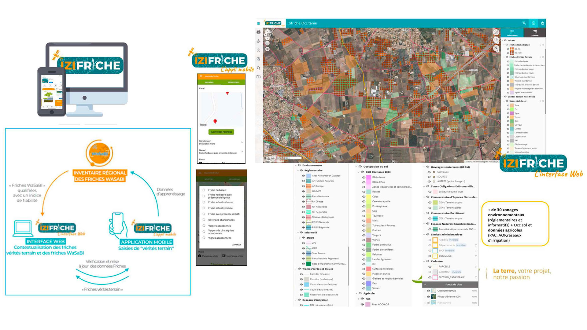
On 5 April 2024, we presented Izifriche®, a method for inventorying agricultural wasteland developed by Safer Occitanie using automated analysis of satellite images and geographical data by the WaSaBI©CNES software. A powerful tool for promoting agricultural wasteland, it is aimed directly at local authorities and stakeholders involved in sustainable agricultural development and environmental conservation. |
The power of agricultural wasteland sites Wasteland sites are a lever for adapting to climate change, ensuring food sovereignty and maintaining biodiversity. In this context, Izifriche® offers a reliable solution for locating these neglected areas, planning their reclamation, implementing appropriate land strategies and meeting regulatory obligations in this area. |
The 2024 edition of WaSaBI wastelands across Occitanie
For the SCO, this project is a long-term benchmark that continues to improve, with the added bonus of concrete potential for nationwide roll-out. Although the SCO phase was completed in early 2024, the tools and processes developed with CNES were re-mobilized by Safer Occitania and improved with the support of Thalès in 2025. The objective is to update the 2023 inventory to produce the "2024 WaSaBI Wasteland Sites" for the entire Occitania region.
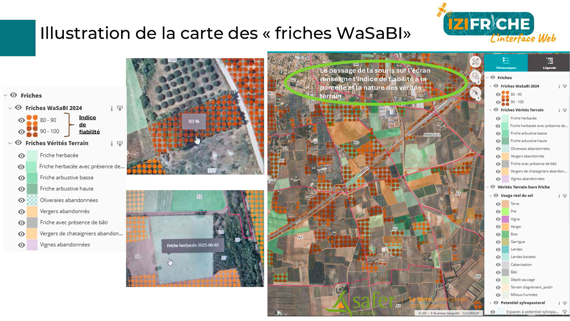
👉 After verification in the field, the WaSaBI software achieved a performance rate of 73%, compared to 65% for the first edition in 2023. This improvement was achieved thanks to the updating of satellite and vector data, the completion of a 7th learning loop for the WaSaBI©CNES software with more numerous and varied "ground truth" data, and a number of methodological improvements made by Thalès.
👉 As Isabelle Botrel, Director of the Territories, Planning and Environment Department at Safer Occitania, points out, "Izifriche provides access to WaSaBI wasteland as well as to areas with silvopastoral potential, representing 29,600 hectares of open forests, wooded moorland and unmanaged grassland. The tool thus gives local stakeholders an overview of underutilized areas in their territory."
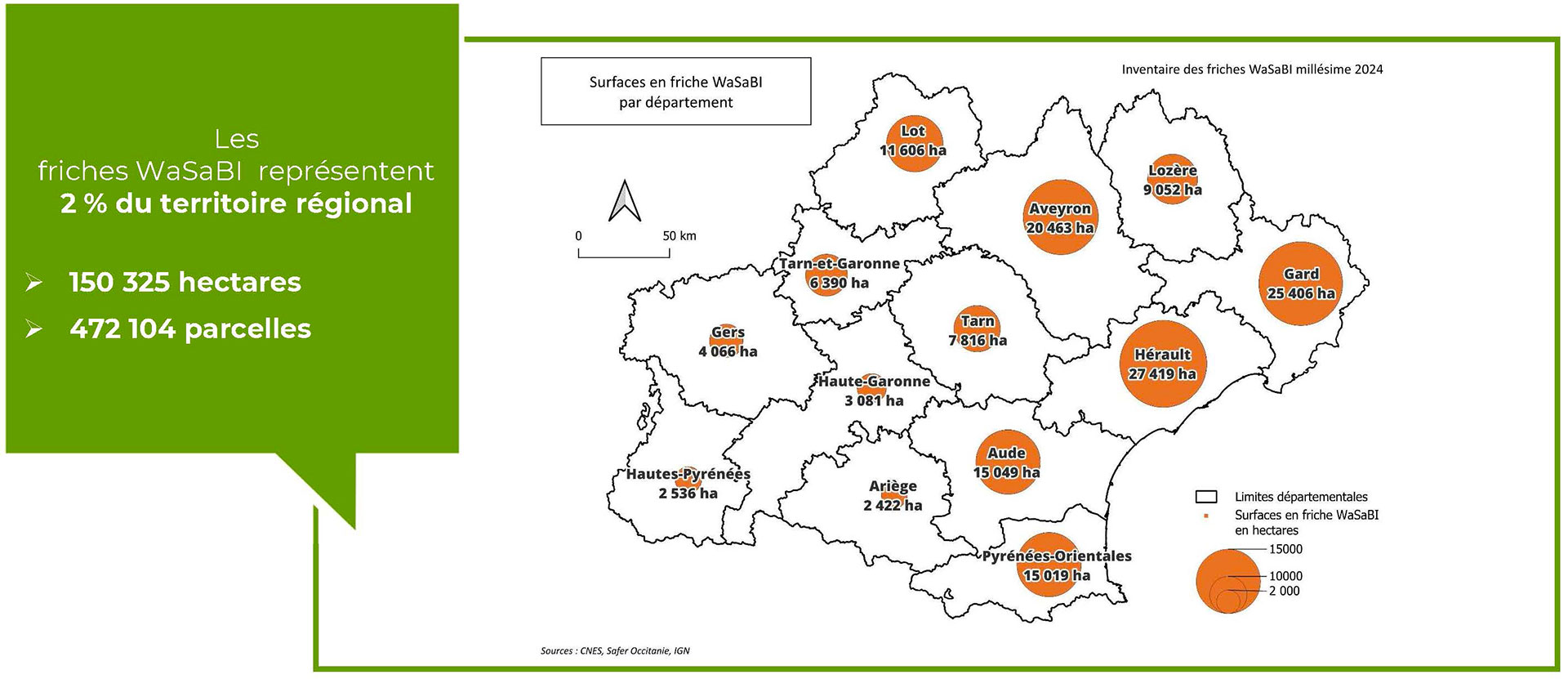
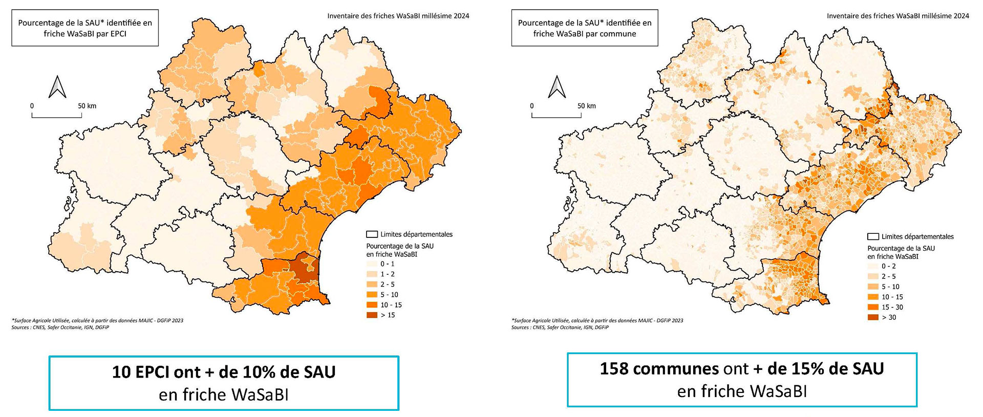
Results at different scales: ▲region and departments, ▼EPCI (public establishments for inter-municipal cooperation) and municipalities. © Safer
|
► Focus on identifying wasteland sites in the Izifriche® web interface. © Safer |
|
What next?
Given the quality of the results obtained in Occitania, the Federation of Safer wishes to extend the methodology and inventory work to the national level, in successive stages. A deployment schedule with new partners has already been finalized. Find out more on the project page, HERE.
☝️️ Are you interested in the Izifriche® solution? The service is available to members. Please send an email to izifriche@safer-occitanie.fr.