

SCOFrance
Liens utilesPresentation of the project
Key wordsRivers, flow, forecasting, warning, hydrology
OpHySE delivers its platform for real-time hydrological monitoring of Guyanese rivers
Under the impact of climate change, the basins of the Amazon biome have been experiencing exceptional rainfall volumes in recent years, resulting in increasingly visible changes in the hydrological cycles of rivers.
Although French Guiana has a network of in situ stations, which are essential for training models and validating their results, it is not immune to the problems of the Amazon basins, such as poor communication between automatic stations, problems of access to data from neighbouring countries, difficulties of access to increase the network of stations, etc. French Guiana has therefore naturally become the pilot region for the OpHySE project, which is being led by the young company Hydro Matters. French Guiana therefore naturally became the pilot region for the OpHySE project, which is being run by the young company Hydro Matters. "Obtained shortly after the creation of our company, the SCO label was particularly important because it supported our first project", confides Adrien Paris, project manager.
Having gone from project to operational service in 18 months, the aim has now been achieved: to make real-time hydrological information available for the various catchment areas in French Guiana, backed up by satellite data. Co-constructed by the SCO OpHySE project and the SAGUI project conducted as part of the Recovery Plan, the platform has been freely available since February 2022.
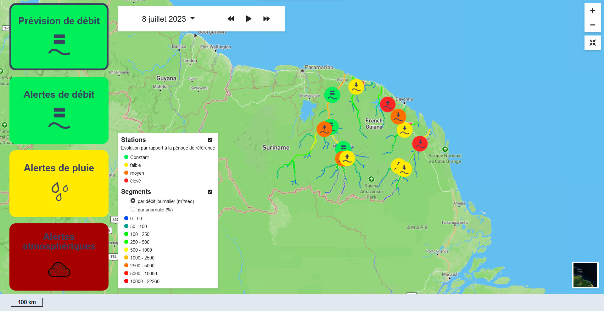
Overall view of the platform and flow forecasts (highlighted in terms of anomalies compared with the reference period) to 8/07/2023. The left-hand side of the screen shows the selectable tabs, where the first "flow forecast" corresponds to the "SCO" climate product. The other three are the various hydro-meteorological alerts set up as part of the SAGUI project. © HydroMatters
The platform provides an overview of the state of French Guiana's rivers, offering a real-time rainfall and flow alert service. Satellite data on rainfall and altimetric water levels are used by the calculation core to provide a picture as close as possible to reality. In addition, it projects likely short-term changes in flow. With a highly visual interface and a parameterizable calculation core based on recent research results, the method is intended to be generic, so that it can be transposed to other basins with varying characteristics. To ensure this, the team has tested the method in African (including Niger and Congo) and Indian basins, often in collaboration with local teams and with data obtained in particular via pilot sites for the calibration/validation of SWOT satellite data.
Responding to user needs
To respond as closely as possible to the needs of the region, the team has surrounded itself with user partners:
- Directorate-General for Land and Sea (DGTM, Direction générale des territoires et de la mer) of Guyana, responsible for monitoring river flows and maintaining the in-situ network, which wants to improve its forecasts and have a tool that complements the existing network;
- The Guiana Water Board (Office de l’eau de Guyane), which needs real-time information on all the water basins, particularly on certain rivers that are not monitored;
- the International Office for Water, a public utility association interested in using the OpHysE outputs in the hydrological bulletin produced as part of the BIO-Plateaux cross-border project, a network for sharing hydrological data between Brazil, France and Suriname.
Balance sheet
OpHySE brings real added value to our understanding of hydrometeorological phenomena. "Thanks to the partnerships involved in the consortium, we have been able to carry out numerous field missions and carry out a highly critical analysis of the spatial data used. This data (mainly satellite rainfall and altimetry of water levels in rivers of all sizes using Sentinel-3 and Sentinel-6 data) enables us to take a look at phenomena never before observed in these areas. We were able to look at different time scales, particularly on the large rivers on the Maroni and Oyapock borders, where we had little information on how rainfall is distributed, and how some of it spreads into the rivers, where it sometimes causes flooding," explains Adrien Paris.
The system comprises a hydrological model, which estimates the distribution of rainfall (absorption by vegetation and soil depending on its type, evapotranspiration, etc.), and a hydrodynamic model, which simulates the propagation of water masses in rivers. The whole package is encapsulated in a scheduler that manages interfaces with real-time products and the assimilation of altimetry data. In addition to the display interface and dashboard, the platform enables everyone to download information automatically.
What about tomorrow?
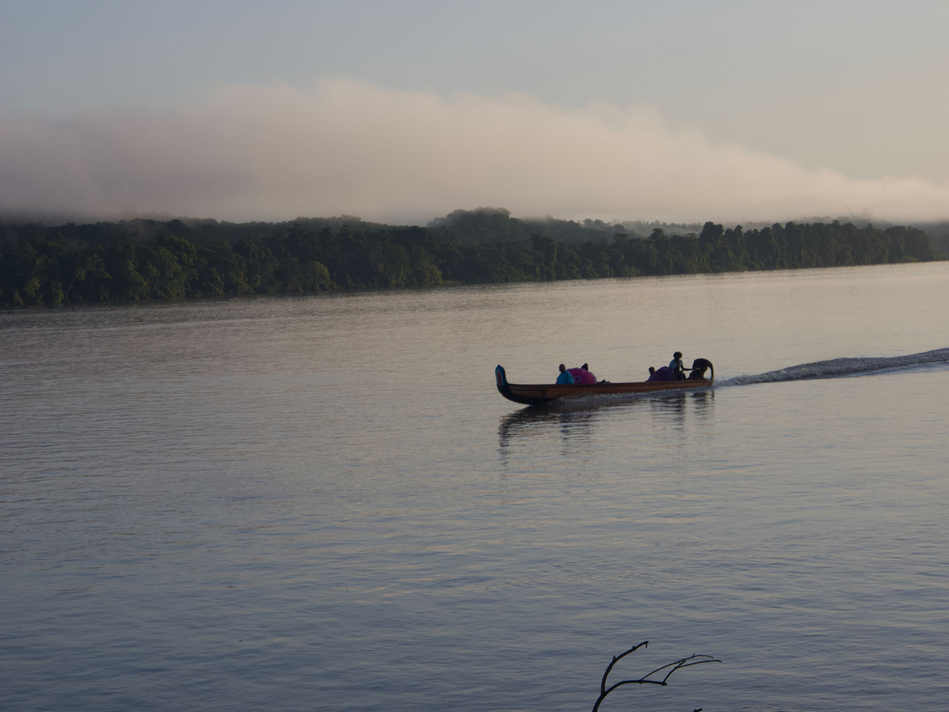
Hydro Matters is now looking into the best way of disseminating OpHySE/SAGUI forecasts and warnings, from public players to pirogue operators. However, if the tool is to be maintained in French Guiana over the coming years, it will be necessary to obtain long-term funding. Discussions are also underway with partners to find funding to continue improvements to the computing core and thus increase the system's observational and predictive capacity.
for full details, to download the final report (in French), contact the project team.