ORENOS
Guidance on the Renovation of Night-time Lighting through Satellite Observation
Project completedA pioneering project in the use of night-time satellite imagery, ORENOS paved the way for the development of decision-support tools for the management of artificial night-time lighting and its impacts in terms of light pollution.
As a result of this work, La TeleScop and Cerema have been involved since late 2025 in the France 2030 HALO project – Night-time lighting and light pollution. The aim of this project is to produce a set of indicators for monitoring night-time lighting, with regard to regulations and its impacts on biodiversity, human health and energy consumption.
Overview
Light pollution disrupts the functioning of living ecosystems and contributes to energy waste. Against this backdrop, the ORENOS project is studying the quality of artificial lighting at night, focusing on the test area of Haute-Savoie (France). This mountainous department boasts a rich diversity of flora and fauna, but is under increasing pressure from urbanization, economic development and the densification of infrastructures. As the first most dynamic department in terms of demographic growth between now and 2050, the artificialization of land and the pressure on ecosystems will continue to increase, particularly in terms of artificial night-time lighting. 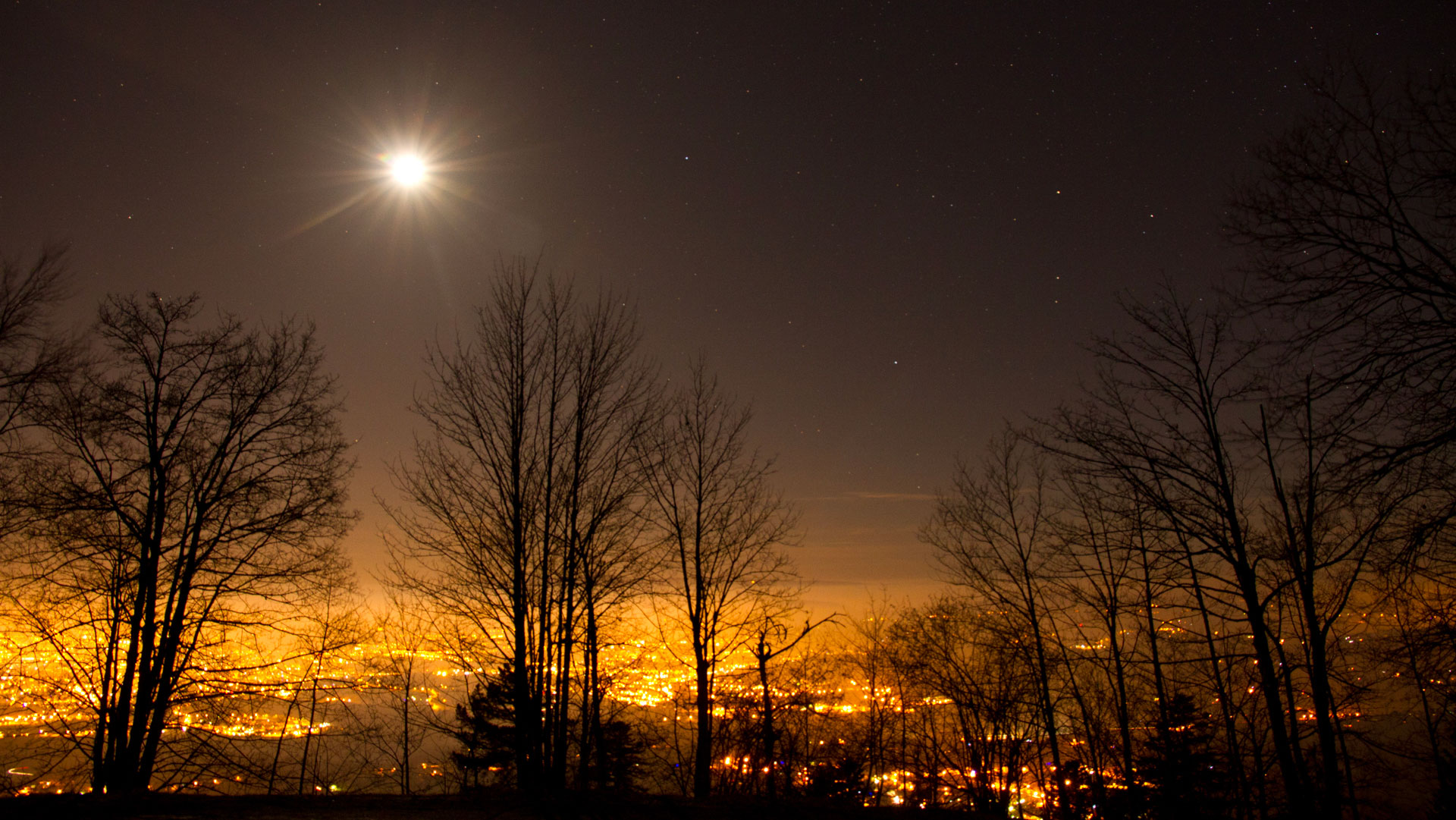 The lights of Annecy. © Samuel Busson | The impacts of lighting on biodiversity The majority of animals are nocturnal and are severely affected by lighting that is too intense, too blue or poorly directed. This light pollution reduces their ability to forage, move around, reproduce, develop and protect themselves from predators. Whilst it is easy to think of insects dying of exhaustion around a street lamp, it is also important to realise that birds and bats are similarly hindered in their ability to forage, or are disoriented by these ‘false’ light signals. Excessive lighting also disrupts the phenological cycle of plants and affects the circadian rhythm of humans, causing a range of health problems. At a time when we are facing a major species extinction crisis, there is therefore an urgent need for action. |
What's more, in 2017, according to ADEME, lighting accounted for 32% of the electricity consumed by local authorities. In fact, the challenges of managing and renovating the stock of public lighting represent a lever for energy savings that is widely used by local and regional authorities, although they sometimes lack the tools to do so effectively and with a global vision over a wide area.
👉 The ORENOS project has enabled the development of indicators for the quality of artificial night-time lighting in the Haute-Savoie region, based on night-time satellite imagery, which will be used to adapt lighting to minimize its impact on biodiversity and save energy.
Methodology
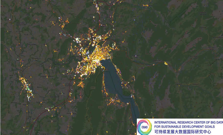
The project relies primarily on night-time imagery from the Chinese SDGSAT-1 satellite, provided by the CBAS (International Research Centre for Big Data on the Sustainable Development Goals) at a spatial resolution of 10 metres. These night-time images contain radiance data, i.e. the light power emitted or reflected by a surface on the ground. As these images require radiometric and geometric pre-processing before they can be analysed, the work began with the development of an automated processing pipeline. The available images were collected over the study area across four years, and annual radiance datasets were produced. Based on these images and the extracted radiance peaks, various direct and derived indicators were calculated by cross-referencing the radiance data with auxiliary data (BD TOPO, OSM, land registry files, local streetlighting database, etc.).
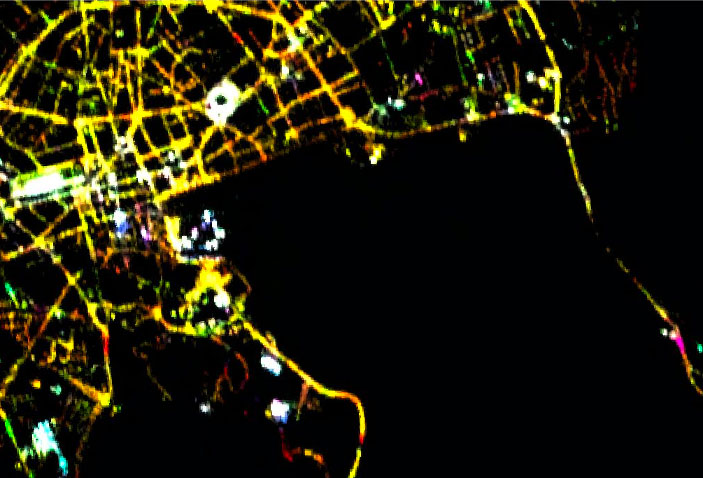 | 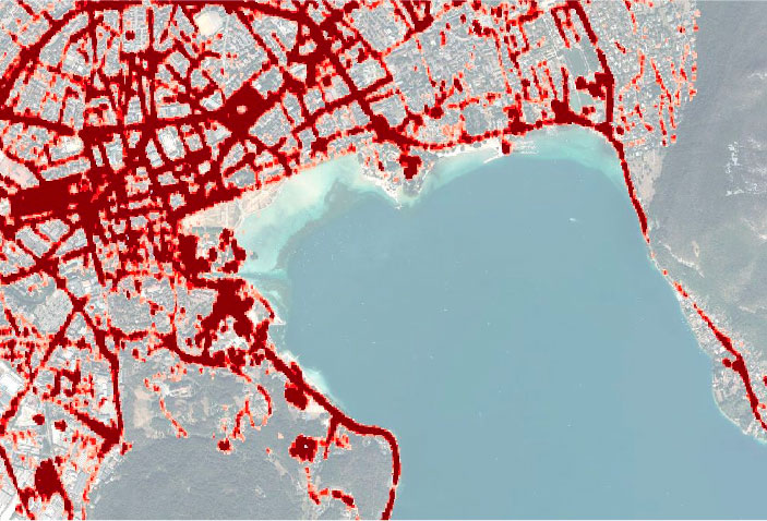 |
◀︎ SDGSAT image on the left (© CBAS) and its extracted radiance on the right (© Cerema). |
Application site(s)
Haute-Savoie Department, France
Data
Satellite
Night-time images (Glimmer) SDGSAT-1 (CBAS)
- Pleiades, Spot 6/7 and Sentinel-2
Other
Local street lighting databases
Field albedo measurements
- Auxiliary data: TOPO database, OSM, land registry records, land use data, etc.
Results - Final product(s)
To enable the end user to visualize and use the results, GIS layers and a QGIS project were delivered to Syane. HTML files were also produced. These resources will enable Syane to identify priority areas for action and will also serve as an awareness-raising tool for its member local authorities and private sector stakeholders.
👉 Read an example of how Syane uses ORENOS
The results are not intended for dissemination to the general public. However, with Syane’s consent, we are sharing below some HTML files relating to the radiance indicator, as well as a video of the web demonstrator.
Furthermore, all the project’s developments and details are available in the summary report (see the ‘Resources’* section below).
⚙️ Pre-processing
Several methods and algorithms for the pre-processing of SDGSAT-1 night-time satellite images at 10-metre resolution have been developed by the consortium, with tools and technical advice from CNES. In particular, the extraction of light sources enables the characterization of illuminated areas and the removal of noise* from the image. | 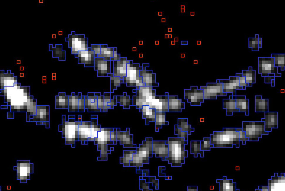 ▲ Segmentation of the panchromatic SDGSAT-1 image into light sources (blue) and noise reduction (red). © CBAS |
📍Indicators developed
Defined in collaboration with the user Syane, the indicators developed characterize lighting in terms of its main components. Their analysis proves particularly revealing.
► © Cerema, generated by AI | 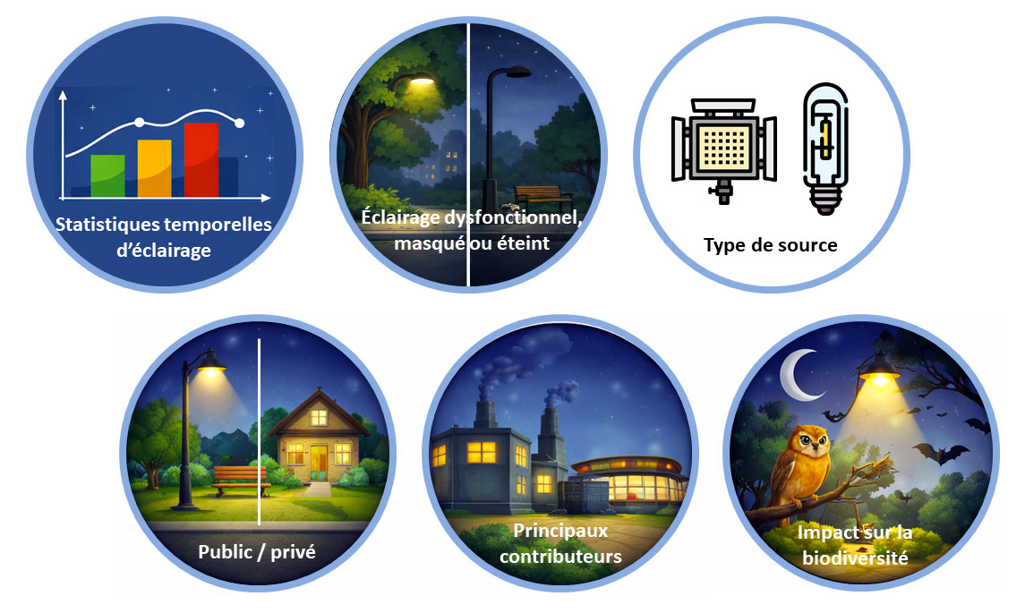 |
💡 Lighting quality: distinction between public and private contributions to night-time lighting; location of the main contributors; radiance statistics at local authority level; potential obscuration of light points by vegetation or buildings; distinction between types of light sources, etc. Some indicators use the department’s public lighting database to supplement the imagery.
View graphs showing the relationship between night-time radiance, population and illuminated areas |
🦇 The impact of artificial lighting on biodiversity, using various external databases: land use, ecological corridors, regulatory and inventory data, and species data (bats).
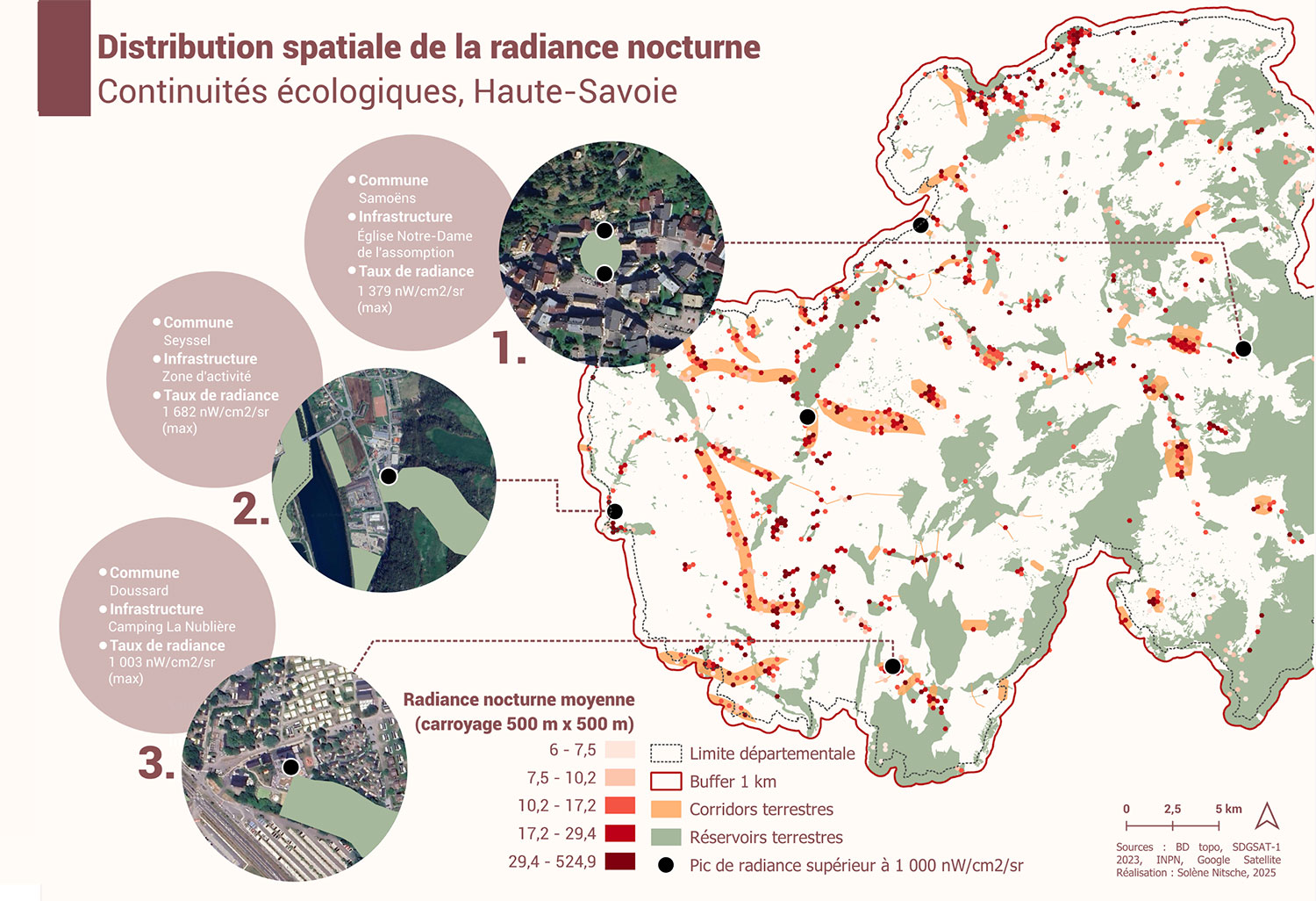 ▲ Indicator of the pressure exerted by night-time lighting on biodiversity in relation to ecological corridors. A peak in radiance (black dot) appearing within a corridor or reserve indicates a location requiring priority action. | 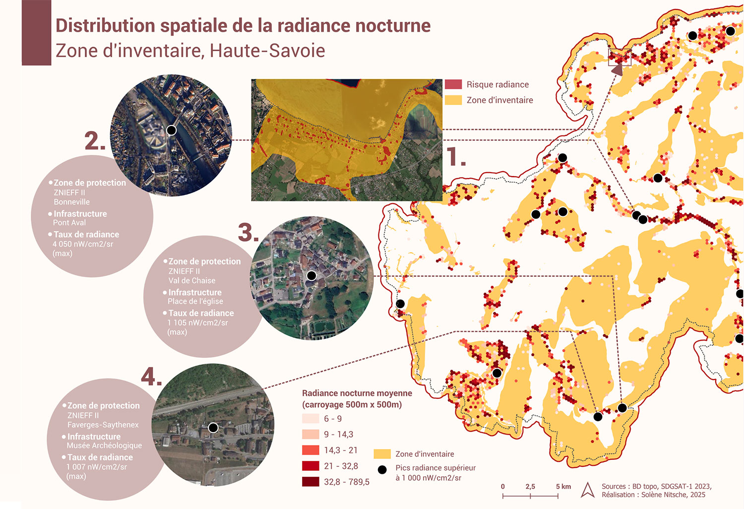 ▲ Indicator of the pressure exerted by night-time lighting on biodiversity in relation to inventory areas, which, by definition, are of high ecological importance. |
► Summary indicator of the pressure exerted by night-time lighting on biodiversity. Derived by combining the various pressure indicators, it enables the identification of areas where pressures and challenges are concentrated. | 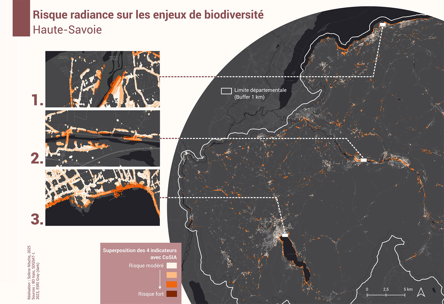 |
👁️ Results visualization demonstrator
In addition to the files that Syane can integrate into its own GIS system, the ORENOS team has developed an application demonstrating what a practical, user-friendly and easily accessible decision-support tool could look like for those working in the field. |
🛰️ Further reading on night-time imagery
Further exploratory analyses have been carried out to improve the understanding of the signal captured by night-time satellites: the impact of the Moon, flickering (very rapid flashing of lights), seasonal variation in vegetation cover, and the albedo (reflectivity) of the ground. On this last point, a specific study was carried out using very high-resolution daytime satellite imagery (Pleiades and SPOT-6) and in situ albedo measurements taken by Cerema’s Lighting and Light research team.
🇫🇷 On the way to HALO
Since late 2025, La TeleScop and Cerema have been involved in the France 2030 Night-time Lighting and Light Pollution project, led by CNES, which aims to develop the HALO service. The objective is to produce a set of indicators characterizing night-time lighting using very high spatial resolution satellites (Pleiades Neo and CO3D) tested for night-time operation, as well as data from SDGSAT-1 and VIIRS. Whilst some of these indicators are based on those developed in ORENOS, the decision-support service will be much more comprehensive. It will result in a commercial service for use by local authorities and the French Ministry for Ecological Transition to address issues related to light pollution (energy efficiency, the preservation of biodiversity and human health).
Project news
- 13 October 2026: Presentation of results in ORENOS, a pioneer in nighttime imaging in the face of light pollution
- 1 October 2026: Presentation of ORENOS by La TeleScop at the EARSeL (European Association of Remote Sensing Laboratories) international conference in Athens, during a ‘Special Session: Night-time Lights RemoteSensing Methods and Applications’.
🎥 3 December 2025: Presentation of ORENOS and its progress at the 19th Quarterly Meeting of SCO France
- 28 October 2025: Presentation of ORENOS at the ALAN international conference (Westport, Ireland)
 ORENOS_rapport_synthese.pdf