


SCOFrance
PartnersCerema, La TeleScop, Syane, CNES
Useful linksProject page
🎥 ORENOS featured in Quarterly
KeywordsLighting, biodiversity, energy, night-time imaging


ORENOS, a pioneer in night-time imaging tackling light pollution
Addressing a need in Haute-Savoie
In 2023, Syane, the Haute-Savoie Energy and Digital Union, seeking indicators to support the region in its ecological transition, approached Cerema for guidance on the large-scale refurbishment of its street lighting network. Cerema, supported by La TeleScop, responded with the ORENOS project, drawing on night-time imagery from the Chinese SDGSAT-1 satellite, kindly made available by the CBAS (International Research Centre for Big Data on Sustainable Development Goals) for the purposes of the project. The project was accredited with SCO certification in 2024. | In France ⚡️ Lighting accounts for 32% of local authorities’ electricity consumption (source: ADEME 2017). 💡 The National Biodiversity Strategy 2030 calls for a 50% reduction in light pollution by 2030. |
18 months of technical development
Whilst night-time imagery may seem ‘intuitively’ suited to this subject as it highlights lights, its use is not common practice, and ORENOS has pioneered an innovative methodology for analyzing night-time imagery.
The first step was to define and develop pre-processing chains capable of making the images ‘clean’ and usable. Once this was done, ORENOS extracted the radiance (the luminous flux directly emitted or reflected by ground surfaces and detected by the satellite) from these images to characterize the illuminated areas. Working closely with Syane, the team was then able to define and develop two main categories of indicators relating to the quality of lighting and the impact of this lighting on biodiversity.
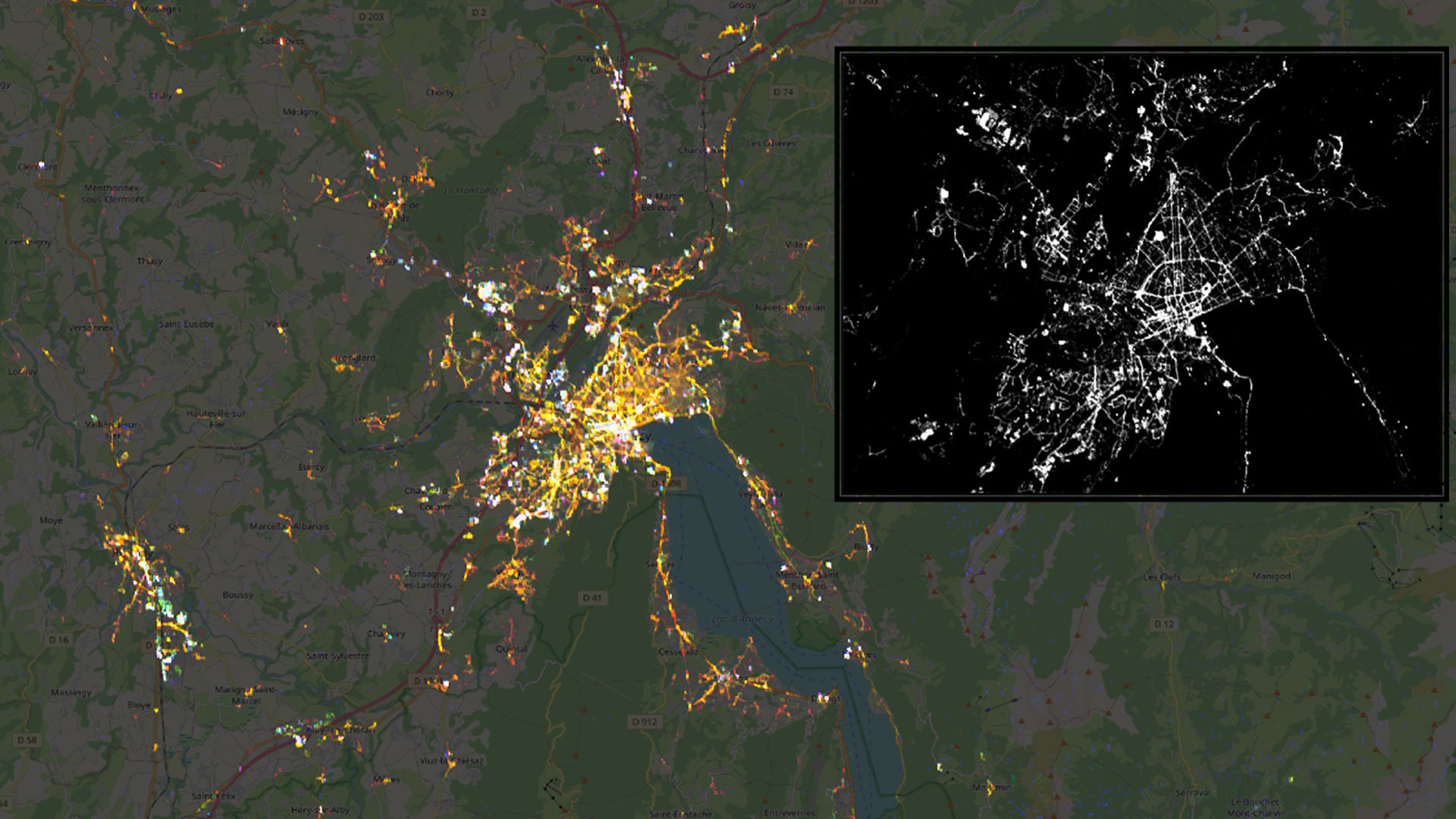 |
◀︎ Night-time view of the Annecy region from the SDGSAT-1 satellite, showing the extracted radiance. © SDGSAT-1: CBAS / Base map: OpenStreetMap / Radiance: Cerema |
Promising results
💡 Lighting quality
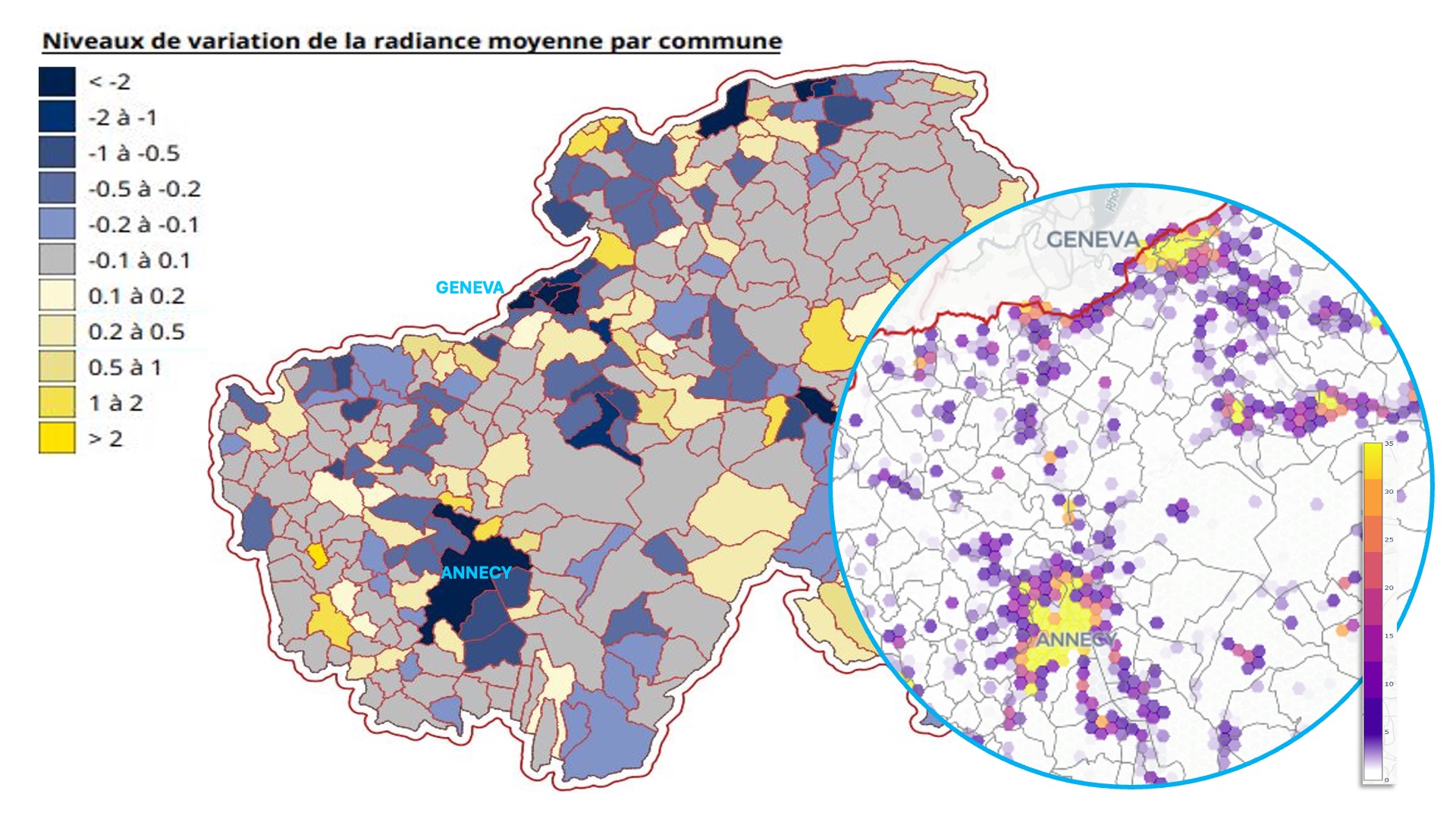
Maps based on images taken on different dates show a 7 per cent decrease in total radiance emitted across Haute-Savoie between 2023 and 2025. At the level of individual built-up areas, these maps enable an assessment of public lighting. They also highlight the plots emitting the lightest, revealing that these are predominantly private properties. This comprehensive view provided by the satellite is all the more valuable given that information relating to private properties is not recorded in public lighting databases. |
🦇 Pressure on biodiversity
When cross-referenced in turn with land use, regulated and protected areas, ecological corridors and data relating to four bat species, night-time radiance reveals important information such as the risk of pressure relative to the level of concern, priority areas for action, and light emissions that disrupt ecological connectivity. A composite map superimposing the four indicators highlights areas where the pressures of night-time lighting coincide with conservation priorities. |
▲ Synthesis indicator. © Cerema |
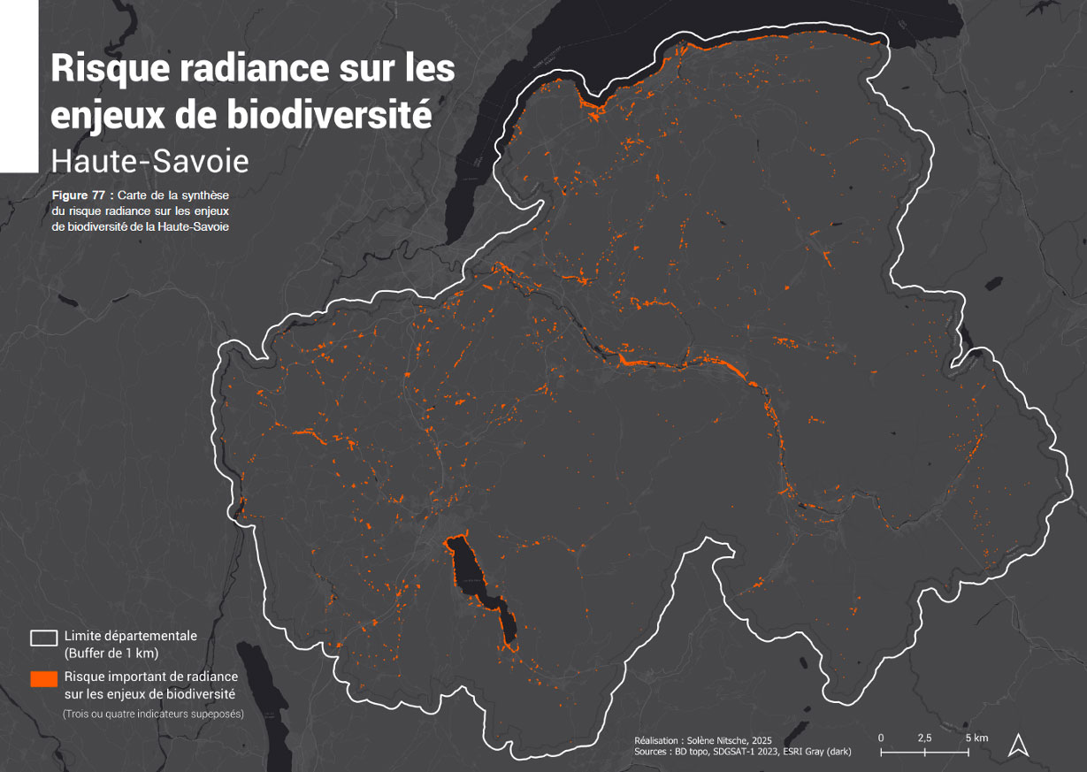
👉 These results were delivered to Syane, at their request, in QGIS files, to be integrated into their own GIS tools. The ORENOS team also provided them with a web application offering a preview of what a dedicated, user-friendly decision-support tool tailored to their needs might look like.
A key tool for Syane
Anne Gizard, a representative of Syane, said she “appreciated being an active participant and receiving support to deliver products that meet our expectations. We wish to capitalize on all this work by supporting local authorities in raising awareness, particularly amongst private sector stakeholders, who have emerged as major contributors. More specifically, thanks to the QGIS format of the files provided, we will be able to integrate ORENOS directly into our assessments, our lighting masterplans and our new-build and renovation projects.”
She cited the example of Évian-les-Bains, where a comprehensive performance plan is being trialed as part of a two-year renovation programme. In this tourist town, which boasts a lake, a promenade, a marina and several illuminated buildings, ORENOS’s radiance indicator has already helped to identify the main sources of light pollution, such as the railway station and the casino. “Thanks to this, we will be able to support the local authority in its discussions with the operators,” emphasizes Anne Gizard. The reduction in radiance also demonstrates that the initial renovation work carried out in 2025 is already having an impact. Finally, in terms of biodiversity, the indicators reveal the vulnerability of the lakeside environment, suggesting that the project should focus its efforts on the lake’s shores.
► Indicator of lighting pressure on biodiversity applied by Syane to the renovation project area in Evian. The most vulnerable areas are clearly concentrated around the lake. © Syane/Cerema | 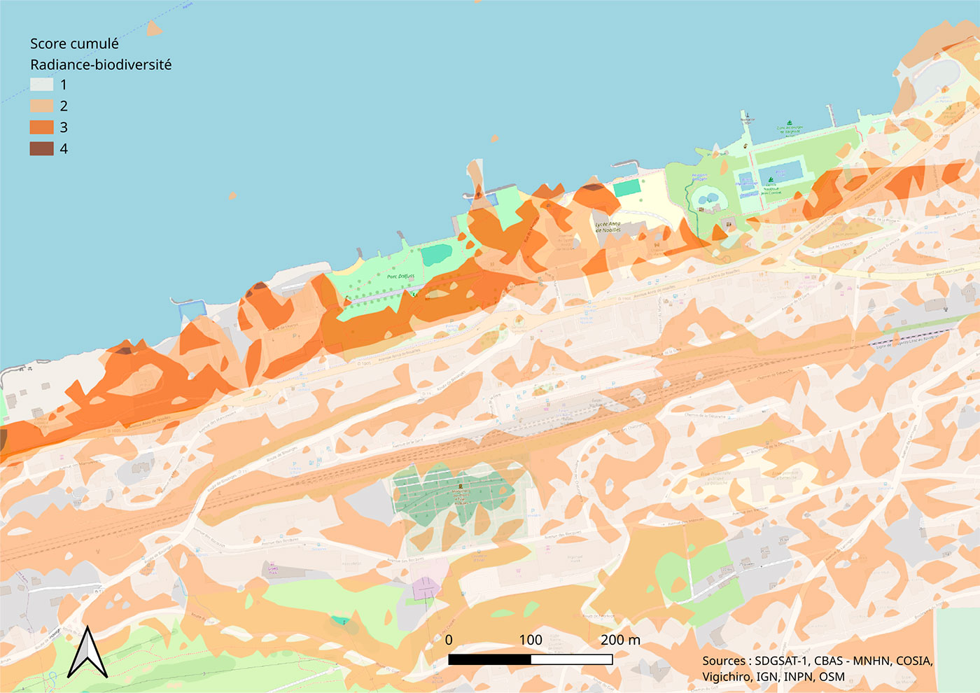 |
Next steps: moving to the operational and large-scale phase with HALO
Thanks to pioneering developments in night-time imaging carried out via ORENOS, Cerema and La TeleScop are continuing their work alongside Airbus DS, ACRI-ST and Dark Sky Lab to implement HALO, the future operational service for monitoring national light pollution, developed as part of the France 2030 projects led by CNES.
Launched in September 2025, HALO is set to provide indicators for monitoring night-time lighting, with regard to regulations and its impacts on biodiversity, human health and energy consumption.
To find out more about HALO:
On the CNES GEODES website
On the website of La Telescop, the project’s lead contractor
🇪🇺 Finally, it should be noted that the ORENOS project was presented by Tom Brunelle (La TeleScop) at the EARSeL (European Association of Remote Sensing Laboratories) international conference in Athens on October 1, 2026, during a “Special Session: Nighttime Lights Remote Sensing Methods and Applications”.