

PrEMHyOM

Precipitation Estimation and Mapping for Hydrological Operational Monitoring
Overview
PrEMHyOM aims to bring innovative rainfall products within the reach of a wide public. The target audience is primarily those involved in operational hydrology, monitoring tropical basins or large tropical metropolises affected by the risk of urban flooding.
These rain fields will be based on meteorological satellites and telecommunication networks, using innovative techniques developed by our teams. To this end, PrEMHyOM will develop a service to provide qualified and improved rainfall information at the scale of catchment areas. The service will focus on inter-tropical basins affected by a lack of in situ rainfall information. The demonstrator will be proposed on a range of basins of different sizes, eco-climatic contexts and urbanization (semi-arid to humid tropical) to illustrate the transposability of the approach.
|
► PrEMHyOM unveiled its logo at the end of a poetic animation of the project. A story of clouds, from which rain falls and plays with the waves sent by a satellite to measure it. (listen carefully). © Dylan Hall |
|
Methodology
-
Following the methods we have developed in our research work, we will analyze fluctuations from the telecommunication liaisons (mobile phone network or satellite TVs) to derive rainfall. This works because raindrops in the atmosphere attenuate the propagation of microwaves. Because if high network density in urban areas, we will provide high resolution rain maps, with km resolution and available every 5 to 15 minutes over cities.
-
At larger scale, to survey tropical river basins, we will use products based on meteorological sattellites to survey and quantify rainfall with typical resolution of 10 km and 30 minutes.
Consortium
IRD, UFHB and HD-Rain will bring their expertise on rainfall estimation from telecommunication networks. HDrain is deploying sensors based on satellite TV receptors.
Hydro-Matters and IRD will work together to bring the satellite information at the scales required for hydrology, and will develop merging to integrate all these rainfall measurement techniques.
Application site(s)
- West and Central Africa
- French Guiana
Data
Satellite
Meteorological satellites
- geostationary (EUMETSAT, GOES, etc.)
- low orbit (GPMcore, SSMIs, MetOp, etc.)
Other
Telecommunications networks
Results – Final product(s)
PrEMHyOM will set up an interactive web platform providing access to various types of rainfall data, maps, risk indicators and time series analysis.
Users will be able to analyse in detail rainfall trends in areas contributing to flooding in target locations/cities. Extreme events will be revisited to better understand their origins.
|
Figure 1 – Analysis of precipitation in the Niger basin during the record floods of 2020 , based on satellite data indicated on each image. © courtesy Romulo Oliveira HydroMatters |
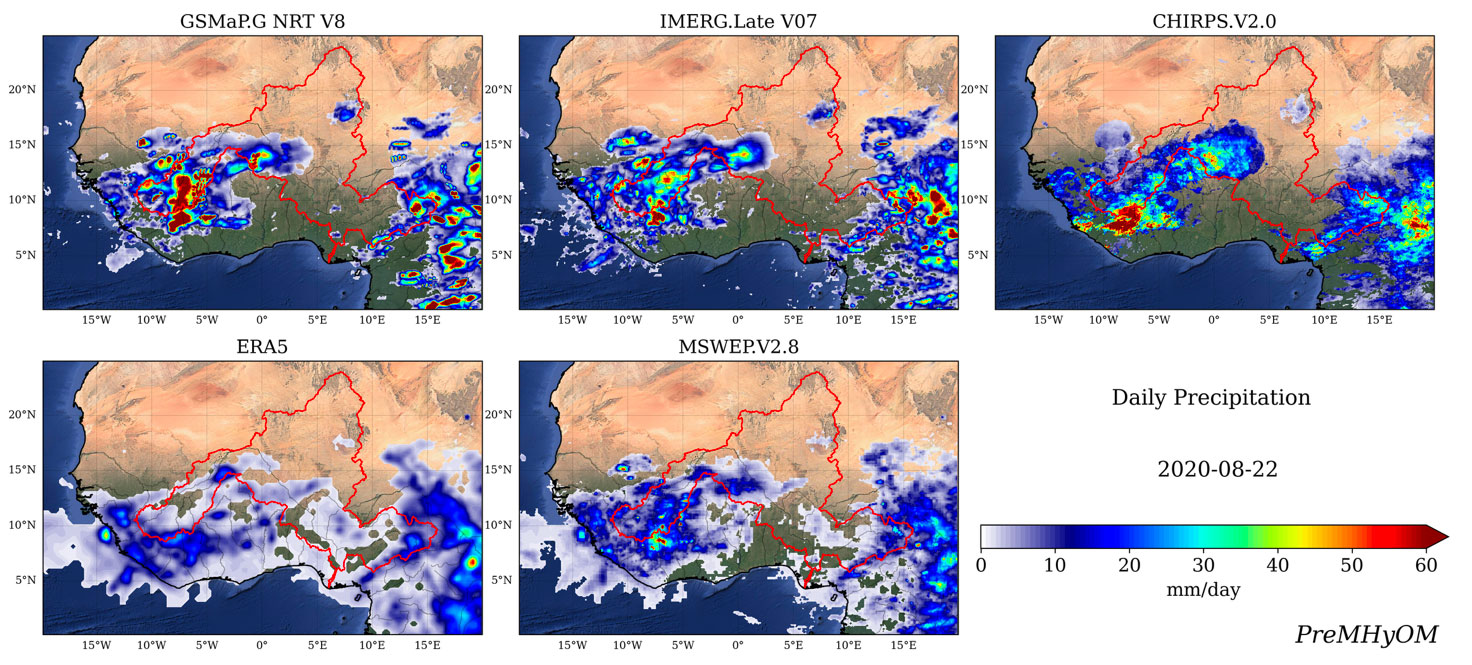
|
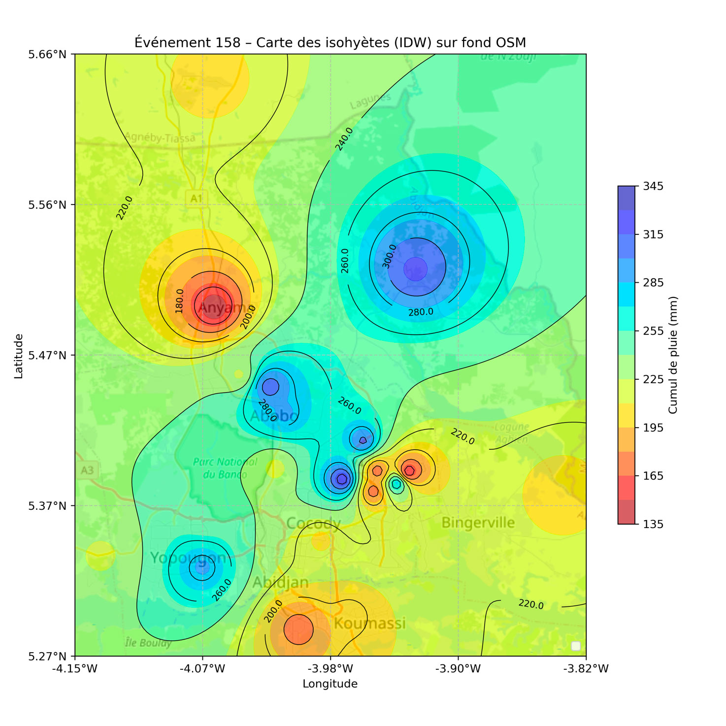
|
Figure 2 – Rain map over the city of Abidjan obtained from rainfall data that will be used in PrEMHyOM with the city's telecom links. © Courtesy Modeste Kacou – UFHB |
|
Related project(s)
SCO OpHySE et OpHySE-MoCha, which develop tools for forecasting extreme hydro-climatic events in French Guiana and Mozambique, respectively.