

SCOFrance
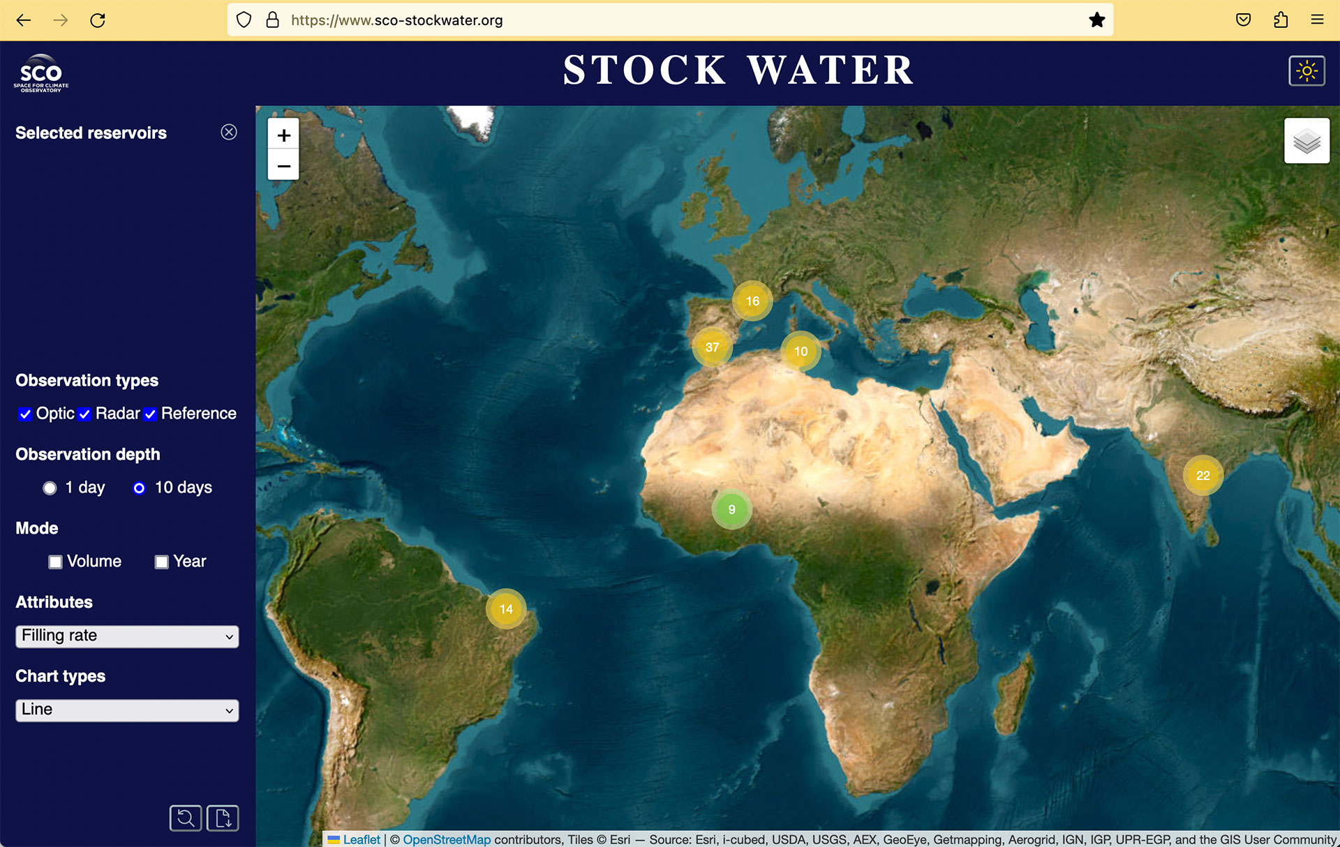
108Dams monitored in 6 countries
Useful linksProject presentation and resources
Key wordsWater management, dams, reservoirs, fill rate, open source
StockWater is available for water volumes and filling rates of dams
On Tuesday, January 24th, 2023, the StockWater team presented the results of its work: a platform for estimating the volume of water and the filling rate of dams using satellite data. Supported by CNES, in partnership with CS Group and Sertit/ICUBE, and in collaboration with several laboratories, results are particularly encouraging. Although the project is now completing its SCO phase, some technical bricks are in place with open source code to establish dam monitoring services in any country.
According to Santiago Peña Luque, satellite measurement processing engineer for hydrology applications at CNES and project leader, "the methodology is not only implemented open to global application, but StockWater is also, and above all, a long-term solution. The project is based on Sentinel imagery, satellites whose renewal is guaranteed by Europe, and therefore the continuity of service. Overall, the estimation of the filling rate shows a very good reliability rate which, in its current state, would be very useful to public authorities".
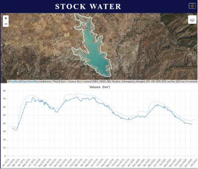
Estimated total volume (dark blue) compared to in situ reality (light blue) on the Viñuela reservoir (Spain). Water volume, surface area and filling rate, the tool provides three types of data, displayed as time series and available to download. These statistics are produced for each dam but can be aggregated for a group of dams. © SCO/CNES
Access the Stock Water Demonstrator
See the open source code of dem4water
A global methodology
The keystone of StockWater is its 'dem4water' algorithm, a tool capable of estimating bathymetric laws, i.e. imagining the underwater shape of a dam's bottom. To do this, dem4water uses 3D information from a Digital Terrain Model (DTM) around the water body and the shape of the surrounding valley. The dam height observed in the DTM allows the estimation of the dam depth. All these observations together improve the algorithm’s result.
France (Occitania), Spain (Andalusia), Brazil and India: the tool was initially applied on 66 instrumented sites, i.e. sites with in situ measurements, in order to compare the algorithm's calculations with the ground reality. After validation and obtaining good results, the team applied its algorithm to 42 other non-instrumented sites, including some in Tunisia and Burkina-Faso. On the Spanish and French sites, the uncertainty of the filling rate is about 8%. The uncertainty in the estimation of the total volume is 20% for Andalusia and 33% for France.
For more information, visit the project page which presents more detailed results as well as the final detailed presentation, downloadable in PDF format.
Perspectives
There is no doubt that dem4water is a powerful algorithm whose open-source code allows it to be used anywhere in the world. While several countries are requesting this type of service, the team is eagerly awaiting SWOT data that should enrich the knowledge of bathymetry and thus allow them to refine the estimation of water volumes. They also recognize the need to work further on huge dams such as Nam Theun-2 in Laos, which are not well suited to the current implementation.
Immediately, the French Ministry of Ecological Transition is collaborating with CNES in the development of a national demonstrator that covers 500 French reservoirs (compared to 16 in the current demonstrator) with 5 years of data. The tool implemented could be reused within the framework of “France 2030” plan to develop an operational service for national and local authorities.