

SCOFrance
2,5Weeks of in situ measurements
Campaign organizersIfremer, IRD, University of Toulon, Sorbonne University and ARBRE association
Useful linksProject page
Key wordsIn situ measurements, bathymetry, reef flat, water column, coral population
A tailor-made campaign for BioEOS
|
The BioEOS (BIOdiversity Earth Observation and monitoring at regional Scale) project, which has been accredited SCO label, proposes to use satellite imagery to extract metrics that can be used to quantify and monitor marine coastal biodiversity by means of indirect estimates. As part of the development of the BioEOS demonstrator, several satellite systems are being considered to assess their potential contribution to the extraction, directly or indirectly, of relevant information for monitoring this biodiversity. |
BioEOS partners |
In order to better calibrate and validate the results of the processing that will be carried out on the satellite images, it is essential to acquire in situ data simultaneously with the passage of the satellite sensors. "We initially chose the Réunion site to set up processing chains, before applying them to the other three study sites in the project. Scene acquisitions have therefore been scheduled specifically for November 2023 for the Pleiades, Pleiades NEO, Prisma and EnMap satellites, supplemented by systematic acquisitions by the Sentinel-2 satellites at the earliest possible dates," explains Touria Bajjouk, head of the BioEOS project for Ifremer.
Two sites sampled during the campaign
- Boucan Canot, with its open ocean configuration and homogeneous sandy seabed, is an ideal site for testing the robustness of algorithms for estimating seabed bathymetry;
- L'Ermitage, chosen for the methodological developments because it presents both a very wide diversity of seabeds and a significant bathymetric variation. This richness means that most of the situations found on the Réunion coast can be covered in a spatially restricted area: outer slope, flat and back-reef depression.
At each of these two sites, several stations were geolocated and sampled in order to take account of the spatial variability that can exist, both in the composition of the water column and in the nature of the seabed.
Several sensors deployed to characterize water properties
The marine constituents that have an impact on the processes of absorption and diffusion of solar radiation in the water column are phytoplanktonic matter (through the concentration of Chlorophyll a), suspended matter and colored dissolved organic matter. Sampling to estimate these components was carried out in the open sea using a semi-rigid boat, and on the reef platform directly from the beach using FMT (Fins-Mask-Tuba).
For some days of acquisition, samples were taken at the same time as these measurements for additional laboratory analysis of the three types of constituents. Temporal variability was approximated by sampling the sites several times on non-consecutive days. The analyses were carried out by the CITEB aquatic environment research centre and the Mediterranean Institute of Oceanography MIO.
In situ measurements of the optical properties of the water and environmental variables were carried out using an "optical cluster". This consisted of a stainless-steel frame on which 4 instruments were placed to measure the water's temperature, salinity, dissolved oxygen, depth, turbidity and downward and upward illumination.
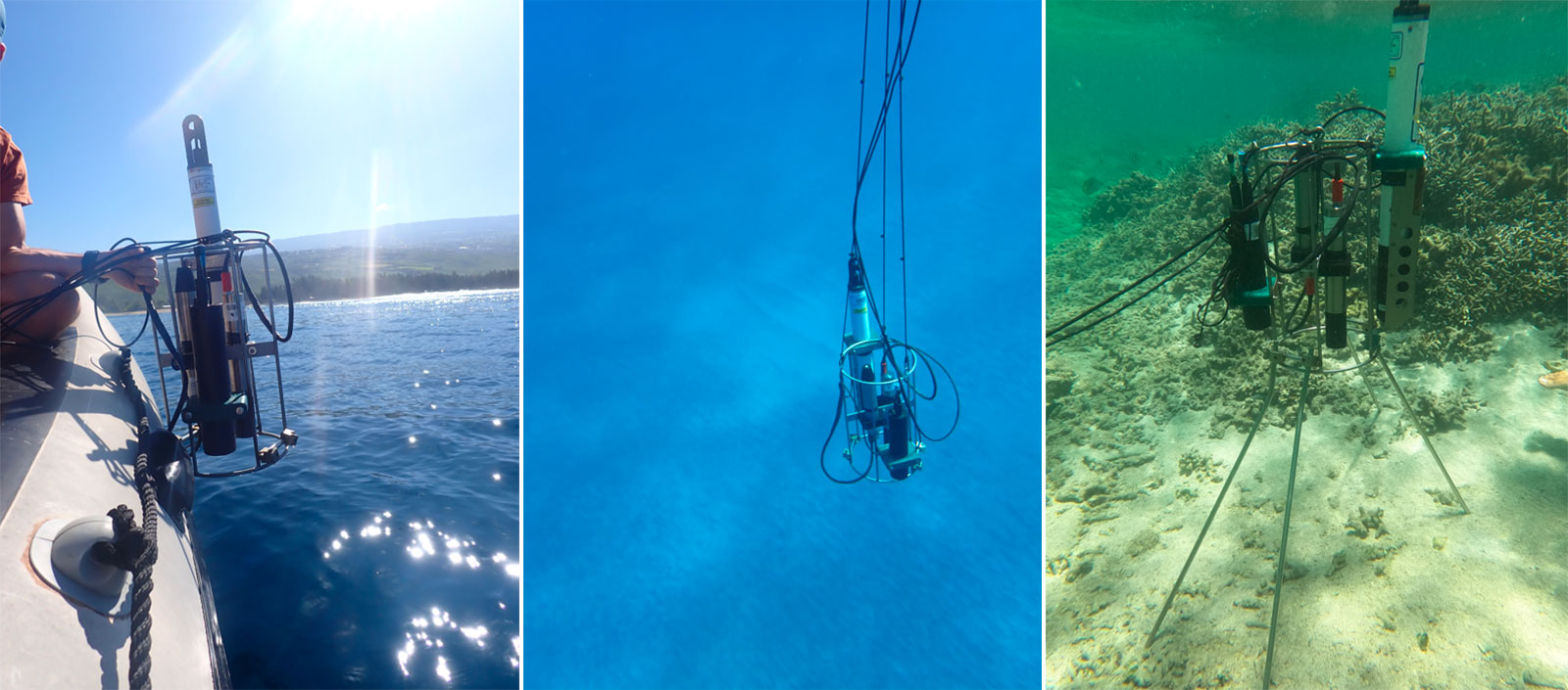
Device for deploying sensors to measure the optical properties of the water on the outer slope of the study sites (left and centre) and on the reef platform (right). © Ifremer-DYNECO/Touria Bajjouk & Aurélien Tancray.
Information also collected on the coral seabed
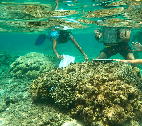
Spectral signatures specific to different types of coral and substrates were collected using a field spectroradiometer placed in a watertight housing. The spectroradiometer can be operated autonomously by a FMT operator aiming at targets on the reef flat and in the back reef depression. This information is needed to feed automatic satellite image processing algorithms and will be added to the spectral library initiated during previous projects.
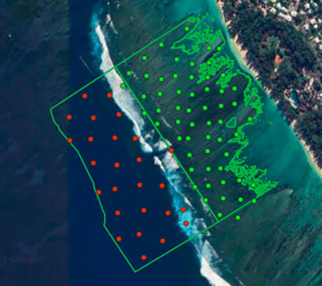
Spot observations were also made using the CORRAM (COral Reef Rapid Assessment Method) protocol, based on the recommendations of the IFRECOR methodological guide to reef mapping. These consisted of a visual assessment of various environmental and biological parameters, in particular the degree of cover of the main components of these populations (algae, coral, substrate, seagrass), which are necessary to characterize the coral beds.
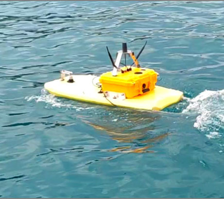
Finally, an instrumented board, developed by Ifremer and CNRS/LIRMM as part of the IoT and PLANCHA projects, has also been deployed to pool the acquisition of spatialized bathymetric and seabed imaging data.
|
Acquisition of spectral signatures of different types of coral seabed. © Ifremer-DYNECO/ Aurélien Tancray |
Sampling plan for acquiring data on bottom types using the CORRAM protocol. © Arbre/Léo Broudic |
Acquisition of spatial information on bathymetry and the seabed by the instrumented board. © Ifremer-DOI/Projet Plancha) |
All the data acquired during this campaign will be banked and distributed at the end of the project, via the national reference information systems (ODATIS, Sextant, Quadrige²).