

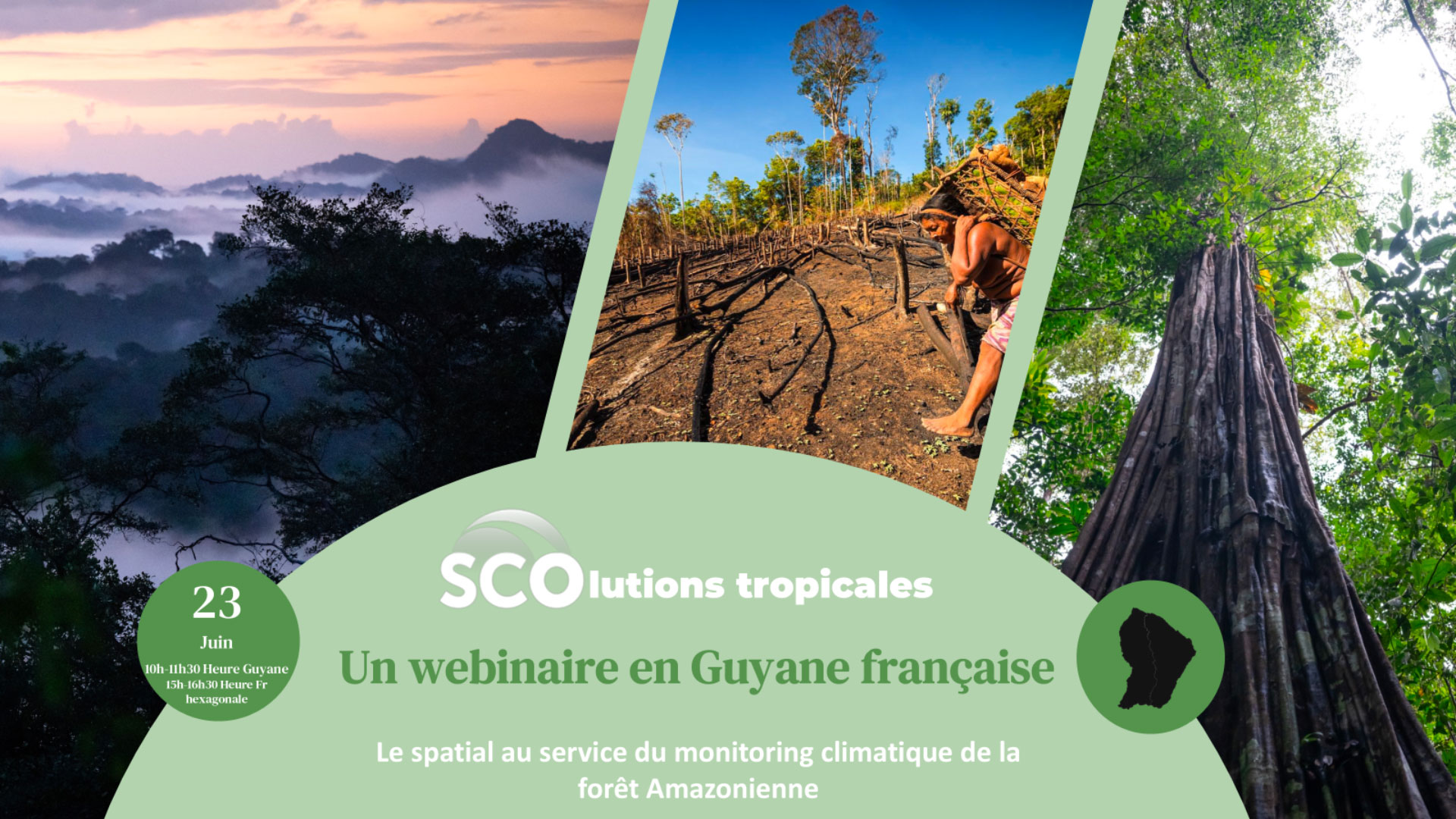
Tropical SCOlutions, a webinar in French Guiana
When we think of the Amazon, we picture a vast, dense, inaccessible forest. And yet it is facing new threats. Today, satellites enable us to monitor its evolution, including the impacts of climate change. But data alone is not enough: it ‘speaks’ and only makes sense when combined with the expertise of those on the ground.
On Thursday 23 June 2026, the SCO, in partnership with the Guiana Space Centre, organized a webinar dedicated to tropical SCOlutions to understand the climate challenges facing French Guiana, promote adaptation solutions – including those supported by space technology – and encourage transatlantic synergies. | Coming soon 🗓️ 21–25 September 2026 🛰️ Seminar: ‘Satellites in the Service of French Guiana’, organized by the Guiana Space Centre 📍 More details coming soon – sign up for the SCO newsletter! |
🙏 A big thank you to the experts, whose clear and compelling presentations gave us an insight into the day-to-day climate realities of an extraordinary region, which we are more determined than ever to protect. Thank you to the participants from French Guiana and mainland France for their attention and attendance.
Key takeaways
- There are numerous climate challenges in French Guiana and neighboring countries, affecting ecosystems, residents and infrastructure alike. The impacts, already recognized by all, are exacerbated by equally growing problems, foremost among which is illegal gold panning, which pollutes the water and kills or drives away the life it supports.
- Stakeholders in the region are joining forces to develop the Regional Climate Change Adaptation Plan. Incorporating feedback from consultations with various communities in French Guiana, it draws in particular on the Climate Change Adaptation Days (CCAD) organized in French Guiana from 3 to 5 June 2025.
- An illustration of the potential of satellite data to address climate-related challenges in the Amazon rainforest through two SCO projects:
- TropiSCO, which monitors tropical deforestation in near real time using radar data, which is therefore unaffected by the heavy cloud cover typical of tropical regions. It is increasingly being used by the French Guiana Amazonian Park to:
- Monitoring “abattis” – small cultivated plots that are the main source of livelihood for many forest-dwelling communities – where traditional burning in September/October can now trigger uncontrolled fires during severe droughts, such as in 2024;
- Obtain data on cross-border areas with Brazil and Suriname to combat illegal gold panning;
- Detect “chablis” (gaps caused by the fall of large trees), which may indicate forest decline.
- TropiSCO, which monitors tropical deforestation in near real time using radar data, which is therefore unaffected by the heavy cloud cover typical of tropical regions. It is increasingly being used by the French Guiana Amazonian Park to:
- Chove-Chuva, which combines a wealth of information to monitor territorial dynamics in Mato Grosso (Brazil). Addressing the various challenges facing this region – which comprises dense forest in the north, savannah in the center and the Pantanal wetlands in the south – the tool offers a range of maps allowing users to visualize, for example, the explosion in soya cultivation since 1985 at the expense of the forest, trends in wildfires and forest degradation, the hydrological network… This tool has enormous potential – watch the demo in the replay!
💡 Both platforms are freely accessible – do give them a try: Tropisco.org and sco.chove-chuva.org
Speakers
- Célie Losada, Data usage expert at CNES and session moderator;
- Eva Cartron, Climate Change Adaptation Project Manager at the French Guiana Urban Planning and Development Agency (AUDeG);
- Mathilde Landemard, Project Officer for the Environmental Change Adaptation Plan, and Matthieu Ahr, Geomatics Engineer, at the French Guiana Amazonian Park (PAG);
- Damien Arvor, Research Director at the CNRS – UMR Littoral, Environment, Remote Sensing and Geomatics, and project leader for the SCO Chove-Chuva project.