

SCOFrance
71 000radar images over Southeast Asia processed on the CNES cluster, covering 1 230 000 km²
Key wordsForest, tropical, deforestation, radar imaging, automatic detection
TropiSCO is making great strides
The TropiSCO project is therefore being deployed on three continents almost simultaneously. The work is as colossal as the method is clear: to use Sentinel-1 radar images, acquired every 6 to 12 days, to map deforestation areas automatically.
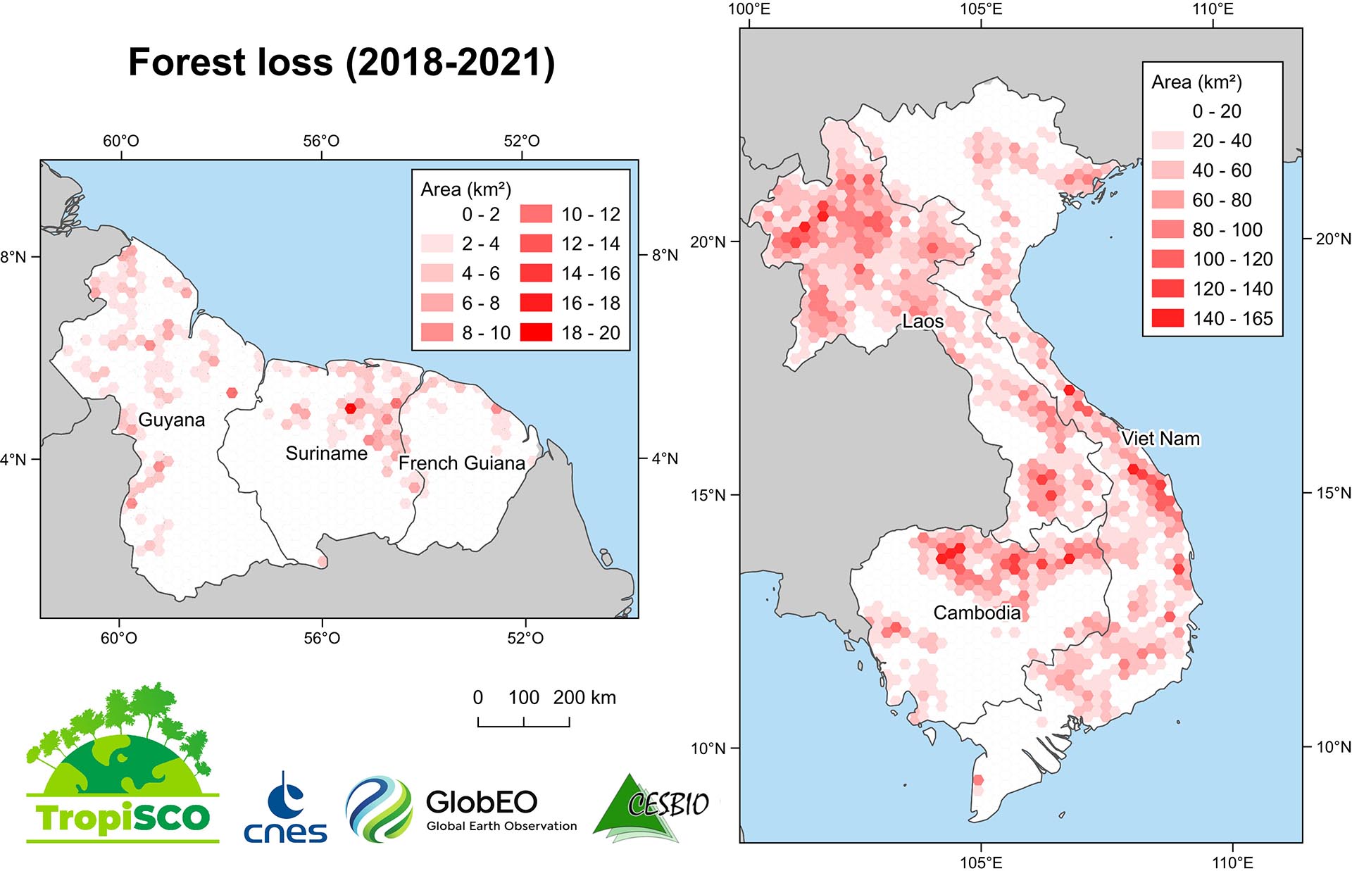
Vietnam/Laos/Cambodia: South East Asia is the territory where the team has made the most progress. By taking over all processing until recently, the team is now entering the automation process.
Production on the Guiana plateau is also well underway and will be completed by the end of January 2022. The team will continue with the first productions in Gabon in the following weeks.
Produced on a national or local scale according to user needs, all deforestation maps will be available via a web-based TropiSCO data dissemination platform. This will allow users to navigate between maps, zoom in, calculate spatio-temporal statistics and download data. When it opens in January/February 2022, this portal will offer results for Southeast Asia and the Guiana Shield, as well as the first demonstrations for Gabon.
As a crucial tool for the future, TropiSCO will undoubtedly contribute to verifying the commitment of the signatory countries to the agreement to halt deforestation, which will be signed at COP26 in Glasgow in November 2021.