

SCOFrance
7Experimental areas
Useful linksPresentation of the project
News: TropiSCO is making great strides
www.tropisco.org: follow tropical deforestation in real time
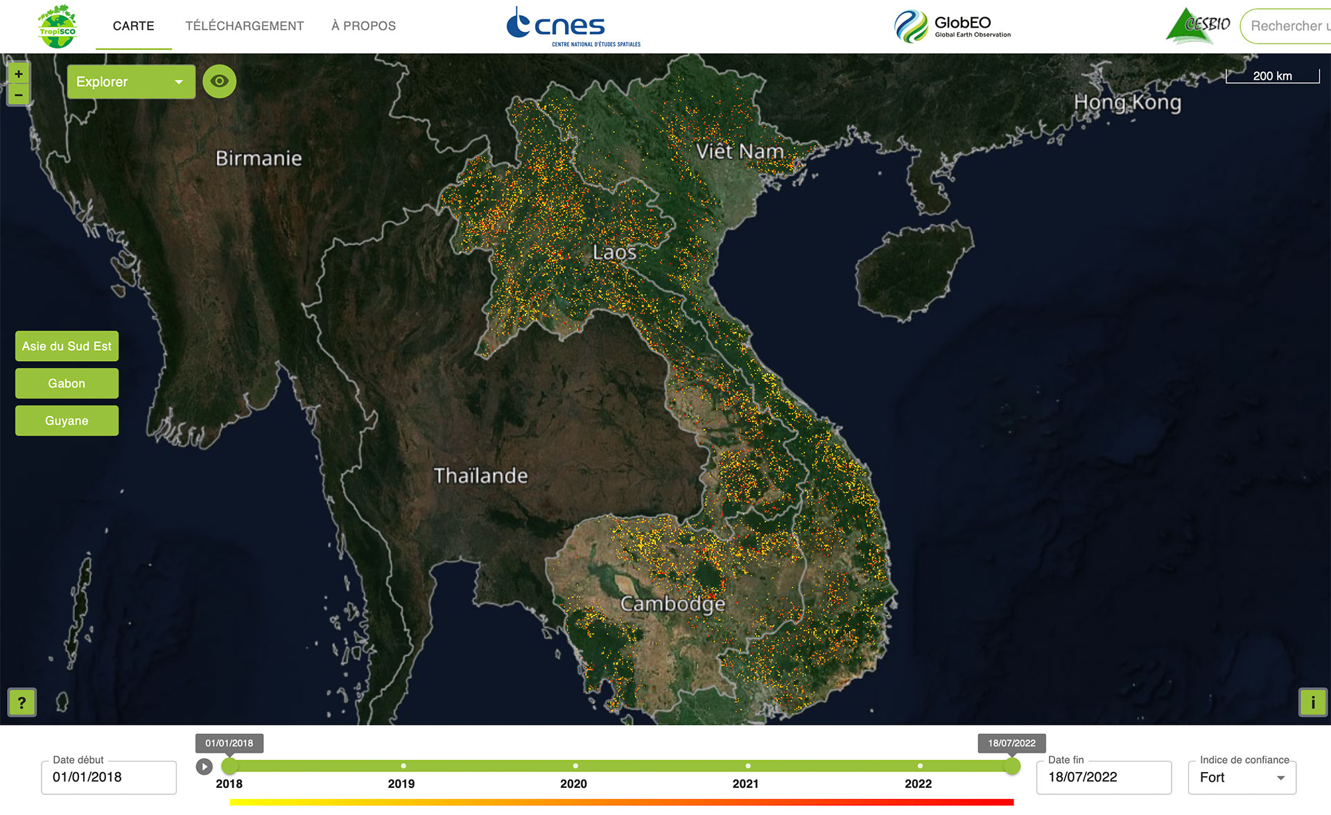
"Explore forest cover loss over Sentinel-1 acquisitions with a pixel size of 10 meters. View monthly and annual statistics at regional and national scales, and download the data." This is how the website www.tropisco.orgwelcomes you, with a map of the Guiana plateau as a backdrop. A click at the bottom left of the screen, the map goes blank, then yellow, then orange, then red dots light up, showing the deforestation that has been eating away at the rainforest since 2018 on three continents.
While this TropiSCO demonstrator offers interactive maps of its seven experimental areas (Guyana-Suriname-Guyana in South America, Gabon in Africa and Vietnam-Laos-Cambodia in Southeast Asia), the platform will eventually monitor all the world's tropical forests.
Tropisco.org in brief
- Monitoring deforestation in near-real time;
- Statistics available for each territory;
- Data can be downloaded directly in Geotiff format or via the WMS protocol;
- Uses: combating illegal logging and mining, combating illegal agricultural crops, wildlife trafficking...