SCOFrance
PartnersIRD-GET, CNRS, HETWA, Magellium, Adour Garonne, CNES
Useful linksProject page
News presenting the method (28/02/2024)
KeywordsWater, quality, small reservoirs, unpublished data, cooperation
XtremQuality presents its water quality monitoring solution at COP30
Climate change is transforming the water cycle, making it much more variable and altering not only the availability of water resources but also their quality. Maintaining the quality of water bodies is essential to ensure the sustainability of the ecosystem services provided by hydrosystems and the use of this resource by populations. It is therefore crucial to monitor the deterioration of surface water quality in order to understand the role of global changes and local human activities in this deterioration, with a view to proposing more resilient strategies for managing multiple water uses.
The XtremQuality solution
|
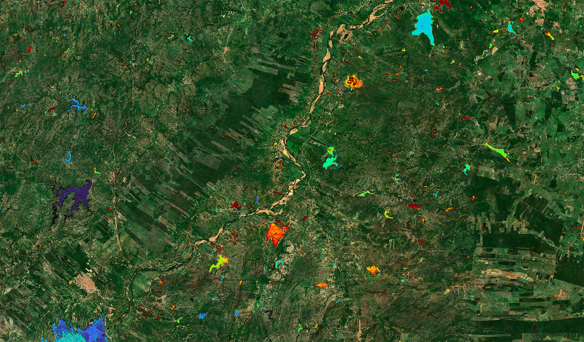
Focused on the south-western region of France, XtremQuality provides an innovative solution for estimating water quality parameters in rivers, reservoirs and lakes from space. Whereas satellite information was previously limited to the largest lakes, XtremQuality makes it possible for the first time to monitor and assess thousands of small bodies of water, most of which are artificial, and to provide unprecedented data for watershed management. 👉 Using satellite images provided by the Copernicus programme's Sentinel-2 constellation, the project has developed a processing chain to map water quality parameters (turbidity level, eutrophication level), which have been validated through a partnership with the Adour Garonne Water Agency. 👉 By combining satellite observations, in situ databases and artificial intelligence, it has been possible not only to monitor water bodies but also to understand the factors contributing to degradation, identifying the contribution of extreme events and comparing it with the characteristics of watersheds, particularly land use, in order to contribute to better adaptation strategies. 👉 The method can be applied anywhere. A web platform is currently being developed to report and visualize the results. |
Strength in unity: the effectiveness of cooperation in building solutions for tomorrow In line with the SCO philosophy, which advocates an alliance between science, the public and the private sectors, the XtremQuality project is the result of a partnership between the French National Research Institute for Sustainable Development (IRD – Toulouse Geosciences Environment Laboratory), the CNRS (Centre for Research on Biodiversity and the Environment), the companies HETWA and Magellium, funded by the CNES and the Adour Garonne Agency. |
|
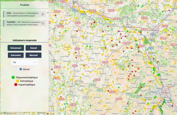
View of the platform providing water quality data from Sentinel-2 images and AI analysis methods on small reservoirs in the South-West region: ► The average level of eutrophication is reported according to the class: oligo/mesotrophic (extremely low in nutrients), eutrophic (excess nutrients), hypereutrophic.
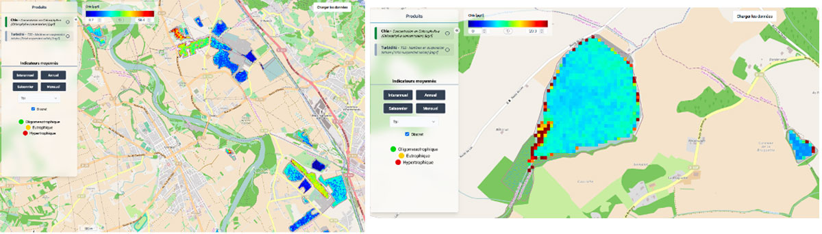
▼ High-resolution spatial maps of chlorophyll-a concentrations. |
|
Presentation at COP30
With the aim of rolling out its system across a large agricultural region in Brazil, which is also facing the problem of agricultural water storage in a context of more frequent droughts, the SCO XtremQuality project took the opportunity to present its method and results during COP 30 in Belém (Brazil). To this end, it chose the side event "From ground to orbit: Combining in-situ and satellite monitoring of water and forest resources for adaptation to climate change" on 10 November 2025. XtremQuality perfectly illustrated the objective of this event, which was to highlight the complementary nature of approaches combining field measurement networks, spatial information and digital analysis to help better monitor the impacts of climate change and provide effective decision-making tools to institutions responsible for environmental management.
|
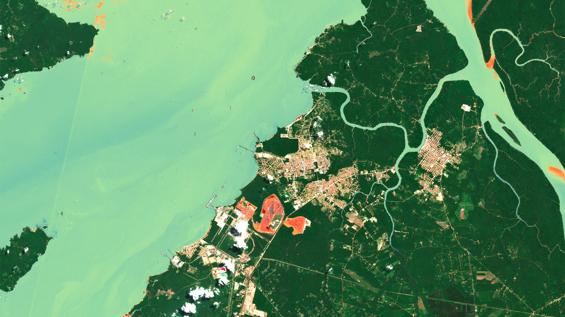
► There are several hundred thousand reservoirs of all sizes in Brazil, used to store water during the rainy season and support multiple uses of the resource. With climate change and intensive land use, the deterioration of water quality is becoming a major issue that public authorities must monitor. Example of a map of chlorophyll-a concentration levels in small reservoirs in the state of Ceará based on Sentinel-2 images (source: FUNCEME). |
|
The audience showed great interest in the project, as water quality analysis from space is one of the most recent innovations to come out of the space sector. Several agencies expressed interest in the results and methods for deploying them in South America.
In the area reserved for official delegations, this event was organized by the International Network of Basin Organizations (INBO), the French Water Partnership (PFE) and the One Water Vision initiative with the support of INRAE, and was attended by representatives of the French (CNES), Japanese (JAXA) and European (ESA) space agencies and the World Meteorological Organization (WMO).
|
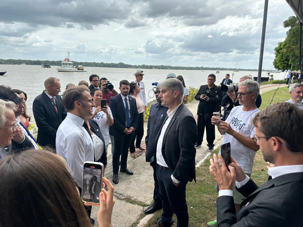
► Based at the IRD office in Brasília, Jean-Michel Martinez, leader of the XtremQuality project, took advantage of this COP held in Brazil to promote this work as widely as possible. Having had the honor of meeting with French President Emmanuel Macron on 6 November in Belém, he discussed with him how the use of space technology in the Amazon was fueling research and the private sector in France, including the SCO. © IRD / Célia Esnoult |
|