

SCOFrance
PartnersTerraNIS, DYNAFOR, AFAC, IGN, OFB et CNES
Useful linksProject page
Key wordsHedges, change detection, ecological planning, agro-ecological transition, ecosystem services
EagleHedges has delivered its tools for analyzing the bocage network
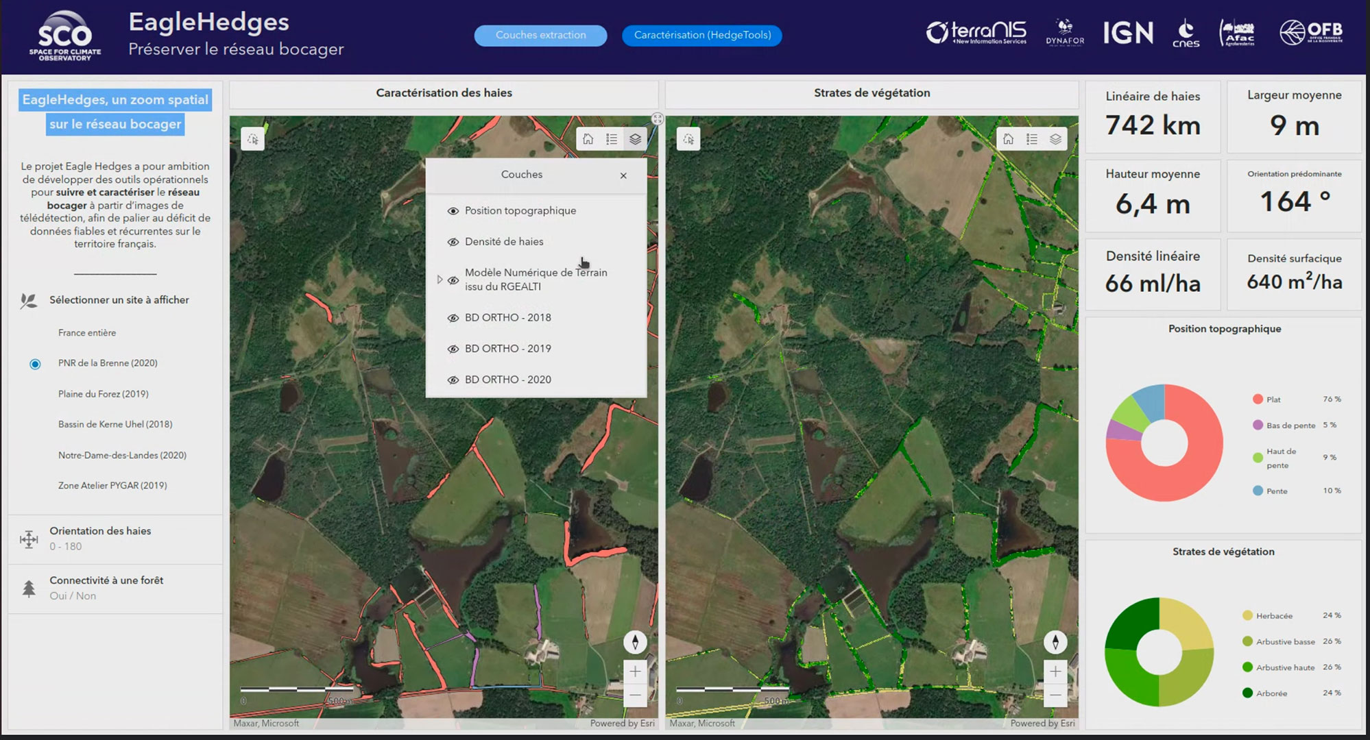
As announced in November 2023 in the article EagleHedges, a spatial zoom on the hedgerow network, this SCO project dedicated to hedgerows has finalized the work planned to deliver a mapping service and hedgerow characterization tool, HedgeTools. These are based on Earth observation data and Digital Surface Models (DSM) at very high spatial resolution.
During the EagleHedges project, pilot sites representative of the French bocage landscape were selected by the partners and their networks of local stakeholders. These sites were used to test and validate the methods and tools developed as part of the project.
The maps and indicators resulting from the project have been integrated into an online interface. Simple and intuitive, the interface is designed as a dashboard to visualize the extractions and characterizations of hedges on a given site over a given vintage. The indicators presented, taken from HedgeTools, are as follows:
- on the scale of the hedge object: length, width and average height, height strata, dominant orientation, morphological clues, connection to a forest, topographical position (ridge, slope, valley bottom, etc.).
- on a landscape scale, calculated dynamically: total length, hedge density, proportion of vegetation strata, etc.
👉 See detailed results on the project page
The dashboard is accessible by account and password, and the team is happy to provide a demonstration.
📧 Request a demonstration from Terranis
While in France the tools developed can be used primarily to complete or adapt the IGN hedgerow database, the method implemented, which can be reproduced, would be particularly useful in areas with little or no field information.
👉Also, in the spirit of SCO sharing, the HedgeTool toolkit is open source, available to users as a QGIS plugin in experimental version.
Outlook
The team intends to continue its work beyond SCO to improve change detection (hedgerow uprooting and planting) and to equip HedgeTools with new functionalities linked to the role of hedgerows (hydrological, ecological, windbreak) and the ecosystem services they provide. A module for calculating indicators from LiDAR data is currently under development.