

SCOFrance
3Sets of indicators developed
25Open access databases analysed
ECLAT methodology is available
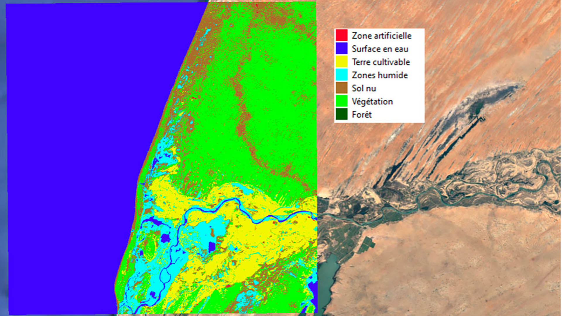
As the project team explained in August 2021, ECLAT is not a project like any other. Firstly, because it touches on a highly sensitive issue, the conflicts linked to water scarcity, and secondly, because it is taking place in a complex area with almost no field data. Hence the interest of an automated method of interpreting satellite images to define land use in order to observe, evaluate and predict the impacts of climate change.
This was the task of the ECLAT project, which proved the effectiveness of remote sensing coupled with the Iota-2 processing chain after searching the public databases they could find. Three themes were exploited to create sets of indicators: agricultural rotations, urban pressure on water areas and demography.
Now the methodology is in place and reproducible. Visit the project page to discover the results obtained, including the final report, and, why not, adapt the method to another area!
See the presentation of the project and the results
It should be noted that the results of the studies carried out within the framework of the ECLAT project were used to feed a service demonstrator for the needs of the AFD (French development agency) aimed at evaluating the impacts of a hydrological development project in N'Djamena region. ECLAT data could also be used to feed UNESCO Water Quality Portal for Lake Chad.