

SCOFrance
Useful linksProject page
Key wordsPolder, wetlands, restoration, salt water, sedimentation, revegetation
EO4Wetlands, depoldering monitored by satellite
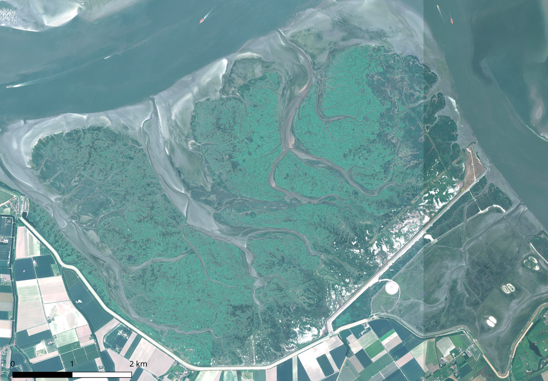
A protective barrier that is all the more important in the current context of rising sea levels, wetlands play a major role in countering disasters such as floods and tides. Faced with recurring sea storms, some northern European coasts are restoring their polders by creating gaps that will allow the sea to take its place once again. This is followed by a sedimentation process that encourages the relatively rapid rebirth of mudflats and salt meadows, which then provide a buffer space to slow down the swell. This is the process implemented by the Living Lab Hedwige-Prosperpolder (LLHPP), on the border between Belgium and the Netherlands, and closely monitored by the EO4Wetlands project to monitor these changes.
Preparation in the field
"We walked for three hours in the mud!" laughs Cyrille Fauchard, project manager for Cerema, as he recalls his first visit to the Hedwige-Prosperpolder last July. "Above all, we saw how, following the demolition of the dykes in 2022, the tides that flow in and out of the polder will give way to marsh-like vegetation. Most of it has already been revegetated - it's really impressive! On site, Stijn Temmerman, a geographer specializing in coastal landscapes and rivers at the University of Antwerp, acted as our guide. Running a research programme alongside other scientists, including biologists and sedimentologists, his team monitors the polder in situ and is very interested in our satellite monitoring approach, particularly for monitoring temperatures and water content. They have given us access to parts of the polder that are off-limits to the public, with permission to install a probe to correlate its data with that from the satellites".
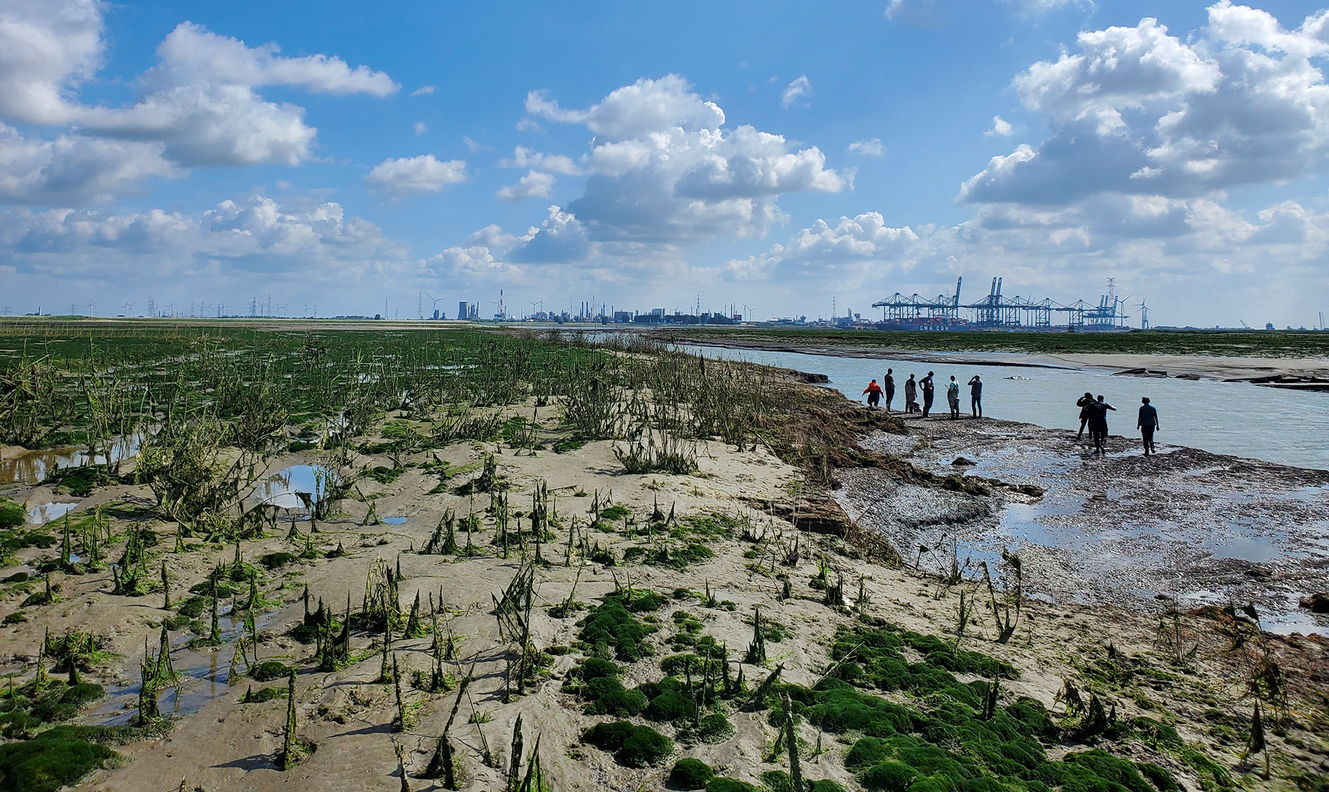
▲ Field visit to LLHPP on 17 July 2023. View of the polder being revegetated with, in the background, the port of Antwerp. © Cerema
|
The EO4Wetlands team returned to the polder on Thursday 9 November 2023 to install the famous probe. The probe will provide near-continuous measurements of the temperature in the air, on the ground and at depth, as well as water content. "This permanent monitoring is essential to validate the satellite data and the results of the algorithms, with the advantage of a connected probe that allows us to easily retrieve the measurements via a web cloud," explains Cyrille Fauchard. |
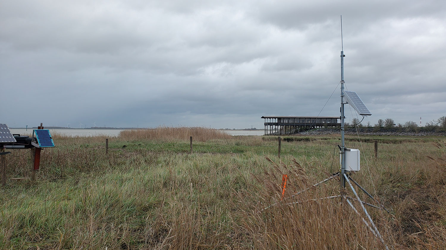
▲ On the right of the image, the probe measures multiple parameters at a depth of 1 m (temperature, water content, permittivity, conductivity). © Cerema |
Preparing the application
|
This is where Geomatys comes in, tasked with developing the tool that will produce vegetation evolution maps. To do this, it is going to generate a digital twin of the polder: "we are currently working on the data cube, which will host different and complex data: geophysical, hydrological, oceanographic, altimetric, meteorological... Some will come from LIDAR sensors (remote laser measurements), others from satellites (in the visible, radar and thermal domains), not forgetting in-situ data. The digital twin will aggregate all these data to visualize the evolution of the polder. We are already capable of modelling the water surface and adapting it to the water heights measured in real time by the in-situ probe," explains Vincent Heurteaux, remote sensing engineer and director of Geomatys. |
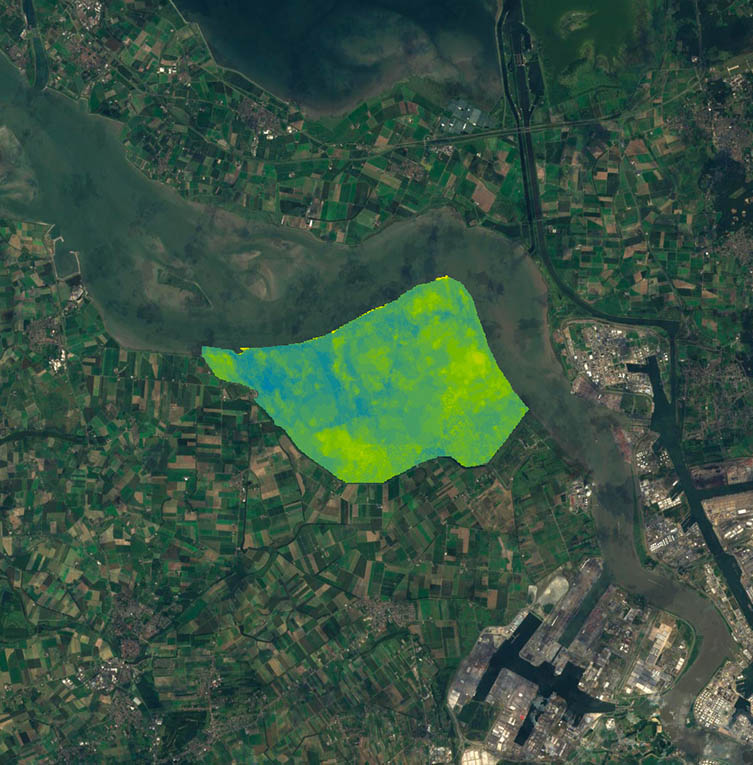
▲ The digital terrain model of the ASTER satellite area is the very first test image. © Image : NASA / DTM : Cerema |
At the same time, Cerema has recruited a post-doctoral student who, from February 2024, will be working on the vegetation component based on satellite images. He will be accompanied by Teodolina Lopez, a research engineer at Cerema: "The aim is to develop a processing chain to classify vegetation in order to study changes over time, particularly before and after a dyke breach. The main building block will be based on visible observations, then we will test the added value - or otherwise!”
In the meantime, Teodolina Lopez will be processing a whole range of images of the polder that Geomatys will use for its initial tests: day and night thermal ASTER images, Sentinel-1 radar images, Pleiades images (visible range), not forgetting LIDAR images.
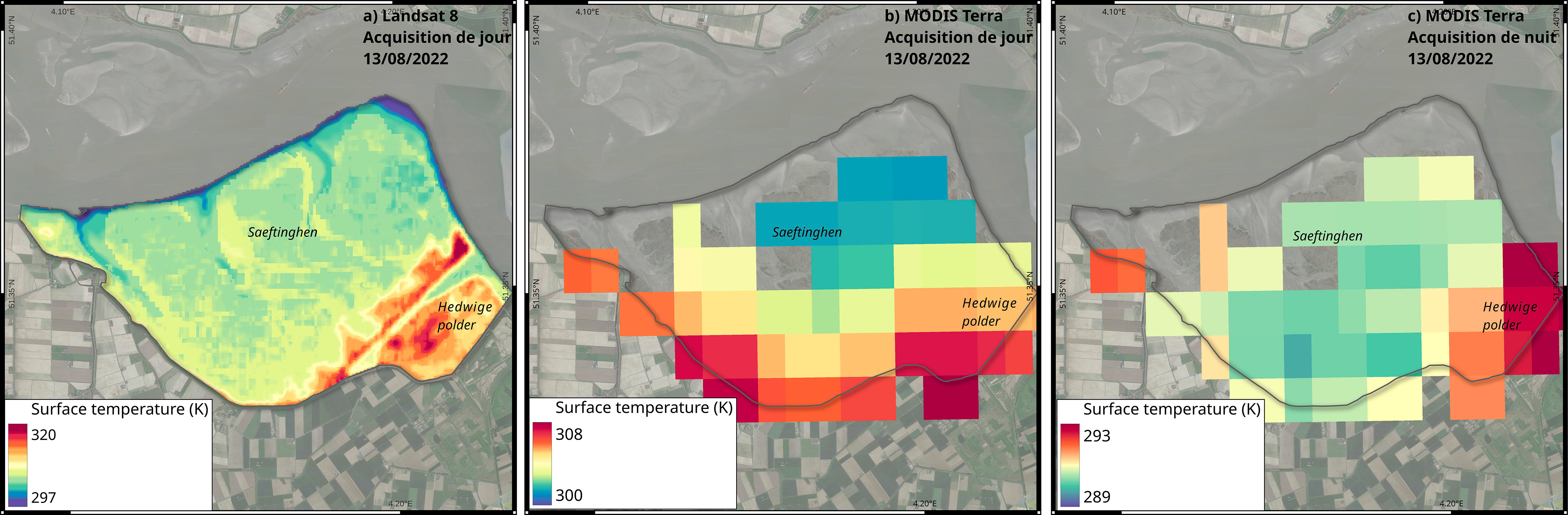
▲ Extracts from various surface temperature maps estimated by a) Landsat 8 and b) and c) MODIS Terra. © Images : NASA / LST : Cerema
So, we have a great project on the go, and we'll be keeping a close eye on it!