

SCOFrance
16Participants
PartnersCNES
DDTM Aude
Météo-France
SGEvT
LISST
Copernicus Climate Change Service
KeywordsAude, floods, flooding, blockages, indicators
Focus on FLAude
4 progressive objectives
FLAude aims to better understand extreme hydrometeorological phenomena and to develop indicators for risk prevention and reduction. With information from space imagery combined with other regional data for:
- Improving knowledge of flooding events in Aude and Occitanie (at both local and regional levels), with tools that can be used repeatedly and replicated for use elsewhere;
- Fine-tuning climate analyses on flooding risks;
- Assessing the impact of major floods and damage resorption at local level;
- Synthesizing knowledge through the use of modelling, with a multi-criteria approach to better understand and conceptualize these phenomena.
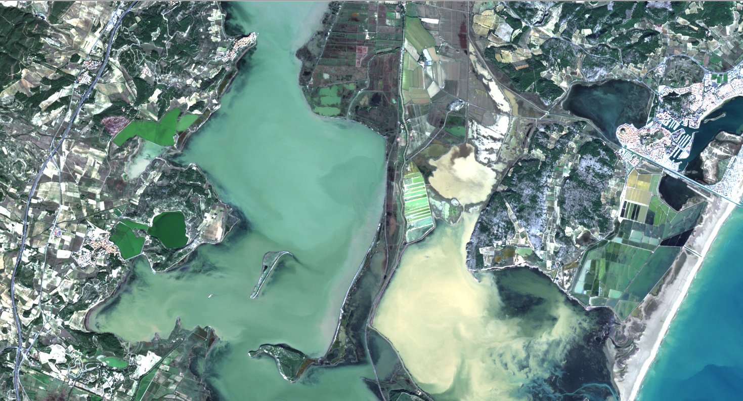
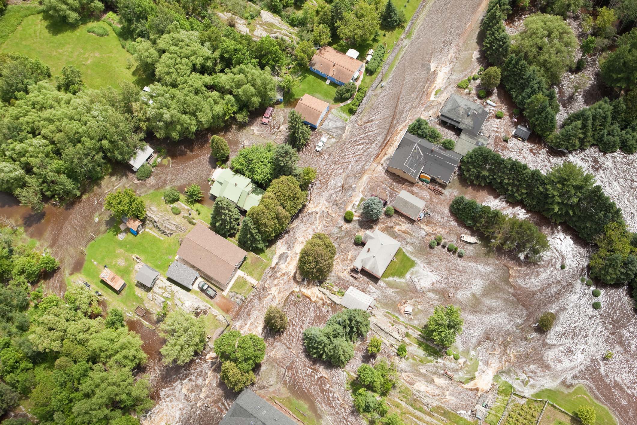
Satellite view of flooded vineyards in the Aude in October 2018. ©Sentinel 2/Copernicus
Analysing climate change in Occitanie
According to data from Météo-France, the average annual temperature (2011-2020) in Carcassonne is +1.5°C warmer than it was in 1971-1980, an increase of +0.3°C per decade since 1959. At the same time, the severity of the extreme weather events is clearly increasing, with a rise of 20% in the intensity of extreme rains across all the Mediterranean regions.
This information is available for the rest of France on this Météo-France page.
What indicators would be useful for the region?
Syndicat Mixte des Milieux Aquatiques et des Rivières- SMMAR (The Joint Union of Aquatic and River Environments):
- Rainfall measurement alone is not enough for decision-making => a volume-to-time ratio and, if possible, hourly tracking of rain intensity due to the brief anticipation times.
- When soaked with water, soils have no retention capacity => soil water saturation should be a strong indicator of vulnerability to a flooding event.
Chamber of Agriculture
- The main damage is caused by the rise of the water level => a need for pre-emptive management of blockages.
- The priority is to protect agricultural equipment, to prevent further damage => a need to know the areas above flood levels.
- In agriculture, incentives can be more effective than regulatory tools => integrate an educational and instructional dimension into the project.
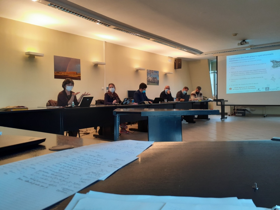
The dialogue went well, from a safe distance! To help the project team develop indicators to best meet their needs, regional leaders presented their expectations. ©FLAude
How can Earth Observation help?
Earth observation by satellite makes it possible to observe regions and the impact of development, facilitating our understanding of how and at what rate things are changing on the ground. When combined digitally with other data sources in scientific models, it provides clear indicators. The FLAude consortium has already proposed such indicators, as shown below for the municipality of Villegailhenc.
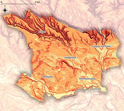
Water system in the municipality of Villegailhenc ©FLAude
The studies highlighted:
The factors involved in flooding that are likely to aggravate or attenuate the risk depending on the hourly intensity of rainfall.
=> And the indicators made possible by satellite observation
Aggravating factors
- Soil erosion, particularly where it is becoming impermeable
=> Map of soil erosion: soil type and structure, crop types, crop distribution, crop rotation.
- Slope (water acceleration)
=> Information about the slope along is not sufficient to be an indicator.
Attenuating factors
- Plants: hedges (correctly planted), riparian woodland (vegetation adjacent to bodies of water), grassy strips, embankments
=> Location of hedges and embankments with their characteristics
=> Identification of locations to be prioritized for future development
- Permanent plant cover
=> Land use map: type of crops, sectors favouring vegetation cover, locations to be recommended - or avoided - for land development...
- Terrace crops, which limit water run-off speed and reduce soil erosion while increasing soil absorption capacity
=> Indicator integrated in land use
- Wetlands (buffer zones in water drainage)
=> Identification of preserved wetlands
=> Remote sensing of potential wetlands
- Retention basins
=> Mapping of retention basins (location, volume and connection to the water system)
Ambivalent factors
- Rainwater system (guiding water in urban areas)
=> Mapping the rainwater system (scaling, connection between small and large water cycle)
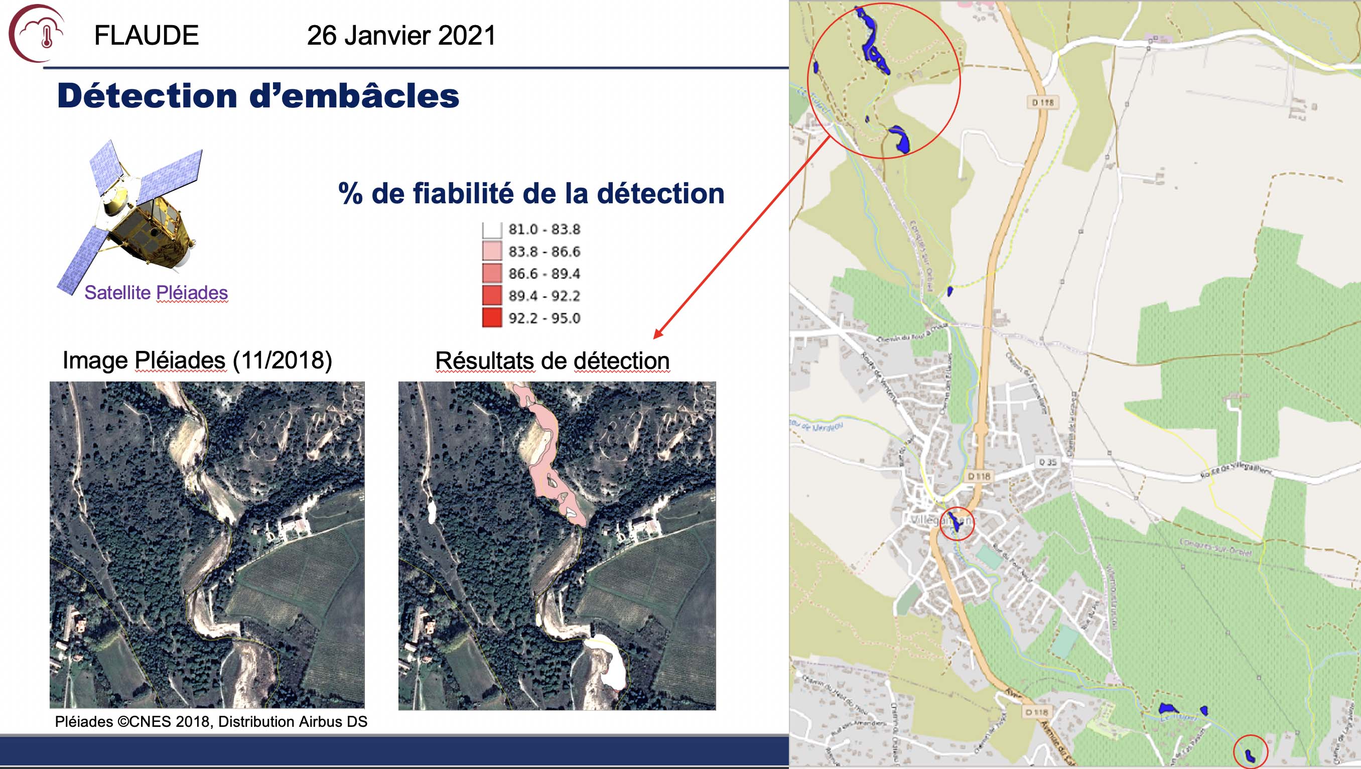
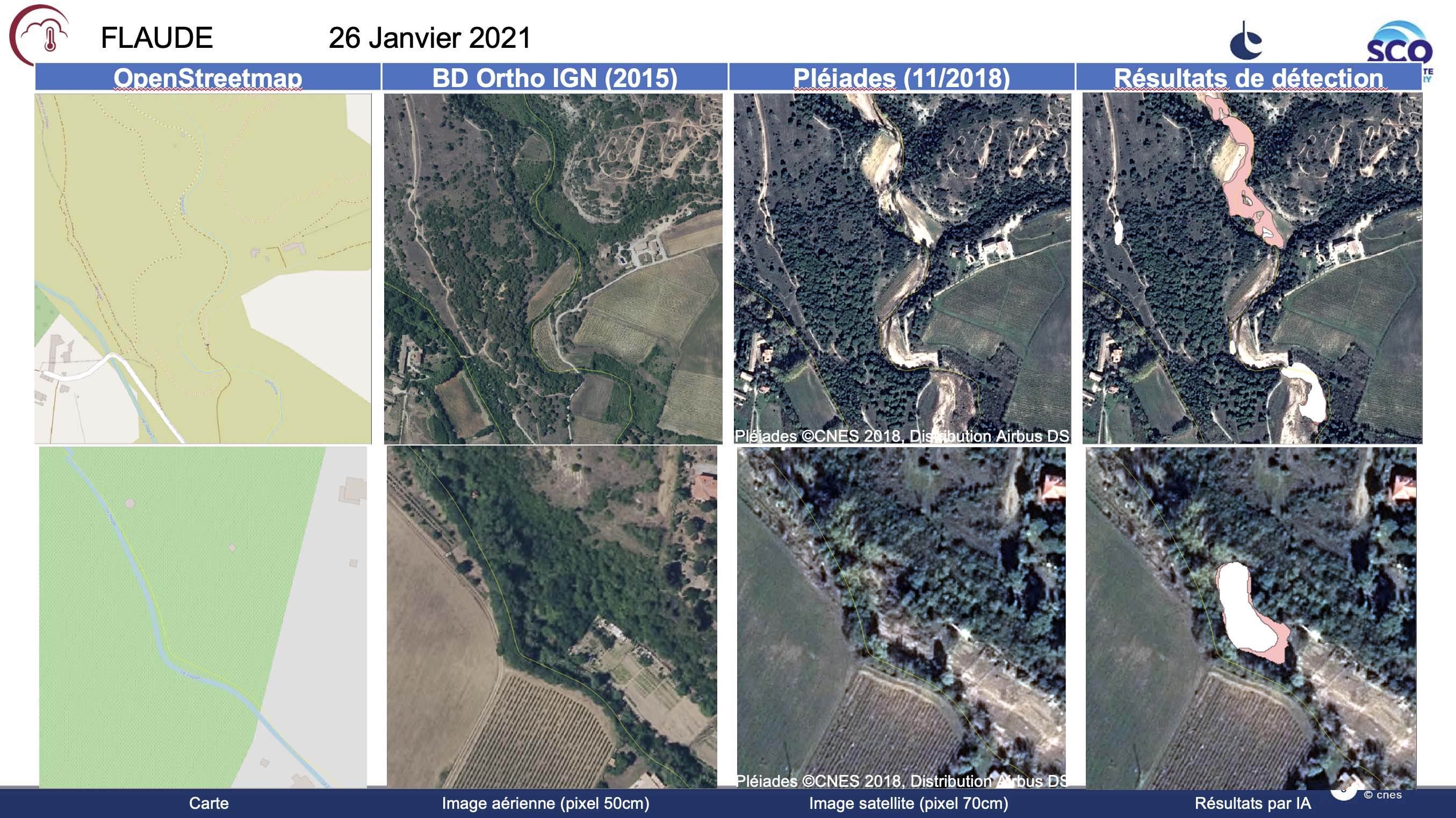
- Blockages: downstream, they increase the risk of flooding and damage but upstream, they help to slow and spread the floodwaters, and are also beneficial to fish fauna
=> Remote sensing of blockages and classification based on their position in the water system
Method :
© FLAude
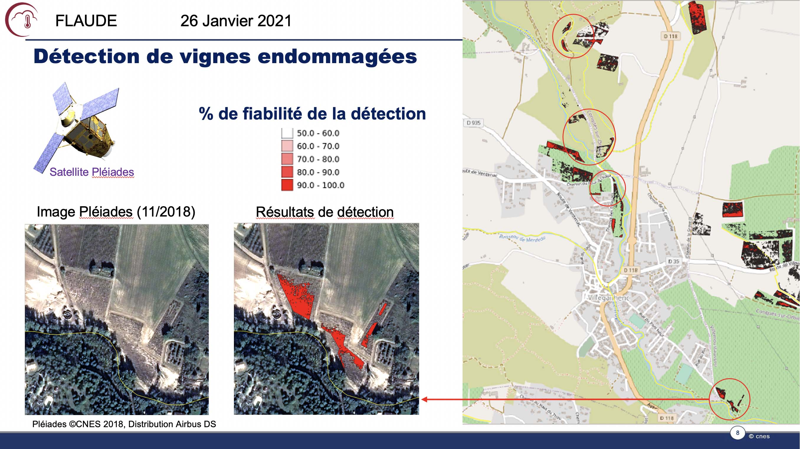
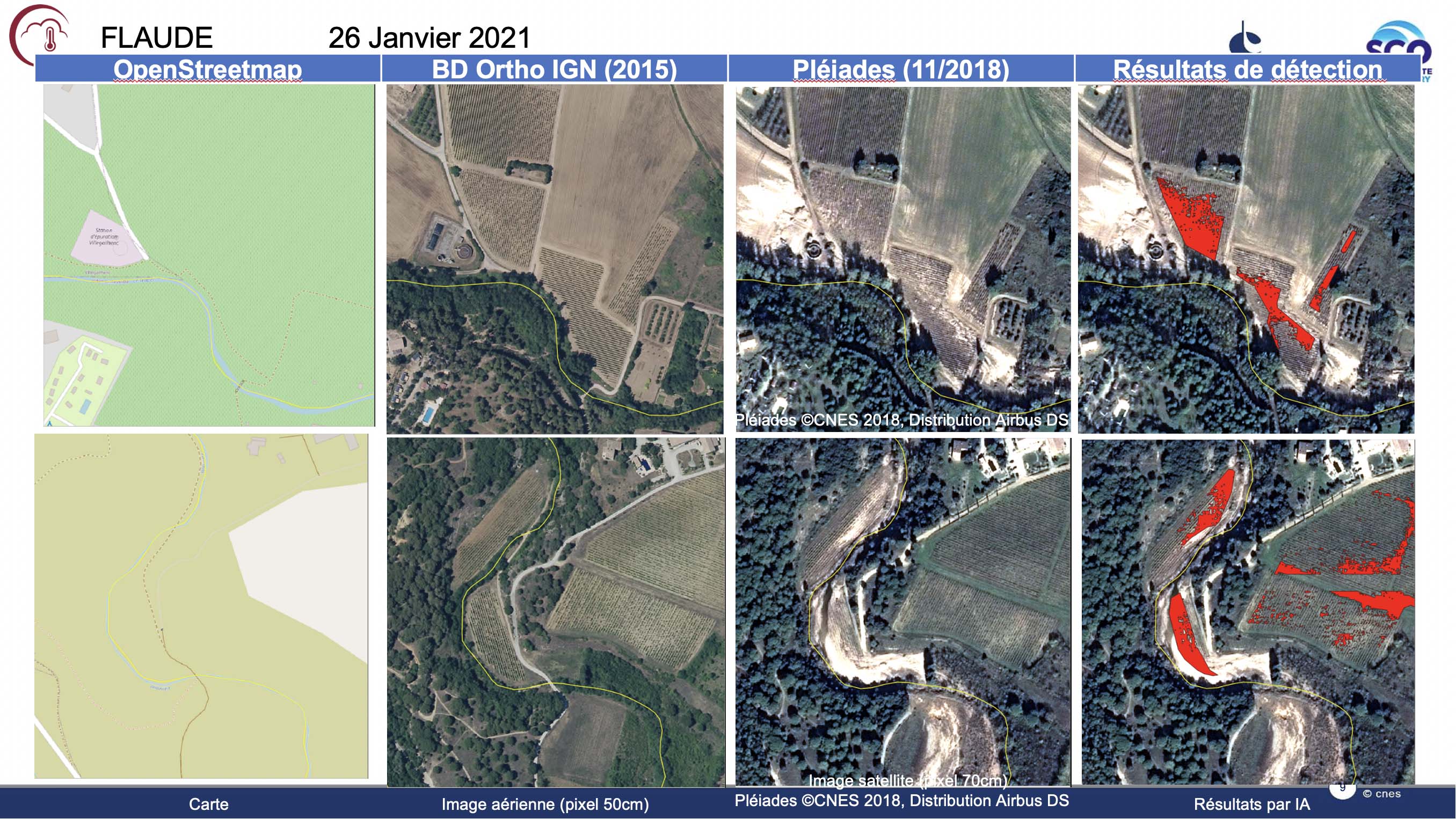
- Types of crops
=> Remote sensing of crops on bare soil (vineyards, arboriculture, etc.) which contribute to retaining water by accumulating run-off vegetation.
Method :
© FLAude