FRAM
FoRest climAte-Risk Monitoring for Southern Sweden
Overview
Context
Forests in Sweden are facing growing pressure from climate change. Droughts are becoming stronger, wildfires are becoming more likely, and seasonal water availability is changing. These changes affect how forests grow, how healthy trees remain, and how well forests can recover after stress. Some forests are more exposed than others. Spruce forests, which cover large parts of southern Sweden, are especially sensitive to heat and lack of water. When trees are weakened by drought or fire, they may also become more vulnerable to bark beetles and other pests. This means that one climate-related stress can lead to several connected risks.
At the same time, many forest risks are still monitored through field visits, manual reporting, or broad regional assessments. These methods are important and provide critical information, but they can be too slow or too general to show where problems are emerging. Forest stakeholders and regional authorities need clearer and more detailed information about which areas are under stress, which tree species are most vulnerable, and where inspections or adaptation measures should be prioritized.
The FRAM solution
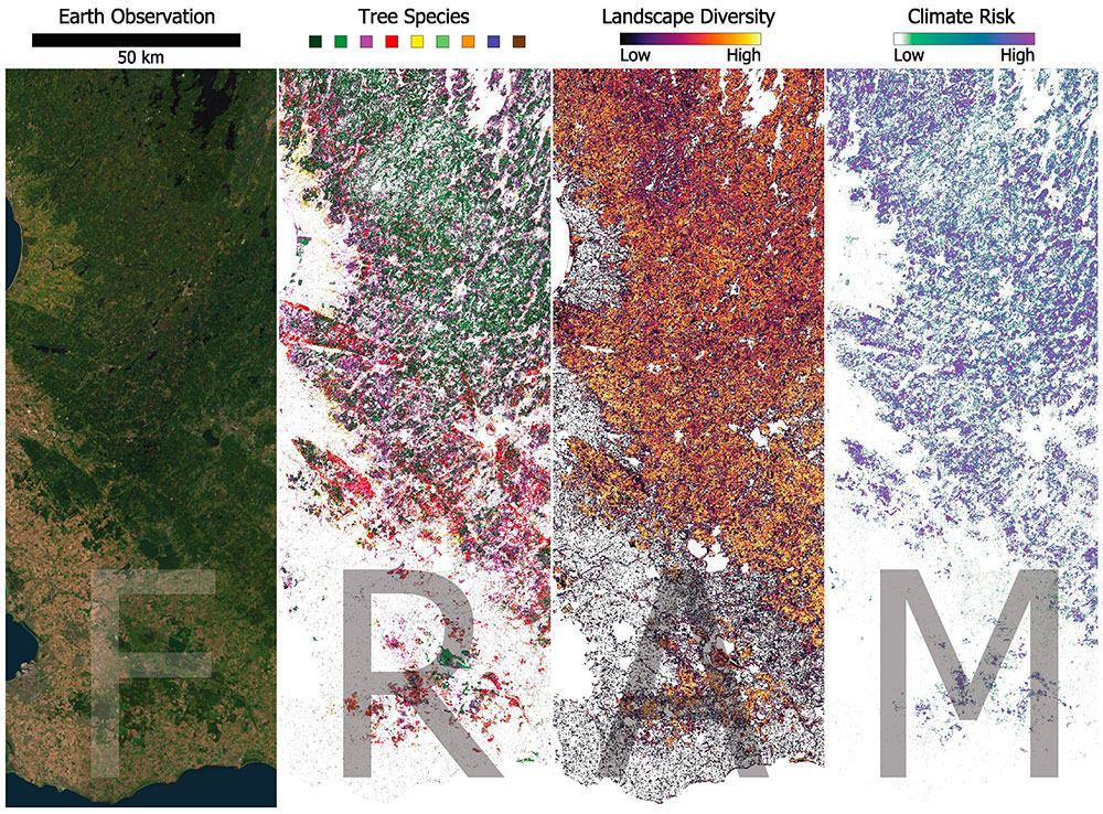
FRAM (FoRest climAte-Risk Monitoring) will help close this gap by using satellite data, climate information, forest structure data, and local field knowledge to monitor climate-related forest risks across southern Sweden. The project will develop a web-based service that provides information on drought stress, wildfire vulnerability, and species-specific sensitivity.
The goal is to turn Earth Observation data into practical information for forest management. By giving earlier warning signs of emerging stress, FRAM can support better planning, more targeted field inspections, and more climate-aware decisions. This can help stakeholders such as forest owners, authorities, and other landscape actors strengthen the resilience of southern Sweden’s forests in a changing climate.
Application site(s)
Southern Sweden
Data
Satellite
Sentinel-1 Synthetic Aperture Radar
Sentinel-2 Multispectral Imager
Other
Canopy Height Model
RGB orthophotos
Gridded climate data
Forest clear-cut database
Swedish national land cover map
European Forest Fire Information System (EFFIS)
Swedish tree species map (9 classes)
Results – Final product(s)
A web dashboard will be created with:
Drought anomaly maps by species
Wildfire-sensitivity index
Bark-beetle susceptibility signals
The project is designed to be reproducible in other regions, both within Sweden and internationally. All processing steps will be documented and implemented using reproducible scripts, enabling other regions to replicate or extend the system with their own data sources. Relying on widely accessible datasets and transparent methods allows the project to offer a blueprint for scaling climate-risk monitoring across diverse forest landscapes.
References
Abdi, A. M., & Wang, F. (2026). Cartographie des essences forestières et de leur incertitude à l’aide de données d’observation de la Terre et de l’Inventaire forestier national : vers une surveillance opérationnelle en Suède. International Journal of Remote Sensing, 47(7), 2912 – 2943.
Related project(s)
🇺🇸 SCO AIFlame: development of a predictive algorithm that assesses wildfire risk weeks, months, or even years before extreme wildfires break out in the United States.
🇫🇷 SCO ALEOFEU: an operational demonstrator for forest fire risk in the Aude department, incorporating observed and modeled changes in climatic and territorial conditions based on IPCC scenarios.
🇨🇳 SCO FireAlert: Forest fire monitoring and early warning in Sichuan (China).