


GEOPARK
Geolocated Estimation and Observation of PARKing areas
Overview
Context
Adapting urban and peri-urban areas to climate change requires a better understanding of built-up areas. Car parks, which are very common on the outskirts and in business s, present a major challenge: they contribute to urban heat islands (UHIs), limit rainwater infiltration, whilst offering significant potential for greening and solar energy production (photovoltaic carport canopies). The Climate and Resilience Act (2021) and the APER Act (2023) reinforce these obligations for large outdoor car parks (>500 m²). | 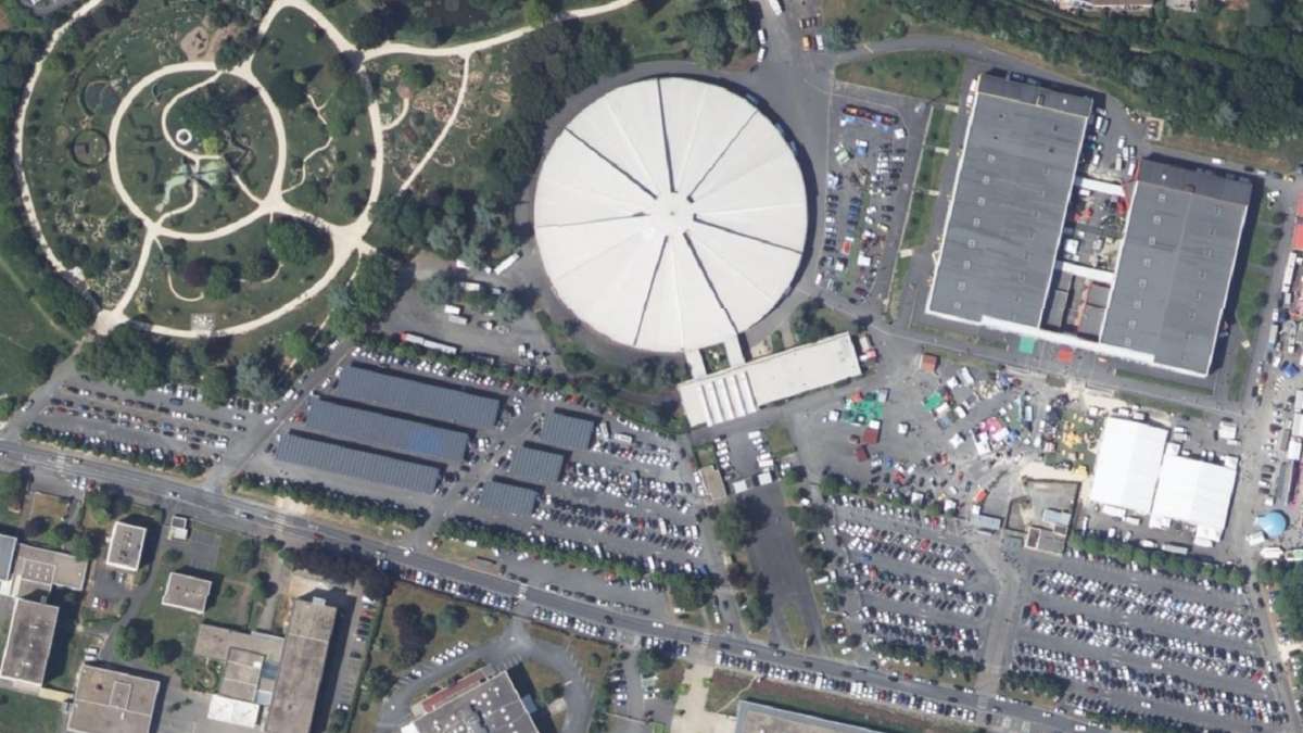 Poitiers Exhibition Centre. © IGN / BD TOPO® |
But how can we identify the car parks posing the greatest challenges and determine, for each one, the adaptation best suited to supporting urban development?
The GEOPARK solution
Bringing together Cerema and the SME Murmuration, the project will aim to develop an automated detection workflow for car park footprints using Pleiades satellite imagery and a semantic segmentation model (AI) developed by Cerema. The workflow will combine data pre-processing (radiometric indices, Digital Elevation Model), supervised training using ground-truth data (IGN TOPO database, OpenStreetMap, local data) and morphological post-processing. The detected areas will then be characterized using indicators such as photovoltaic potential, greening potential, contribution to urban heat islands, etc.
Replicability
The project is designed to be replicable thanks to a modular workflow that supports different image sources (Pleiades, BD ORTHO, CO3D), paving the way for international replication. Joint experiments in the Lille European Metropolis and Greater Poitiers – which have different yet complementary urban densities and characteristics – will enable this replicability to be tested.
Application site(s)
France:
Lille European Metropolis (MEL)
- Greater Poitiers
Data
Satellite
Pleiades
CO3D
Other
HD LiDAR
IGN Digital Elevation Models (DEMs)
BD TOPO®
OpenStreetMap
- Local data
Results – Final product(s)
The final tool of the GEOPARK project will be a visualization interface, designed as a user-friendly and collaborative tool for local stakeholders. Developed in close collaboration with local partners, it will provide interactive access to the results of car park detection and characterization. The aim is to enable intuitive data consultation, participatory data correction and the facilitated use of the data in urban planning processes.
👉 The interface will be based on a dynamic web-based mapping environment, incorporating high-resolution imagery, vector land-use layers and automatically detected car park polygons. Each feature will be enriched with metadata derived from the characterization phase (potential for photovoltaic installations, greening, impervious surface area, etc.). Particular attention will be paid to ease of use: thematic filters, selection tools, visualization and standard export formats (GeoJSON, shapefile).
Map of car parks > 500m2 around the Poitiers Exhibition Centre. | 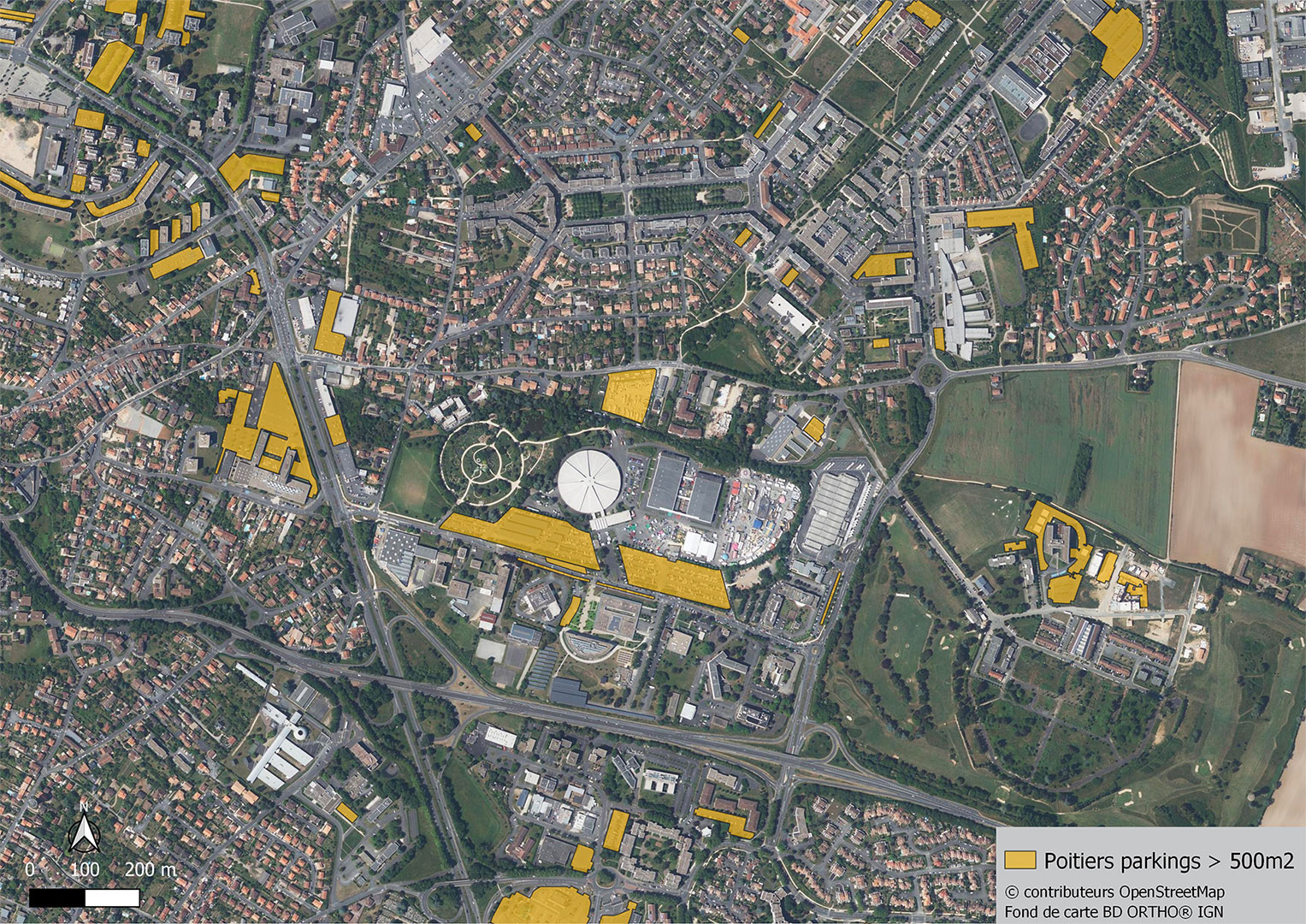 |
👉 A collaborative editing module will enable local authority staff to correct, supplement or validate the detected land uses, particularly in dense urban areas that may not be covered due to the complexity of the built environment or vegetation cover, or, conversely, in peri-urban areas where the diversity of landforms may make interpretation difficult.
👉 The interface will be designed as a prototype that can be adapted for use in other regions and will serve as a decision-support tool for urban adaptation policies, land management and energy planning. Furthermore, the core of the methodology is intended to be made available as open-source software.
References
DGALN Reference Guide Guide-parcs-de-stationnement-WEB.pdf
Related project(s)
SCO Projects
- Green Urban Sat and GreenSpace (urban vegetation)
- SatLCZ (urban heat island assessment)
- COSIADES (land use and international replicability).
Non SCO Projects
Cerema - Assessment of car parks in the Greater Poitiers area: Parcs de stationnement : Comment concilier photovoltaïque et renaturation ? | Cerema
- MEL – ‘Car Parks’ reference framework aimed at developing a methodology for identifying and characterising car park areas using orthophoto maps
- Cerema – Technical expertise and studies on the multifunctionality of car parks.


