

SCOFrance
PartnersCerema, La TeleScop, Syane, CNES
Useful linksProject page
🎥 ORENOS featured in Trimestrielle
KeywordsLighting, biodiversity, energy, night-time imaging
ORENOS to reduce light pollution
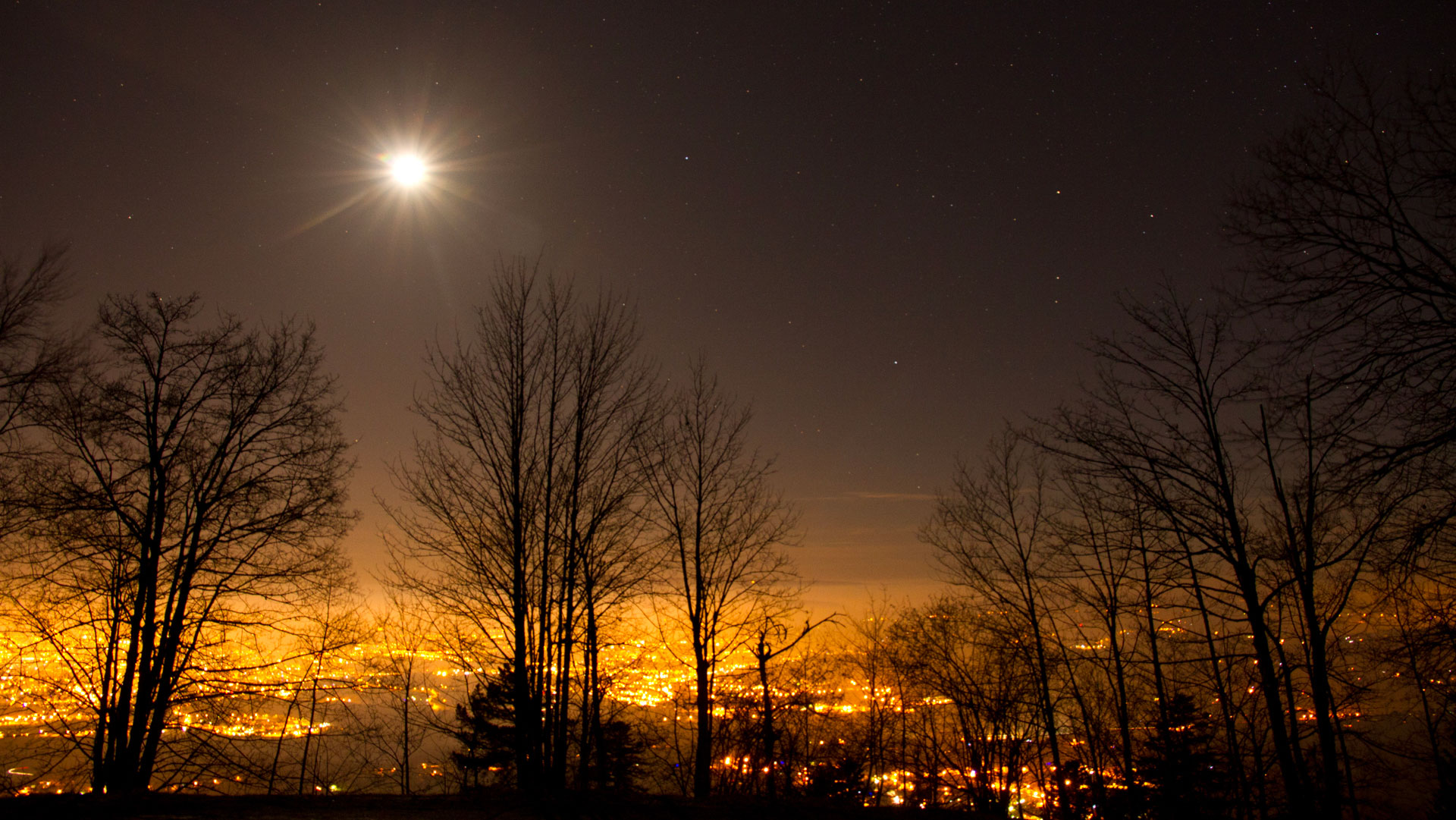
This story is set in Haute-Savoie in France. Why? Because this mountainous department boasts a rich diversity of flora and fauna, yet is facing increasing pressures linked to urbanization, economic development and the densification of infrastructure. These pressures all have one thing in common: the artificial lighting they rely on.
|
Against this backdrop, the ORENOS project aims to characterize artificial night-time lighting across the Haute-Savoie region using satellite imagery, enabling lighting managers and local decision-makers to take action to adapt, upgrade or switch off lighting, with the aim of providing more energy-efficient, better-suited and less harmful lighting for biodiversity. |
In France
|
The impacts of lighting and the ORENOS response
Most animals are nocturnal and are severely affected by lighting that is too bright or poorly directed. This light pollution reduces their ability to feed, move around, reproduce, develop and protect themselves from predators. While it is easy to think of insects whose entire life cycle and movements are disrupted by a streetlight, or birds and bats that are disoriented by these ‘false’ light signals, excessive lighting also disrupts the phenological cycle of plants and could have an impact on human health. At a time when we are facing a major species extinction crisis, there is therefore an urgent need for action.
|
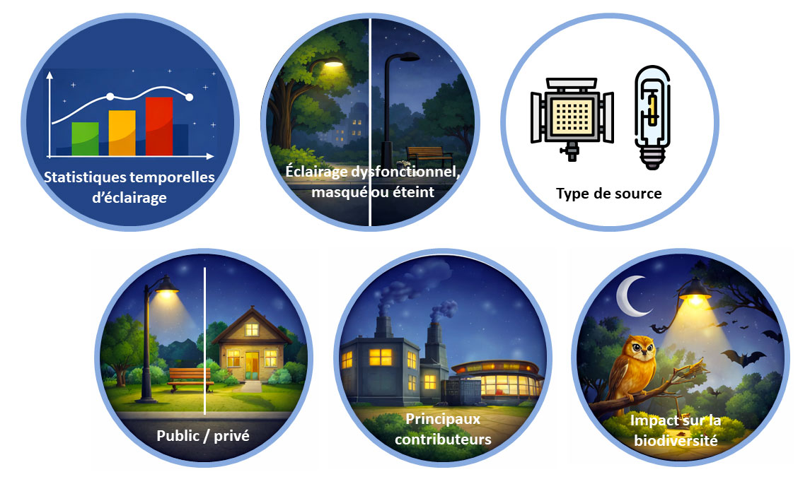
Implemented by Cerema (the French Agency for Ecological Transition) and La TeleScop in partnership with Syane (the Haute-Savoie energy and digital union), the project involves the development of several indicators:
► ORENOS indicators. © Cerema, generated by AI |
|
Night-time satellite imagery to characterize lighting
In an innovative approach, ORENOS uses night-time images from the Chinese SDGSAT-1 satellite, kindly made available by the CBAS (International Research Centre of Big Data for Sustainable Development Goals) for the project’s objectives. ORENOS focuses specifically on the radiance extracted from these images, i.e. the luminous flux reflected by ground surfaces and detected by the satellite.
|
|
|
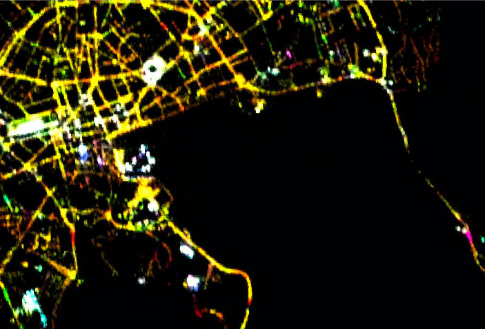
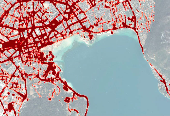
▲ SDGSAT image on the left (© CBAS) and its extracted radiance on the right (© Cerema).
|
👉 Several methods and algorithms for pre-processing these 10-metre resolution night-time satellite images have been developed by the consortium, with tools and technical advice from CNES. In particular, the extraction of light sources enables the characterization of illuminated areas and the removal of noise* from the image. * Noise is a salt-and-pepper pattern present in images, particularly visible when the signal is weak. To avoid confusing this noise with ‘real’ light sources, it must be filtered out. |
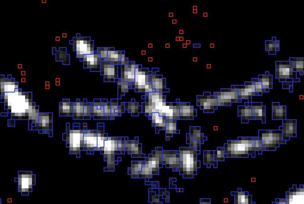
▲ Segmentation of the SDGSAT-1 panchromatic image into light sources (blue) and noise reduction (red). © CBAS |
👉 The time series of pre-processed SDGSAT-1 images are then used to construct various lighting quality indicators, defined in collaboration with Syane: distinguishing between public and private contributions to night-time lighting, locating the main contributors, radiance statistics at the local authority level, potential masking of light points by vegetation or buildings, distinguishing between types of light sources, etc. Some indicators use the department’s public lighting database in addition to the imagery.
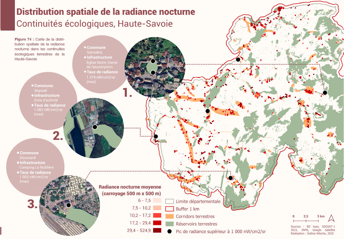
👉 A second set of indicators analyzing the pressure of artificial lighting on biodiversity is also produced, drawing on various external databases: land use, ecological corridors, regulatory and inventory data, and species data (bats).
|
► Indicator of lighting pressure on biodiversity in relation to ecological corridors. A peak in radiance (black dot) appearing within a corridor or reserve indicates a location requiring priority action. |
|
🛰️ Further exploratory analyses are being carried out to improve our understanding of the signal captured by night-time satellites: the impact of the Moon, flickering, seasonal variations in vegetation cover, and the albedo (reflectivity) of the ground. On this last point, a specific study is being carried out using very high-resolution daytime satellite imagery (Pleiades and SPOT-6) and in situ albedo measurements.
Now in the final stages, Cerema and La TeleScop are determining the best way to present the indicators produced for the Syane. The aim is to provide a practical, user-friendly and easily accessible decision-making tool for those working in the field. Several consultation meetings and service presentations are planned; look out for updates before the end of the year to discover the solution that has been put in place!
Find out more
- 🎥 Replay of the ORENOS presentation at the SCO Projects Quarterly Meeting by Emma Bousquet, project lead for Cerema.
- Please feel free to contact the project team to find out about its upcoming events. In 2025, ORENOS was presented at various conferences, including the ESA Living Planet Symposium, GeoDataDays and the Artificial Light At Night conference.