

SCOFrance
43Connections to the demonstrator during the user test phase
Useful linksPresentation Space4IRRIG
Key wordsIrrigation, water management, agriculture, water resources
Space4IRRIG, significant progress
In keeping with the SCO philosophy, Space4IRRIG illustrates the desire to make the link between research work and the end user. Valérie Demarez, a research professor at CESBIO (Center for Space Studies of the Biosphere), recalls the origins of the project: “CESBIO has been working on the subject of irrigated areas for several years. Given the explosion in demand, we concluded that we needed to accelerate the transfer of our work, submit a thesis to make progress on the methods and ensure that the territories could turn to an actor like MEOSS to meet their needs”.
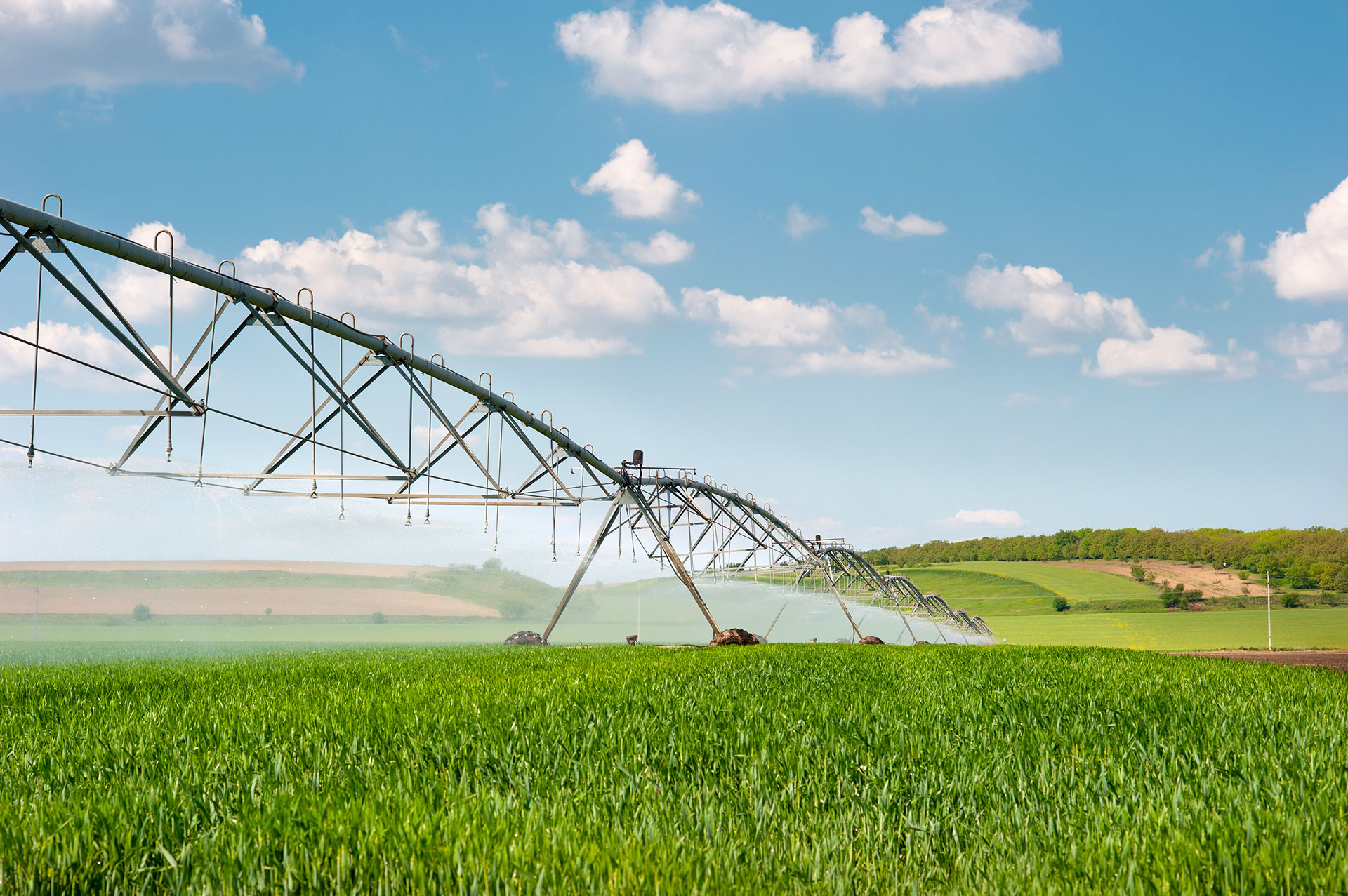
Thus, in line with the products - operational and available - designed within the framework of the SCO MEO-Climate project, the young company MEOSS is developing the MEO-Irrigation service with Space4IRRIG. The objective this time is to monitor irrigation, mainly of field crops (maize, wheat, barley, grassland), to evaluate the total irrigated areas, their rotation and to anticipate the water needs and tensions of these areas.
"With Space4IRRIG, we are testing the effectiveness of optical and radar satellite data applied to irrigated crops and areas. Our initial idea was for field crops, but as our partners provided us with additional data, we extended our tests to orchards and vineyards. The results are very encouraging and motivate us to improve our algorithms and deliver a complete system by summer 2023," says Virginie Dahinger, project manager for MEOSS.
A typical SCO consortium and development
In order to develop a service that is as close as possible to the problems and needs of the region, the Space4IRRIG consortium brings together several families of actors. Co-pilots of the project, CESBIO and MEOSS are surrounded by regional (PACA, Occitanie) and departmental (Tarn) chambers of agriculture, land use managers (Smavd and SCP), who have mobilized to collect data in situ, as well as the Tetis research laboratory, BRGM and CNES, which provide data and their professional expertise.
In terms of methodology, Space4IRRIG is organized according to the key steps recommended by the SCO:
-
Define the profile and needs of the end users
👉 17 entities were contacted for which presentation meetings were organized. 12 agreed to become test users of the demonstrator.
-
Testing the technical feasibility
👉 Construction of two indicators from Sentinel-1 (radar) and Sentinel-2 (optical) satellite images:
- Detection of irrigated and non-irrigated plots: compared with the field data collected by the partners in the Val de Durance catchment area (~2/3 field crops and 1/3 grassland), the results of the demonstrator show an overall accuracy of 81.5% with radar images alone and 86.4% with a combination of radar and optical images;
- Mapping of agricultural land use with classification of crop types using a combination of optical and radar: the results reach 97% accuracy in the Loiret department, where field measurements were mainly carried out on field crops, and 87.5% accuracy in the Durance basin, where field surveys were carried out on more diversified crops (field crops, market gardening, meadows, orchards and vineyards).
NB: In comparison with the performance of the OSO 2018 land use map, produced from optical data with the CESBIO IOTA2 chain, these results for the Val de Durance in 2021 tend to show that the addition of radar data allows for a better classification of the orchards (fscore: OSO: 0.52 / MEOSS: 0.74) This must be confirmed by additional work (other years, other territories).
In view of these excellent results, the team is continuing to develop its algorithm and is carrying out a thesis to free itself from land use data.
-
Develop a web mapping application to visualize the indicators and make the service more concrete to users and potential customers
👉 Creation of the MEO-Irrigation service and its user guide. To show the potential of this tool for water resource management, MEOSS integrates, in addition to the two indicators above, its Water Reserve (monthly inventory of water bodies), indicators on water quality as well as the volumes of water withdrawn for irrigation by drilling (declarative data, BNPE).
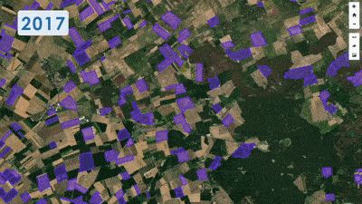
Visualization of the plots irrigated between 2017 and 2020 © MEOSS
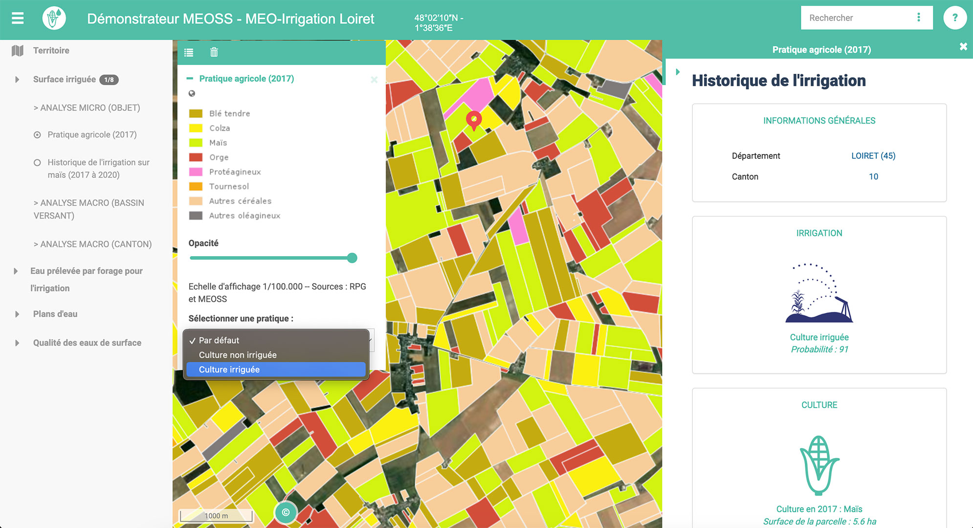
Identification of crop types and their status (irrigated or non-irrigated) in 2017 © MEOSS
-
Prepare the deployment of the service with a view to its industrialization
👉 System architecture is being defined
-
Economic feasibility
👉 Ongoing study of the different costs to define a viable economic model capable of guaranteeing the sustainability of the service.
-
Coordination with partners to ensure the smooth running of the project
👉 CESBIO and MEOSS have ongoing exchanges and regular technical and steering meetings with other consortium members.
The project is therefore on track to deliver an operational system on schedule in July 2023. In the meantime, MEOSS will be presenting a demonstration of these services at the Quarterly Meeting on 22 June 2023 (subscribe to the Spirit of SCO newsletter to make sure you don't miss out on the opening of registration).