

VULANMEX
Vulnerability analysis in Mexican agricultural areas
Overview
Context
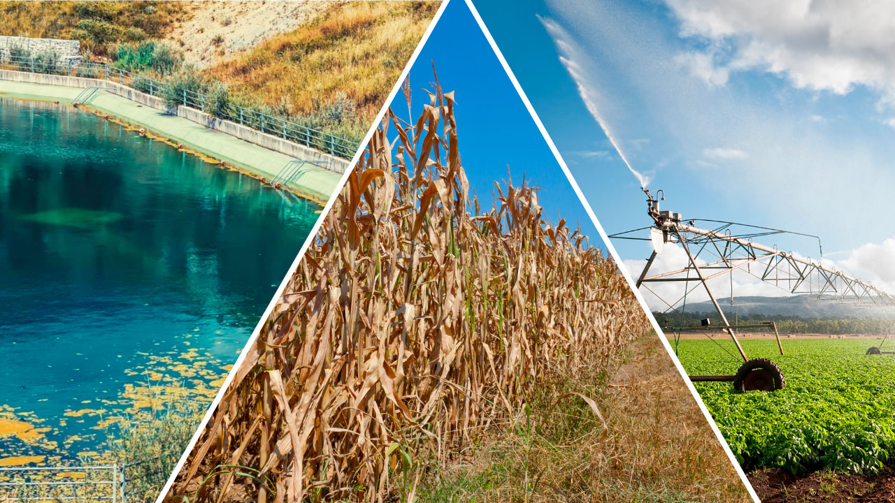
Mexican agricultural production, particularly corn in the center of the country, is threatened by climate change. Droughts are longer, and rains are delayed and irregular. These effects caused a 40% drop in corn production in the central states of Mexico in 2023. This is why it is important to take action and adapt farming practices in response to climate change.
Governments at various levels need reliable information on the effects of climate change on agricultural production in order to anticipate and mitigate these effects. In recent years, the National Polytechnic Institute of Mexico, in collaboration with the Mexican Space Agency (AEM) and other Mexican institutions, has been monitoring the effects of climate change on agricultural areas by instrumenting various fields. The field experiments, called Terrestrial Hydrological Experiments in Mexico (THEXMEX) (Monsivais-Huertero 2022, 2023), have been conducted since 2018 in different agricultural areas. The datasets collected have highlighted changes in precipitation patterns and their effects on vegetation growth.
In parallel with Mexico's development of agricultural area monitoring, the French company MEOSS has been developing a service for the past five years to support decision-making by public and private land managers. Drawing on various projects and user feedback, MEOSS has specialized in water resource management with three dedicated products: MEO-Irrigation to optimize irrigation, MEO-WaterReserve to monitor the surface area, volume, and fill rate of water bodies, and MEO-Drought to monitor drought anomalies. MEOSS aims to provide, via a single platform, consistent and up-to-date data on water needs, resources, and uses across large territories. This prototype is currently being tested in pilot areas in France and Senegal. This project is therefore a continuation of MEOSS's work on water and agriculture, developed as part of several previous SCO projects, including the monitoring of water bodies (MEO-Climate), irrigation (Space4Irrig), and agricultural water (EO4AgriWater)*.
As part of the VULANMEX project, MEOSS will have the opportunity to collaborate with a new scientific partner and work on another continent, where the impacts of climate change are particularly severe.
👉 The main objective of this project is to test the transferability of the mapping tool developed by the consortium to Mexican agricultural areas, using in particular the databases collected since 2018 as part of the THEXMEX projects, and to enrich them with the products developed by MEOSS on water reservoirs for irrigation.
Methodology
The project is divided into "Work Packages" (WP) leading to the development of a decision-making tool for the experimental territories. The content of the five WPs is as follows:
WP1 – Link with end users
Define user profiles and their needs, validate the decision-making tools produced during a user testing phase. A report presenting the main profiles of key players in the sector and their needs will be produced.
WP2 – Agroeconomic indicators (IPN)
Indicator of water deficit on agricultural fields due to climate change and the impact on corn production.
WP3 – Hydrological indicators (MEOSS)
Indicators for quantitative monitoring of water bodies, drought anomalies, and irrigated crops.
WP4 – Web mapping platform
Development and provision of a common platform for distributing results.
WP5 – Project coordination and management
Ensuring the smooth running of the project and reporting on progress (meetings and deliverables, including a final report).
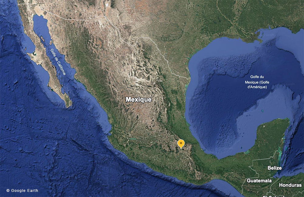
Application site(s)
Central Mexico
Data
Satellite
- Irrigation, crop rotation, and drought monitoring
- ESA Copernicus Sentinel-1 (radar), Sentinel-2 (optical): time series every 6 days, with a resolution of 10 m.
- NASA Landsat-8: time series every 16 days, with a resolution of 30 m
- Soil moisture and climate variability
- NASA MODIS: time series every 16 days with a resolution of 1 km
- NASA SMAP: time series every 3 days, with a resolution of 36 and 9 km
- ESA SMOS: time series every 3 days, with a resolution of 36 and 25 km
Other
Field data:
- Vegetation (type and health)
- Irrigated/non-irrigated
- Weather stations
- Soil moisture measurement stations (TDR)
Results – Final product(s)
|
The final product will take the form of a simplified, clear, and up-to-date web-based mapping platform designed to enable non-experts to use information derived from space imagery. |
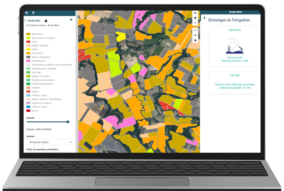 |
Users will be able to select and view the following mapping indicators:
- Identification of irrigated crops,
- Monitoring of crop droughts,
- Identification and surface monitoring of water reservoirs,
- Summary indicator, a real decision-making tool, resulting from joint analysis in response to user needs.
References
-
H. E. Huerta-Bátiz, D. E. Constantino-Recillas, A. Monsiváis-Huertero, et al., 2022, “Understanding root-zone soil moisture in agricultural regions of Central Mexico using the ensemble Kalman filter, satellite-derived information, and the THEXMEX-18 dataset”, International Journal of Digital Earth, 15:1, 52-78.
-
J. Martínez-Fernández, A. Gonzalez-Zamora, N. Sanchez, and A. Gumuzzio, “A soil-water based index as a suitable agricultural drought indicator”, 2015, J. Hydrology, 522, pp. 265–273.
-
J. Martínez-Fernández, A. González-Zamora, N. Sánchez, et al., “Satellite soil moisture for agricultural drought monitoring: Assessment of the SMOS derived Soil Water Deficit Index”, 2016, Rem. Sens. Env., 177, pp. 277–286.
-
Mishra, T. Vu, A.V. Veettil, and D. Entekhabi, “Drought monitoring with soil moisture active passive (SMAP) measurements”, 2017, J. Hydrology, 552, pp. 620-632.
-
Monsiváis-Huertero, A., Constantino-Recillas, D. E., Hernández-Sánchez, J. C., , et al., 2022, “Assessment of NASA SMAP soil moisture products for agricultural regions in Central Mexico: An analysis based on the THEXMEX dataset”, IEEE Journal of Selected Topics in Applied Earth Observations and Remote Sensing, 15, 3421-3443.
-
Monsivais-Huertero et al., "Assessment of The Nasa SMAP Soil Moisture Product Over a Semi-Arid Agricultural Region in Mexico," IGARSS 2023 - 2023, Pasadena, CA, USA, 2023, pp. 2243-2245.
Related project(s)
-
SCO MexiCorn, led by the Polytechnic Institute of Mexico (IPN) and SCO accredited in 2021. This project has developed an operational tool that uses optical and microwave satellite data to monitor corn field parameters.
-
SCO MEO-Climate, led by MEOSS and SCO accredited in 2020. This project led to the development of the MEO-WaterReserve tool, dedicated to the identification and surface monitoring of water bodies using satellite images. Aimed at land managers and planners, MEO-WaterReserve has enabled the project partner to improve its knowledge of the levels of use of hillside reservoirs.
-
SCO EO4DroughtMonitoring, led by INSIGHT and SCO accredited in 2021. This project led to the development of a decision-making tool for institutions and management in the agricultural sector. The system is capable of assessing the intensity of drought events, estimating their severity by analogy with a historical reference state, and, when coupled with current data, providing an indication of the plausible future trajectory of a hydrological season.
-
SCO Space4Irrig, led by UMR CESBIO and MEOSS, and SCO accredited in 2021. This project has led to the development of methods for identifying irrigated crops and the MEO-Irrigation decision-making tool for water managers. The mapping tool combines several indicators to improve knowledge and identify effective water resource management strategies for the future.
-
SCO EO4AgriWater, led by MEOSS and INSIGHT and SCO accredited in 2023, is a decision-making tool for agricultural and water stakeholders. Using satellite imagery, a set of mapping indicators is produced, providing knowledge and in-depth analysis to monitor and respond to drought events in agriculture. The tool can be used to monitor crop drought, irrigation, and water reservoirs.