

SCOFrance
Partners
- France: UMR Espace-Dev, IRD, CNES
- Indian Ocean: BNGRC, Université de la Réunion, IOGA, IST
Useful linksProject page
KeywordsMadagascar, cyclone, impacts, location, trajectory, prevention, warning
Cimopolée fully operational
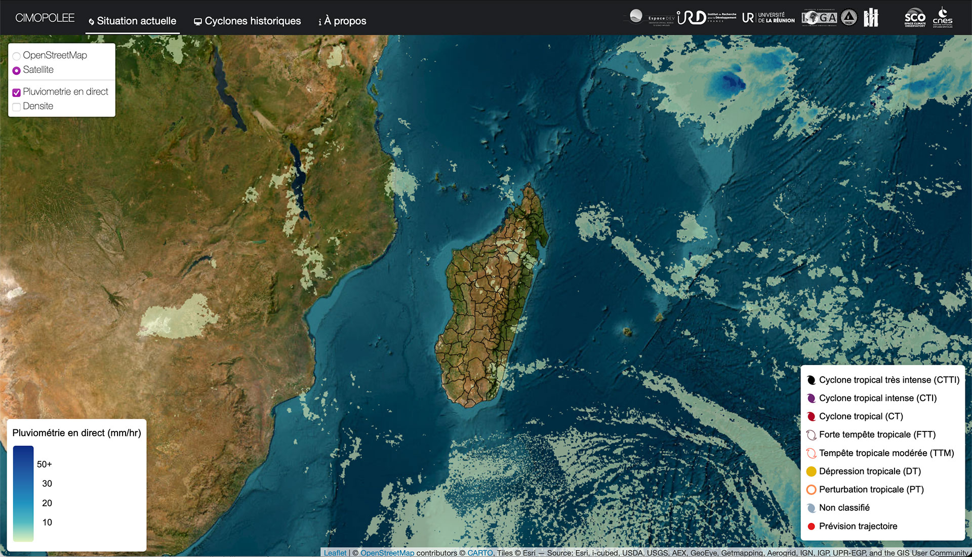
In the Indian Ocean, Madagascar experiences 3 to 4 major cyclones a year. On this immense island, where travel and communication are not easy, local authorities need precise information as soon as possible to analyze the situation and prepare for intervention in the affected areas.
|
Today, the Cimopolée web application, co-constructed with the project's Madagascan partners, enables them to visualize:
|
Hosting the tool on SEAS-OI's server in La Réunion facilitates data flow and connection for BNGRC, Madagascar's risk management unit based in Tananarive. "When a cyclone arrives, this unit will alert its agents in the field to warn the population and deploy actions according to the risks envisaged. Cimopolée supports this system by providing additional precise information, in particular the location of the cyclone's passage and the population basin that will be affected," explains Christophe Revillion, project manager at UMR Espace-Dev. |
|
► Example of flood mapping following cyclone Freddy in February 2023. Flooded areas, in purple, are located and quantified by change detection on Sentinel-1 images before and after the cyclone . © Cimopolée
|
|
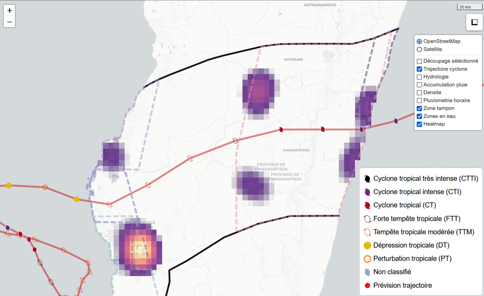
Behind the simple interface, the algorithms
To achieve this result, the automatic processing chains developed during the project mobilize Sentinel-1 and 2 satellite data, as well as meteorological and contextual data (population database, location of inhabited areas, etc.).
👉 The tool is entirely open source, including the algorithmic code, which is available on UMR Espace-Dev's Git.
"Today, Cimopolée is fully operational, and we are responsible for its maintenance and updating. In the event of a major cyclone, we'll be "on deck" alongside the BNGRC to see if and how the information fits in perfectly with their risk management process," assures Christophe Revillion.
SCO synergies in prospect
Although the project does not call for any official follow-up since the tool is already operational, it does offer strong synergies with other SCO projects, particularly CASCADES. The latter, which is just getting underway, will set up processing chains to generate maps of the extent of water zones based on Sentinel-1 and 2 data. “Madagascar is a privileged field of application for this, and the data could be fed into Cimopolée, ideally as a continuation of the partnership with IOGA and BNGRC", hopes Christophe Revillion.
Other synergies are on the table with MangMap, and all these project leaders are in serious discussions to move forward together. Let's bet they'll have something to announce before the end of the year...!