RIVERS
Rich Immersive Virtual Environments for Education, Early-warning and Response to flooding using Remote Sensing
Overview
Context & problem statement
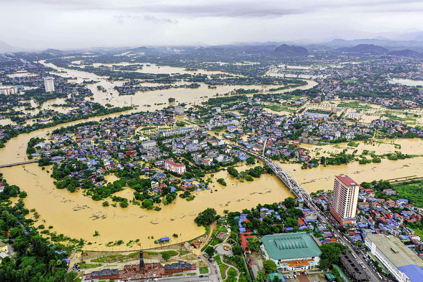
The RIVERS project tackles the growing threat of flood risks in South-East Asia (Vietnam, Thailand) and France, which has been significantly exacerbated by climate change and the rapid urbanisation of deltas and estuarine areas. Current forecasting systems often produce abstract hydrological indicators that are difficult for emergency response teams, schoolchildren and members of the public to use to effectively anticipate the impacts of flooding and organize evacuations.
To address these challenges, RIVERS is developing an ‘on-demand’ platform featuring immersive virtual reality digital twins. It integrates multi-sensor satellite imagery, high-resolution hydrodynamic simulations and agent-based behavioural modelling of evacuation, enhanced by generative AI. This tool enables decision-makers, crisis managers and members of the public to design, test and trial flood management and evacuation strategies in real time. ► Developing an immersive digital twin platform combining space-based remote sensing, hydrology, agent-based modelling and virtual reality for flood management. © IRD / UMMISCO / ACROSS / CNES / INRAE | 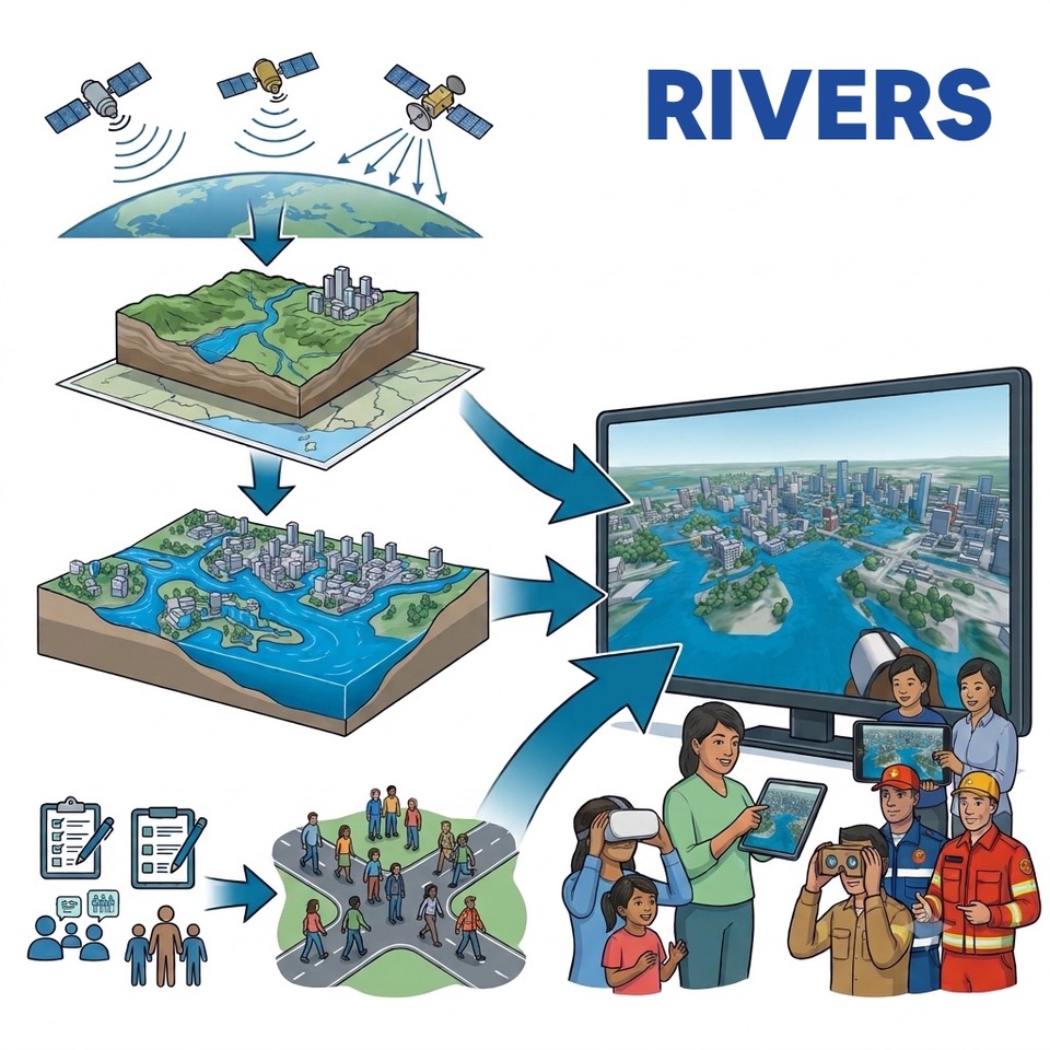 |
This approach presents several major challenges:
the real-time synchronization of complex models (hydrology and agent-based social dynamics),
the procedural generation of accurate 3D environments from heterogeneous geospatial data,
the deployment of frugal, low-cost and low-tech virtual immersion solutions (stand-alone headsets, smartphones) adapted to the constraints of the field.
Methodology & innovation
RIVERS is based on a modular pipeline comprising:
Offline processing: acquisition of radar time series (Sentinel-1, NISAR, TerraSAR-X), optical data (Pleiades, super-resolved Sentinel-2 at 5 m via CESBIO, CO3D) and digital elevation models (DEMs via CARS and drones) on the TREX platform.
High-resolution hydrological modelling: dynamic flood propagation (HEC-RAS / TELEMAC-2D).
Social and behavioral modelling: agent-based simulation of evacuation strategies, enhanced by generative AI to generate realistic synthetic populations.
Procedural 3D generation for virtual reality: automatic creation of interactive virtual worlds connected in real time to the simulations, available in low-cost and low-tech versions (stand-alone headsets, smartphones and Cardboard viewers).
Application site(s)
- Vietnam (Main pilot site): The port and estuary city of Haiphong (Red River Delta)
- Vietnam (Secondary pilot site): Nhat Le River catchment area / City of Dong Hoi, Quang Binh Province
- Thailand: Pilot catchment areas and Thammasat University campus, Pathum Thani
- France: Metropolitan pilot catchment (site to be determined)
Data
Satellite
- Radar: Sentinel-1 (C-band SAR), NISAR (L-band), TerraSAR-X (X-band)
- Optical: Pleiades, Sentinel-2 (CESBIO super-resolution), CO3D (THR stereo).
Other
- In situ hydrometeorological data
- Tide gauge stations (Hon Dau)
- LiDAR and drone (UAV) photogrammetry data
- Population census data and local land registers.
Results – Final product(s)
An open-source RIVERS platform, an interactive digital twin available as a downloadable virtual reality application and a web application, enabling users to:
Select any area and flood scenario from a predefined list on demand.
Plan and test mitigation measures (dikes, floodplains) and evacuation strategies subject to time and budget constraints.
Experience the event immersively (using VR headsets or smartphones/Cardboard) to assess the effectiveness of early warnings and train decision-makers and members of the public.
References
Chapuis, K. et al. (2022). Exploring multi-modal evacuation strategies for a landlocked population using large-scale agent-based simulations. International Journal of Geographical Information Science, 36(9).
Taillandier, P. et al. (2019). Building, composing and experimenting complex spatial models with the GAMA platform. GeoInformatica, 23(2).
Drogoul, A. et al. (2025). Coupling Agent-Based Simulations and VR universes: the case of GAMA and Unity. arXiv:2502.07405.
Related project(s)
SCO Projects
VIETARRO and VIMESCO-Rice, which implemented the VIETSCO platform offering mapping tools to support the resilience of rice cultivation in Vietnam in the face of climate change phenomena, including flooding.
FloodDAM-DT, which designed a digital twin of the Earth system based on the water cycle and developed the FloodML algorithm (open access) to generate flood maps from satellite data.
Non SCO Projects
- European SIMPLE project (2023–2027, https://project-simple.eu),
- ANR ESCAPE project, ANR ATEST project,
- FEF ‘FLEUVES’ project,
- PEPR TRANSFORM ‘AN CƯ’ project.