

Monitoring the evolution of natural areas by remote sensing
Natural areas provide habitats for wild animals, and sometimes also for those we have domesticated, and provide (many) ecosystem services. As users and beneficiaries of all this wealth, we must now protect the environments most affected by our human activities and by climate change. Thanks to the latest generations of satellites, which are able to distinguish finely between different types of vegetation, remote sensing is becoming a major tool for monitoring the evolution of natural areas in order to help us decide on preservation strategies.
Three SCO projects demonstrated this on Tuesday 27 September 2022 during the 6th Quarterly Meeting of the SCO France, which you can watch again in the videos below.
If you have any questions about this quarterly, please send an email to seminairesco.fr@capgemini.com.
Cartovege
Temperatures are rising particularly fast in alpine and polar regions, resulting in a redistribution of species and changes in natural habitats, including a strong growth of invasive plants. Presented by Diane Espel from the Ecobio laboratory at the University of Rennes, the Cartovege project combines remote sensing and modelling of potential plant species occurrences in order to answer the most urgent questions for the safeguarding of biodiversity in the sub-Antarctic archipelago of Crozet and Kerguelen.
To remember
- Main objective: to develop a semi-automated mapping method for plant communities to study the past and present evolution of these habitats and to provide information for predictive models of habitat distribution.
- Data used: VHR Pleiades satellite images, NASA radar topography rasters, in situ surveys and HFI terrain database. At the end of 2022, a drone will be used to capture aerial images.
- Use of satellite data: generation of DTMs (digital terrain models), from which the team derived slope rasters and explanatory variables for the habitat model.
- With 4000 training points acquired for its model, the project has defined a new habitat typology.
- The automated image processing chain will allow users to feed the model with their input data.
ADOPT
In the context of climate change, Regional Nature Parks (NRP) play a crucial role for the French natural heritage and the development of rural territories. Co-presented by Bernard Thumerel and Gérard Dedieu, from the Espace Living Lab (E2L), the ADOPT project is building its remote sensing services in close partnership with 7 Regional Nature Parks in Occitania. Their philosophy: to offer free access to the project's results, to extend the service to all the French NRPs and even, ideally, beyond.
To remember
- From mountains to coasts, the 7 pilot NRP present a great diversity of landscapes and are directly involved in the project through a Living Lab approach.
- Data used: existing remote sensing data and products (from Theia, Dinamis, Copernicus C3S, USGS, ESA, NASA), public databases, field surveys and climate projections.
- Use of spatial data: construction of indicators to assess the seasonality and productivity of grasslands, document the evolution of snow cover and monitor "sentinel" environments (from which a rapid and strong response to climate change is expected), i.e. peatlands and sansouïres.
- The indicators generated offer short-term use and, at the request of the NRP, provide long-term impacts and trends.
- 15 NRP pilot officers were trained in remote sensing and satellite data processing with the open source GIS QGIS. This "hands-on" community thus increases its role as co-developer of ADOPT services and promotes peer-to-peer transfer within the NRP community.
ORION
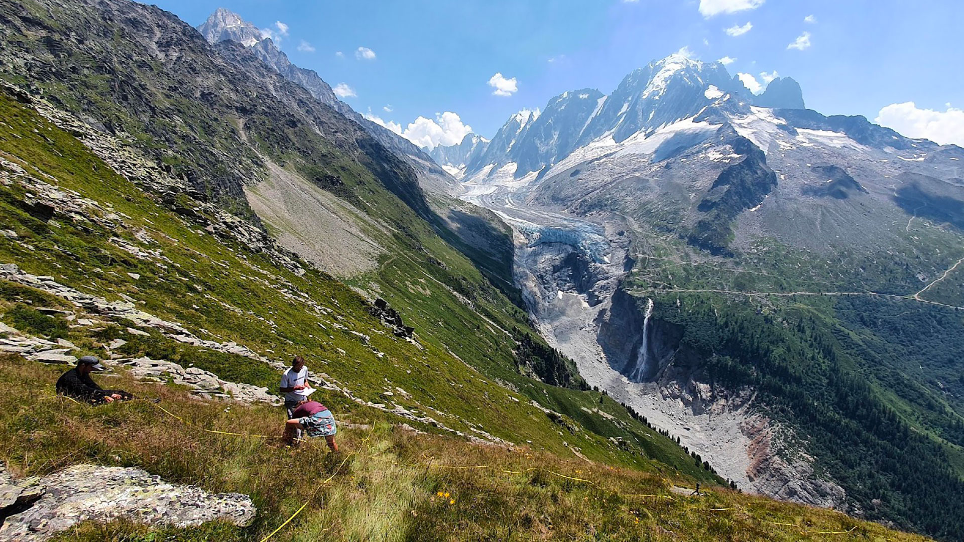
In recent years, the Alps have seen a strong expansion of heathland-type vegetation (shrubs such as rhododendron), favoured by climate change, which reduces the duration of snow cover, and by the abandonment of pastoralism in favour of tourism. These moors are gradually replacing the mountain meadows, leading to a reduction in the diversity of flora and plant resources for wild and domestic herbivores. Led by Brad Carlon, from the CREA Mont-Blanc research centre, the ORION project is developing operational services to help decision-makers manage the expansion of heathlands in their territory and the ecosystem issues of the various landscapes.
To remember
- Moors are a complex target to capture, as they are sparse vegetation, often in a mosaic, intermingled with meadows and rocks. Able to distinguish them from grasslands, the latest generations of satellites are significantly improving the spatio-temporal monitoring of mountain environments and making it possible to refine the land use.
- Data used: Sentinel-2 images (corrected) via Theia, Copernicus vegetation indices, snow indices from the CESBIO snow product, IGN Géoportail aerial photos. Camera traps complete the system to observe the passage of wildlife and its use of natural habitats.
- Use of spatial data: after establishing the (1000) training points by photo-interpretation, definition of a supervised classification then cross-referenced with explanatory variables (days without snow, luminosity, soil moisture, etc.) to train a predictive habitat model.
- Results: high-resolution maps of the distribution of environments (forests, moors, meadows, rocks, bare ground), indicators of floristic diversity and wildlife frequentation, vulnerability maps indicating grasslands likely to be colonised in the coming years and therefore priority management areas.
- The field measurements carried out at 142 sample points are consistent with the vegetation groups identified by satellite.
- Eventually, the tool will be integrated into the Mont Blanc Atlas web platform.