

3 projects, 3 environments, 1 lever: satellite data
26 of the 50 essential climate variables can only be observed from space. If we add the fact that no location is inaccessible to satellites, and that a great deal of data is free of charge, we have the SCO's raison d'être: to exploit the potential of this accurate and regular data to help territories adapt to the impacts of climate change.
On Thursday March 27, 2025, at the 17th Quarterly Meeting of SCO France, three SCO projects demonstrated how they use a variety of satellites, including several in common, to preserve environments and respond to different issues.
By Marc Lucas (CLS)
|
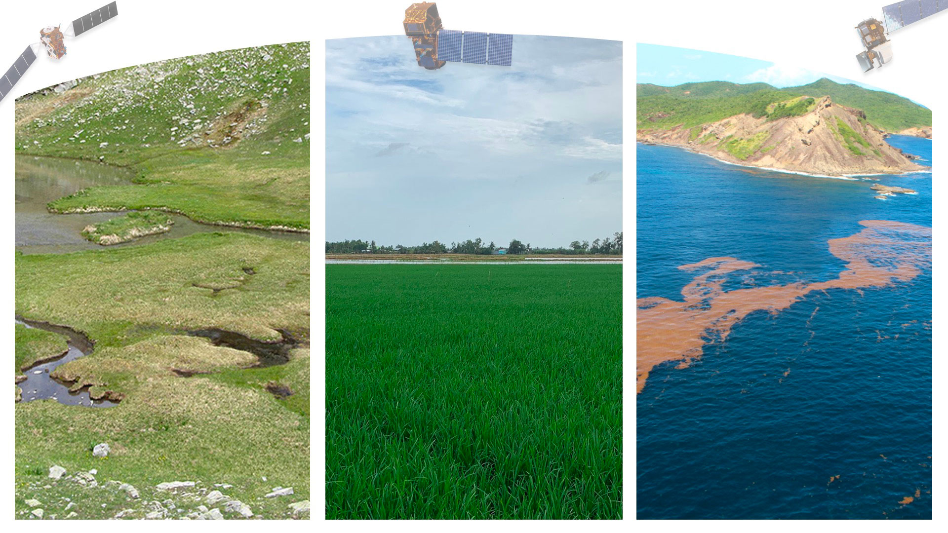
Since 2011, Sargasso seaweed has been proliferating as a result of climate change, disrupting coastal life from the Caribbean to West Africa. Supported by the SeSaM project, the use of satellites is proving to be the most technically and economically sensible solution for obtaining a real-time view of seaweed beds throughout the Atlantic basin and anticipating their stranding. |
|
To remember
- Satellites used:
- GOES at 1 km resolution every 15 minutes to counter the cloud problem.
- Sentinel-3 and MODIS at 300 m, to calculate an index of Sargassum presence and map it.
- Sentinel-2 and Landsat at 20 m to estimate the surface area and volume of seaweed beds.
- Developed by the IRD, the Sargassum growth and movement model makes it possible to forecast the arrival of Sargassum on coastlines 3 to 6 months in advance.
- The freely accessible SeSaM platform displays satellite detections of Sargassum, and will include movement forecasts from summer 2025.
💡 Tackling the scourge of sargassum with SeSaM - April 10, 2025
By Stéphane Mermoz (GlobEO)
|
In the Mekong Delta, known as the "rice bowl of Vietnam", the government wants to encourage intermittent rather than continuous irrigation of rice fields, as this reduces emissions of methane, a powerful greenhouse gas, as well as the amount of water used, without adversely affecting yields. In support of this national strategy, Mérimée maps the irrigation status of rice fields using satellite radar data and combines this with a spatial and temporal estimate of methane emissions. |
|
To remember
- Radar satellites used:
- Sentinel-1 C-band to produce rice and plant phenological stage maps.
- SACOCOM and ALOS2-PALSAR in L-band, a longer wavelength that penetrates to the base of plants to detect the presence or absence of water.
- In addition, the project's Vietnamese partners carry out a large number of in situ measurements during satellite overflights (918 fields visited on 11 dates between November 2023 and March 2025).
- The maps clearly show a majority of fields irrigated alternately in the north of the delta and continuously in the south. According to the latest results, intermittent irrigation of the entire delta would have resulted in a reduction of 37 gigagrams (or 37,000 tones) of methane over the three months of the early 2025 season.
- Rice irrigation maps will be aggregated by November 2025 in the VietSCO platform, pre-developed as part of the VimeSCO-Rice and Viet-ARRO projects.
💡 VietSCO Mérimée presents its first results in Vietnam - March 31, 2025
By Jean-Philippe Malet (A2S/EOST)
|
Climate change is altering landscapes and agro-pastoral crops in environments with high carbon storage potential and numerous ecosystem services. Thanks to satellite data, EO4MP provides TerEcoData, a customizable online analysis service for creating and visualizing vegetation condition indicators for environmental diagnosis over large geographical areas and over the long term. |
|
To remember
- Input data: Sentinel-2 satellite data, supplemented by high-resolution topographic and parcel data, including user upload of own file.
- Examples of products: habitat mapping, identification of green corridors, phenological monitoring of plants...
- Specific features of the tool: on-demand calculation of 60 indicators, organization of information layers into data cubes, calculation of zonal statistics, phenomenometric indicators.
- Everything is automated: all the user has to do is define the study area, the period of interest and my calculation parameters.
- Launch of the TerEcoData service, operated and maintained by IR Data Terra, in July 2025.
If you have any questions about this quarterly, write to us here.