


SCOInternational
144Accredited projects in total
Useful Link
Next call for projects
September 1st, 2026


SCO International: 2026 Edition
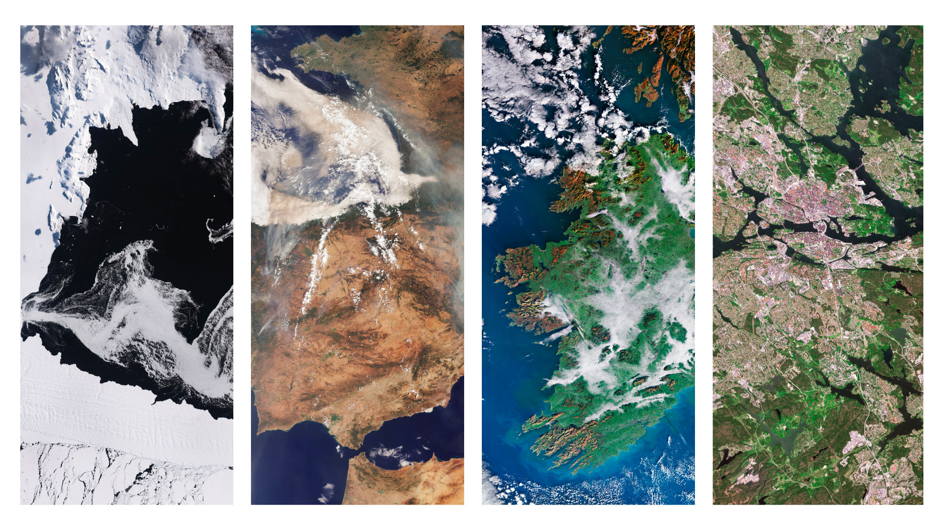
The call for proposals launched in the fourth quarter of 2025 resonated around the world! Thanks to the collaborative analyse by 15 international reviewers - whom we sincerely thank for their dedication - nearly three-quarters of the selected projects cover “new” countries.
| Following the example of the Principality of Monaco, which is deeply committed to the preservation of marine environments, it is pledging this year to support a highly innovative SCO project aimed at combating Sargassum algae. A look back at the opening remarks by Her Excellency Valérie BRUELL-MECLHIOR, Monaco’s Ambassador to France, just minutes after signing the SCO Charter in March 2025. |
Focal Point: Canadian Space Agency (CSA)
- Arctic-NEMO, Natural Emissions Monitoring & Optimization
Supported by C-CORE
Theme: Atmosphere
The Arctic-NEMO project aims to improve the monitoring of natural methane (CH₄) emissions from wetlands, lakes and permafrost in the Arctic, where global warming is accelerating.
By combining data from several satellite sensors and processing it with AI models, the project aligns methane‑emission figures from different ecosystems. The system connects emission data with land use, infrastructure and ecosystem restoration planning. Co-designed with territorial and Indigenous authorities, Arctic-NEMO can be extended to other regions to support adaptation and restoration strategies, thereby providing decision‑makers and communities with concrete tools to reduce climate‑change‑related risks.
- EeyouSat, Satellite coastal monitoring system for Eeyou Istchee
Supported by Arctus Inc.
Theme: Coastal adaptation
Coastal ecosystems are facing increasing biodiversity loss, particularly in submerged habitats like eelgrass meadows, which support biodiversity, stabilize sediments, and improve water quality. Combining atmospheric correction, bathymetry, shoreline mapping, and water quality, EeyouSat is developing a satellite‑based cartography and monitoring system to improve the representation of submerged vegetated habitats and the observation of coastal ice in Eeyou Istchee, within the Northern Quebec Administrative Region.
Deployed in partnership with Cree Nation, a First Nations people of Canada, the project will give geospatial data which to support Indigenous-led conservation efforts and provide insights for Canadian researchers, policymakers, and restoration initiatives.
- AI2Peat, All-Ireland, AI-enhanced Peatland Monitoring Platform
Supported by CeADAR - UCD School of Computer Science
Theme: Carbon storage
Peatlands play a crucial role in carbon storage and climate regulation, but their condition is difficult to assess at national scale. The AI2Peat project combines satellite remote sensing and artificial intelligence to monitor peatland conditions across Ireland.
The project develops machine learning models designed to perform well in previously unseen areas, enabling reliable nation-wide mapping. Following a sustainability-driven approach, it starts with small models and small datasets and gradually scaling up when needed. It provides policymakers reliable information to better monitor peatland conditions and support climate mitigation and restoration strategies.
Focal Point: Monaco Space Office (MSO)
- BESS, Blue Economy Sargassum Insurance System
Supported by Grogenics SARL
Theme: Coastal adaptation
Coastal regions are increasingly affected by massive Sargassum seaweed blooms linked to extreme weather events, threatening ecosystems, tourism and coastal livelihoods. The BESS project develops a blueprint for parametric insurance to accelerate Sargassum collection after extreme events to protect coastlines.
Building on the recognized Sargassum upcycling process, the goal is to develop a blueprint for Sargassum Index Insurance and accelerate access to scale for this Blue Economy opportunity.
- CUP, Carbon Updates Platform
Supported by Chyau Bio Technologies Pvt. Ltd.
Theme: Carbon storage
CUP is an innovative climate technology platform designed to accelerate global efforts in climate change adaptation and carbon finance. It leverages space-based Earth Observation data combined with data from ground-based sensors, advanced AI analytics and tools for carbon finance transparency that connect users to offset and funding opportunities.
Providing real-time actionable insights, the platform offers a unified dashboard where governments and researchers can upload and analyze spatial data, simulate decarbonization strategies and track greenhouse gas emissions at multiple scales. Its open and customizable 3D models enable better planning of high-resolution scenarios.
Focal Point: Philippine Space Agency (PhilSA)
- HEATMAP-PH, Space-Based Heat Vulnerability Mapping and Analysis for Highly Urbanized Cities in the Philippines
Supported by Adamson University
Theme: Urban adaptation
In response to rapid urbanization and increasing heat exposure, the HEATMAP-PH project aims to produce detailed maps and a composite Heat Vulnerability Index for selected highly urbanized cities in Philippines.
It combines satellite-derived thermal indicators with vegetation and impervious-surface indices, as well as socio-economic data to identify areas of high exposure and low adaptive capacity. A web platform enables local authorities, health services, risk‑management agencies, and academic institutions to explore, compare and download these data, providing a decision‑support tool for climate‑adaptation planning and health protection.
- Atlantic SENSE, Geospatial Tool for Climate Resilience and Environmental Monitoring
Supported by CoLAB + ATLANTIC
Theme: Coastal adaptation
The Atlantic SENSE project aims to provide a geospatial multi-hazard information system to support climate resilience of Portugal’s coastal areas across their three components: land, ocean, and atmosphere.
A web platform provides operational modules covering air quality (temperature extremes, health indicators, air quality monitoring), land monitoring (land-use and land-cover change, ecosystem services), coastal erosion(coastline evolution and sea-level rise scenarios) and ocean forecasting (metocean models and marine heatwaves). The system offers a web-based interface for multi-parameter visualization and analysis. It delivers downscaled land–ocean–atmosphere information within a single operational platform for end users, helping decision makers better anticipate climate risks and support resilience planning.
Focal Point: Institute of Space Studies of Catalonia (IEEC)
- MARE, High Resolution Drought Monitoring
Supported by isardSAT
Theme: Water management
In Mediterranean regions where Drought is a growing challenge, MARE produces weekly high-resolution soil moisture and drought index maps over two areas in Catalonia to improve drought monitoring and support more efficient irrigation management.
By making its data available to users on a web platform, the project aims to significantly enhance drought monitoring and irrigation decision-making. Moreover, MARE has developed pilot soil moisture maps at 5 m resolution using data from the Catalan Government’s second nanosatellite. This very high resolution makes it possible to monitor soil moisture variability within individual agricultural parcels.
- PETRI-MED, Plankton biodiversity through remote-sensing and omics in the Mediterranean Sea
Supported by Instituu de Ciències del Mar, Consejo Superior de Investigaciones Científicas
Theme: Biodiversity
The Mediterranean Sea is one of the world’s main marine biodiversity hotspots, supporting essential ecosystem services for millions of people. To understand and monitor the health of its marine ecosystems, the PETRI-MED project focuses on assessing plankton biodiversity in the Mediterranean Sea using satellite observations and biological data.
In fact, plankton plays a key role in ocean processes such as food chain support, carbon storage, nitrogen cycling and ocean acidification. Changes in its composition provide important information on ecosystem health.
As a result, the project allows stakeholders to translate plankton biodiversity data into actionable insights for marine ecosystem monitoring and management.
Focal Point: Swedish National Space Agency (SNSA)
- FRAM, Forest Climate-Risk Monitoring for Southern Sweden
Supported by Department of Earth and Environmental Sciences, Lund University
Theme: Forests
In southern Sweden’s forests, where climate change is increasing drought, heat and wildfire risks, The FRAM project aims to support forest owners and regional authorities with a practical web-based monitoring service.
By combining satellite data with tree-species maps, canopy structure information and high-resolution climate indicators, the platform will provide monthly assessments of drought stress, wildfire vulnerability and species sensitivity. It will deliver early warning signals of emerging stress and help prioritize field inspections and adaptation measures for climate resilience. Developed in close collaboration with forest stakeholders, FRAM project can be extended to other regions.
- Urban HEAT, Satellite based tools for climate-smart municipalities
Supported by Green Urbansights AB
Theme: Urban adaptation
Launched in southern Sweden but intented for European-wide deployment, the Urban HEAT (Health, Environment, Adaptation, Trees) project aims to develop an operational WebGIS to help cities meet climate adaptation goals and respond to rising urban temperatures.
It integrates satellite data, LiDAR, aerial imagery and in-situ sensors to map heat, vegetation and tree vitality at high spatial resolution. Thanks to these data, the system identifies areas with high heat exposure and low cooling capacity and supports decisions on where new green infrastructure can provide the strongest climate benefits. By delivering actionable indicators and practical recommendations, the platform underpins local and national climate policies for urban planning, health protection and nature‑based climate‑resilience solutions.