

EDUCSCO
The educational component of Space for Climate Observatory
OVERVIEW
EDUCSCO is an SCO project with a difference. Whereas the purpose of conventional SCO projects is to address issues relating to the impact of climate change and suggest solutions based on satellite data, EDUCSO is positioned further upstream with the aim of targeting the public directly.
The purpose of this project is to disseminate knowledge in order to accelerate awareness of climate change issues in our society.

© Getty Images
The subjects below make up the main focus of the project:
- Mechanisms of climate change: the greenhouse effect and essential climate variables, most of which are accessible only by satellite.
- Measuring the causes of change through atmospheric sampling from space: greenhouse gases.
- Measuring the consequences on a large scale from space: rising ocean levels, higher temperatures, the cryosphere and melting ice caps, drought, extreme climate events, etc.
- The role of the SCO in risk management and regional adaptation to climate change: practical cases of use based on SCO projects!
|
The first step involves setting up a dedicated training programme to raise awareness across the educational community on the cause of climate change and the key role played by space applications in understanding, measuring and – ultimately – confronting it. The Toulouse regional education authority has become a pilot for the 2020/2021 school year, with training organised for secondary school teachers. A larger-scale deployment is under consideration. |
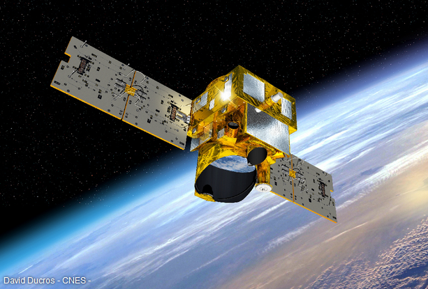
▲ Merlin, a satellite to study methane © CNES/DUCROS David |
Application site(s)
- Toulouse regional education authority, France
DATA
Satellite
All families of earth observation satellites will be used as part of this project, covering the following areas:
- Optical and radar imagery
- Atmospheric sampling
- Oceanography
- Meteorology
Other
- Land use plan, land register, graphic parcel register
- Socio-economic data
RESULTS - FINAL PRODUCTS
👨👩👦👦 Informed citizens aware of the stakes of climate change!
Online apps in English and French
Three apps are available via a shared access link: https://ee-eolabcnes.projects.earthengine.app
-
Middle school level: EducSCO Weather and Climate, looks at the evolution of weather (short-term) and climate (long-term), and defines the notion of seasonal “normal”.
-
High school level: EducSCO temperature, dedicated to studying temperature changes from space. (Video tutorial here).
-
Raising awareness in territories about the potential of satellite imagery: Earth as seen by Sentinel-2
Training
- Tailor-made training for secondary school teachers in the Toulouse academy with the prospect of extending them to the national level. 🎥 See the videos
- Interventions within the framework of the Precious Earth training for school teachers
2 Educational videos (in French)
- Thermocity, adapting cities to climate change
|
Thermocity is a SCO project pioneering the use of thermal satellite imagery. By measuring urban surface temperatures, Thermocity is able to detect heat loss from buildings in winter and heat islands in summer. |
|
Vincent Lonjou, CNES engineer and head of the SCO Thermocity project, answers 4 questions from students at the Jean-Lagarde centre in Ramonville-Saint-Agne (Haute-Garonne).
- FLAude, greater resilience to flooding
|
Implemented in the Aude department following the dramatic floods of 2018, the FLAude project has developed a system based on satellite imagery to identify water run-off, limit flooding and provide practical solutions for better management of these natural disasters. |
|
Christelle Iliopoulos, CNES engineer and head of the SCO FLAude project, answers 5 questions from pupils at Vauquelin secondary school in Toulouse (Haute-Garonne).
- ADOPT, Earth observation data applications for regional nature parks and their territories
|
Thanks to satellite data and the ADOPT project (Applications des Données d'Observation de la Terre pour les Parcs naturels régionaux et leurs Territoires - Earth Observation Data Applications for Regional Nature Parks and their Territories), it is possible to study the evolution and concrete impacts of climate change on the grasslands, forests and mountains of Occitanie. |
|
Gérard Dedieu, remote sensing expert for the E2L cooperative, former researcher at CESBIO/CNES and head of the SCO ADOPT project, answers 4 questions from students at the Lycées Stéphane Hessel in Toulouse (Haute-Garonne).
Resources for the classroom
French translation of ESA Climate Change Initiative Teaching Packs
Comprising a guide for teachers and worksheets for students, each resource offers stories about the climate, practical experiments and integrates the ESA web application "Climate from Space".
The initial English-language resources are available on the ESA Climate Office website.
👉For primary education
- The water cycle - The effect of global warming on floods and droughts
- Is ozone good or bad? - The role of human pollution in the deterioration of the ozone layer
- Countries at risk - The role of global warming in sea-level rise and the flooding of coastal towns and small islands
👉For secondary education
- A passageway opens - The threat of melting sea ice due to global warming
- Taking the Planet’s pulse - How satellite data helps us understand climate change
- Biodiversity and habitat loss - How climate change is leading to the loss of biodiversity and habitats
References
| EducSCO on GEO Knowledge Hub, a long lasting digital repository created by the Group on Earth Observations: https://doi.org/10.60566/05b31-vqm11 |
RELATED SCO PROJECTS
All!
PROJECT NEWS
- 03/10/2025: EducSCO: 1 link for 3 apps
- 13/09/2024: EducSCO apps are bilingual
- 11/09/2023: 3 educational videos to explain to young people the impact of climate change and SCOlutions
- 16/05/2022: EducSCO: 2nd training session
- 18/01/2022: EducSCO: 1st set of resources for the classroom
- 15/11/2021: EducSCO: the videos are online!
- 05/05/2021: EducSCO to educate tomorrow's citizens