

Applications Toolbox
Below are the tools developed and delivered by the SCO projects.
ORION
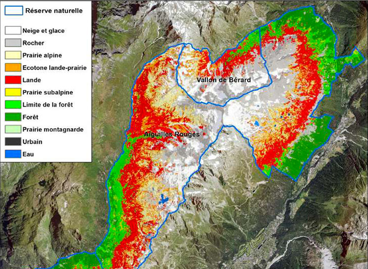
Monitoring changes in the mountain environment
Faced with the colonisation of moorland to the detriment of Alpine meadows, the Orion project has used satellite imagery to develop a detailed map (10 m) of natural habitats as well as fauna and flora indicators, including grazing area.
Replicable and scalable, the method is particularly well suited to managers of these areas, which are undergoing major changes to protect the environment as well as pastoral and tourist activities. It also offers very interesting prospects for understanding and preserving the ecosystems that emerge when glaciers retreat.
🟢 Free access