

Applications Toolbox
Below are the tools developed and delivered by the SCO projects.
Supporting solutions based on urban vegetation
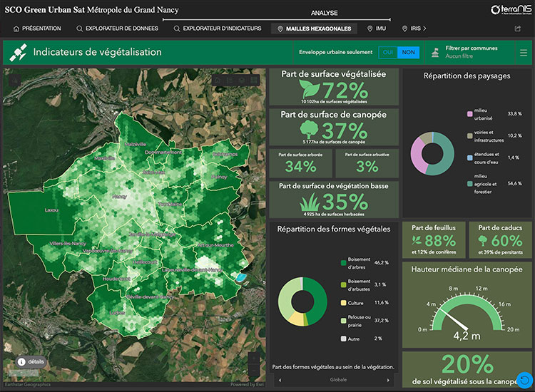
Supported by Cerema, the GUS project has developed a method for fine mapping urban vegetation in order to better assess its many ecosystem services. The results obtained in Greater Nancy are available online on the Landia platform (ex Green City) operated by TerraNIS. This platform offers summary indicators at different grids (hexagonal, urban morphological island, IRIS, municipalities, etc.), data explorers and summary dashboards.
🟢 Access to the Nancy demonstrator is open.
🟢 Based almost entirely on THR satellite images, the method can be replicated for any town => the algorithmic codes are available on Cerema's Github.
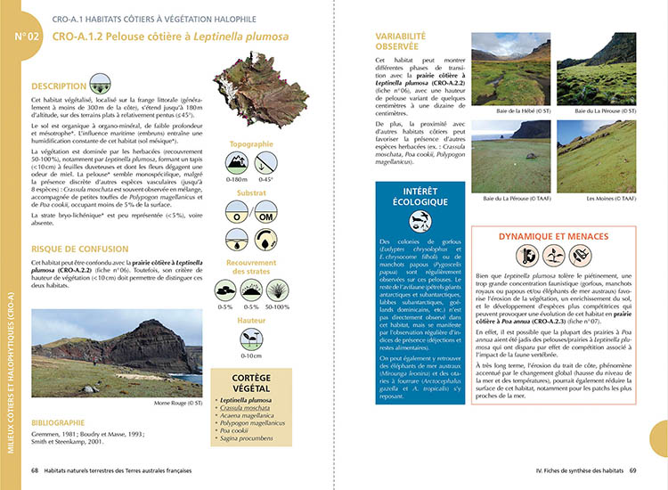
Natural terrestrial habitats of the French Southern Territories, a common frame of reference for knowledge and preservation
Knowledge of habitats and their distribution is crucial for the long-term management and monitoring of protected natural areas, particularly in sub-Antarctic regions, which have been profoundly affected by climate change and invasions by exotic species. Based on the reference work carried out on Possession Island (Crozet archipelago), this absolutely unique guide is the fruit of the multidisciplinary Cartovege project team, which is developing a cartographic modelling tool for habitats specific to the Southern Territories.
🟢 Free digital version (pdf, in French)
🔵 Paper version available from Quæ
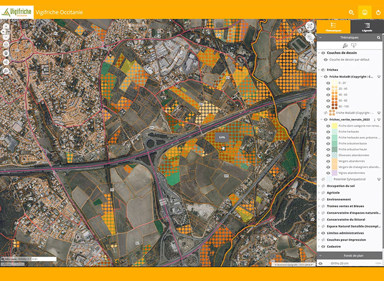
Identify and visualize agricultural wasteland
The Izifriche solution is a comprehensive support service for the identification and visualization of agricultural wasteland, aimed at local players wishing to act for the resilience of their territory.
Developed as part of the SCO FrichesAgricoles project, the method for automated identification of wasteland is based on the use of geographical and satellite data analyzed by the WaSaBI ©CNES software's Artificial Intelligence, at the scale of the entire Occitanie region (France). The parcel data from the regional inventory of wasteland is used in a web interface equipped with numerous geographic databases, providing a global vision of the issues at stake at different territorial scales (commune, inter-commune, département).
🔵 Service marketed by Safer Occitanie from June 2024.
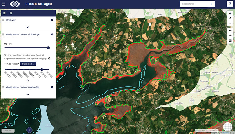
Coastline monitored by satellite
Littosat distributes seasonal image mosaics at high and low tide, systematically and at high spatial resolution (10 m). From these data, it generates high value-added products on foreshore vegetation, and will soon offer products on submerged vegetation and foreshore morphodynamics, feeding seasonal change detection functions on a regional scale.
3 interfaces are online: Littosat Brittany, Littosat Normandy and Littosat Gulf of Lion
🟢 Free access