

Applications Toolbox
Below are the tools developed and delivered by the SCO projects.
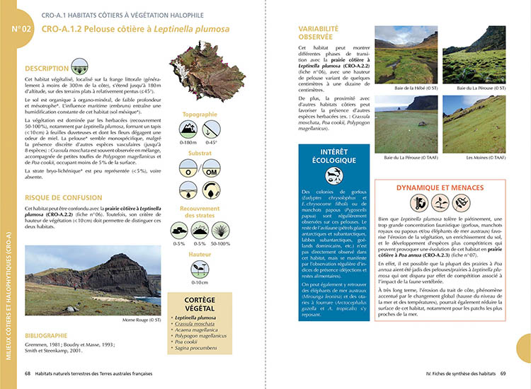
Natural terrestrial habitats of the French Southern Territories, a common frame of reference for knowledge and preservation
Knowledge of habitats and their distribution is crucial for the long-term management and monitoring of protected natural areas, particularly in sub-Antarctic regions, which have been profoundly affected by climate change and invasions by exotic species. Based on the reference work carried out on Possession Island (Crozet archipelago), this absolutely unique guide is the fruit of the multidisciplinary Cartovege project team, which is developing a cartographic modelling tool for habitats specific to the Southern Territories.
🟢 Free digital version (pdf, in French)
🔵 Paper version available from Quæ
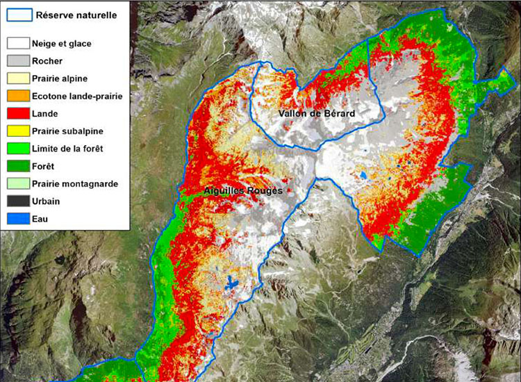
Monitoring changes in the mountain environment
Faced with the colonisation of moorland to the detriment of Alpine meadows, the Orion project has used satellite imagery to develop a detailed map (10 m) of natural habitats as well as fauna and flora indicators, including grazing area.
Replicable and scalable, the method is particularly well suited to managers of these areas, which are undergoing major changes to protect the environment as well as pastoral and tourist activities. It also offers very interesting prospects for understanding and preserving the ecosystems that emerge when glaciers retreat.
🟢 Free access
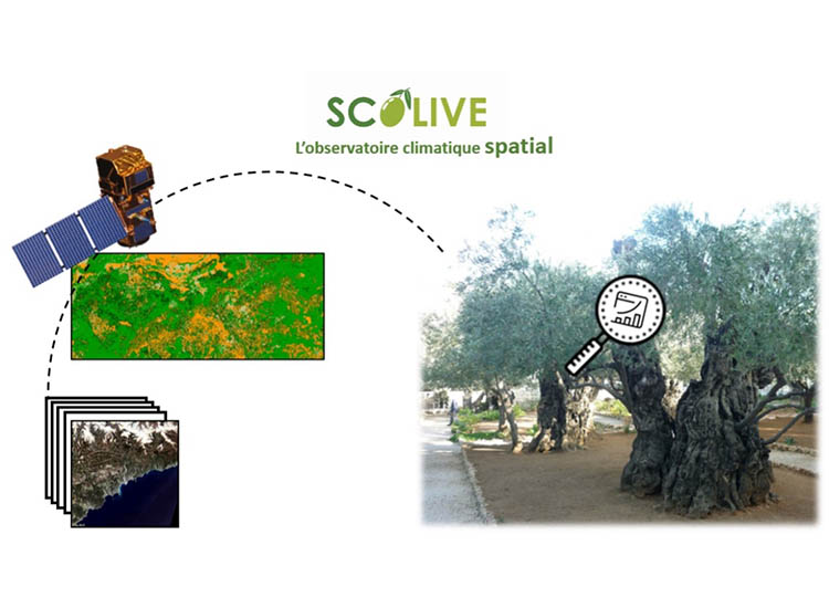
An olive tree observatory, a bioindicator of climate change
SCOLive has set up an observatory to better understand the conditions under which olive tree diseases appear and to anticipate treatments. In doing so, it uses changes in the condition of trees as a marker of climate change.
As a community project, it relies on a mobile application that provides geolocated, time-stamped information. The whole system has great potential for geographical expansion.
🟢 Free access
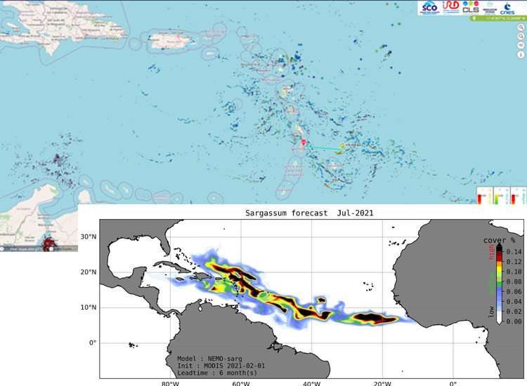
Seasonal Sargassum Monitoring
Faced with massive strandings of Sargassum seaweed on beaches from the Caribbean to West Africa, SeSam uses satellite water colour to locate the seaweed at sea and then, through modelling, predict its arrival on coastlines up to 3 months in advance.
🟢 Free access